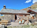
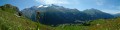
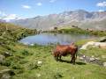
Pointe Tierce from Bessans

Walk to Pointe Tierce and the Chapelof Notre-Dame du Mont-Carmel

Details

n°69356954
Creation:
Last update:
Last review:
  • Walking
    Activity: Walking
  • ↔
    Distance: 8.34 mi
  • ◔
    Average duration: 7h 45 
  • ▲
    Difficulty: Difficult

  • ⚐
    Back to start: Yes
  • ↗
    Ascent: + 4,521 ft
  • ↘
    Descent: - 4,551 ft

  • ▲
    Highest point: 9,754 ft
  • ▼
    Lowest point: 5,686 ft

Description of the walk

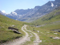
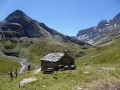
The route starts in Bessans, in Haute Maurienne, from the car park situated at an altitude of 1,740 m, slightly upstream of the Pont du Ribon.

(D)A) From the car park, head south-west along the track that runs alongside the Vallon du Ribon.

(1) Pass close to the Oratoire Saint-Antoine andcontinue for about 450 m until you reach a fork in the track, signposted at an altitude of 1,956 m.

(2) Turn left to reach the Oratoire Sainte-Anne, which overlooks the track. A sign indicates‘Chapelle de Tierce – aerial path’ and gives an estimated walking time of 3 hours 30 minutes.The path climbs initially through the forest before crossing the mountain pastures. A long diagonal ascent gradually leads towards the ridgeas the landscape becomes more rocky.

(3) A section equipped with a handrail allows you to cross a small rocky outcrop before reaching the ridge at an elevation of 2,902.

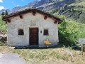
(4) Continue to the left, due north, along the ridge to the summit of the Pointe de Tierce, marked by a chapel.The chapel is accessible and can be visited.

(5) Retrace your steps to the fork you passed earlier at the 2902 mark.

(4) Head down to the left towards the Avérole valley. Begin the very steep descent leading to the Torrent d’Avérole.

(6) Turn left to follow the stream. 

(7) Turn left to follow the path uphill. 

(8) Cut across a forest track and continue straight ahead. You’ll reach a junction at the edge of the forest.

(9) Turn left towards the biathlon stadium and walk past the shooting range. 

(10) Turn left onto the path which leads into the forest, then veers sharply to the right and leads straight to the car park (S/E).

Waypoints

  1. S/E : mi 0 - alt. 5,719 ft - Car park
  2. 1 : mi 0.5 - alt. 6,161 ft - Saint-Antoine Oratory
  3. 2 : mi 0.63 - alt. 6,276 ft - St Anne’s Oratory
  4. 3 : mi 1.6 - alt. 8,104 ft - Section with handrail
  5. 4 : mi 2.34 - alt. 9,518 ft - Ridge. Junction. Round trip: Pointe – Chapelle Tierce
  6. 5 : mi 2.67 - alt. 9,665 ft - Pointe and Chapelle de Tierce
  7. 6 : mi 5.21 - alt. 6,007 ft - Avérole Torrent
  8. 7 : mi 6.27 - alt. 5,827 ft - Junction
  9. 8 : mi 6.81 - alt. 6,060 ft - Forest track
  10. 9 : mi 7.26 - alt. 5,725 ft - Crossroads
  11. 10 : mi 7.76 - alt. 5,738 ft - Path
  12. S/E : mi 8.34 - alt. 5,719 ft - Car park

Reviews and comments

4.7 / 5
Based on 1 review

Reliability of the description
4 / 5
Ease of following the route
5 / 5
Route interest
5 / 5
Bruno Piccon
Bruno Piccon

Overall rating : 4.7 / 5

Date of your route : Aug 12, 2025
Reliability of the description : ★★★★☆ Good
Ease of following the route : ★★★★★ Very good
Route interest : ★★★★★ Very good
Very busy route : No

Magnificent hike. The view from the summit is exceptional. The route is exposed but safe if the ground is dry. The slope is steep (especially at the start of the descent).

Machine-translated

Other walks in the area

For more walks, use our search engine .

The GPS track and description are the property of this route's author. Please do not copy them without permission.