Country:

 City:


Drive to the Col du Soulor, where access is sometimes blocked by our animal friends. Park in the car park.
(S/E) Cross the road and follow the track opposite heading south-west.
(1) After walking about 500 m along the track without going as far as the Col de Saucède, take the small path on the left which descends towards the Laün stream.
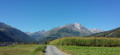
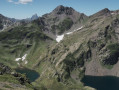
(2) A few dozen metres from the Cabane du Clot de Laün, cross the stream, then climb south-east along a path that is not very well marked at first, but which soon becomes clearly visible. After just twenty minutes’ walk, the view towards Cap d’Aout is already stunning. Reach an altitude of around 1,630 m: there’s a lovely view to the left over the Arrens-Marsous valley and the Pointe de Surgatte straight ahead.
(3) Cross the Ruisseau de Bernet and continue along the path which winds towards the Can Dessus ridge.
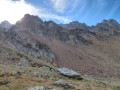
(4) At an altitude of around 1,730 m, leave the path and head right to climb up to a small hilltop on the ridge at 1,782 m. Alternatively, you can stay on the well-marked path which skirts this hilltop below. Reach the small, unnamed grassy pass at the foot of the Can Dessus ridge, which extends to the south-east, and the Bassiarey ridge much further away towards Petit Gabizos: a stunning view of the Balaïtous massif (3,144 m).
(5) You’ll soon reach the Pointe de Surgatte:if you have children, do not let them climb to the top of the peak on their own; keep them with you.
(6) Turn back towards the pass. Follow the well-marked path without going back over the hilltop.
(4) Follow the ascent route in the opposite direction to return to the Col du Soulor and the car park (S/E).
 Visorando Member

 Very difficult
 Moderate
 Difficult