


Pleasington
Details
Creation:
Last update:
–
–
-
 Activity: Walking
 -
 Distance: 6.58 mi
 -
 Average duration: 3h 35
 -
 Difficulty: Not specified
 -
-
 Back to start: Yes
 -
 Ascent: + 604 ft
 -
 Descent: - 607 ft
 -
-
 Highest point: 679 ft
 -
 Lowest point: 259 ft
-
 Country:
United Kingdom
Country:
United Kingdom
-
 City:
Blackburn with Darwen
City:
Blackburn with Darwen -
 Start/End: N 53.754233° / W 2.506906°
 -


 Hour-by-hour weather


Waypoints
- S/E : mi 0 - alt. 630 ft - Start on Revidge Road
- 1 : mi 0.43 - alt. 646 ft - Keep right onto Billinge End Road
- 2 : mi 1.16 - alt. 627 ft - Keep right onto Billinge End Road
- 3 : mi 1.86 - alt. 469 ft - Turn left
- 4 : mi 2.58 - alt. 361 ft - Turn slight left onto Sandy Lane
- 5 : mi 3.3 - alt. 344 ft - Keep left onto Victoria Road
- 6 : mi 3.77 - alt. 322 ft - Turn sharp left onto Preston Old Road, A674
- 7 : mi 5.01 - alt. 351 ft - Turn slight right onto Preston Old Road, A674
- 8 : mi 5.53 - alt. 325 ft - Turn left onto Buncer Lane, B6447
- 9 : mi 6.15 - alt. 495 ft - Keep left onto Buncer Lane
- 10 : mi 6.31 - alt. 587 ft - Turn right onto Billinge End Road
- S/E : mi 6.58 - alt. 627 ft
Other walks in the area
Witton Park
 Visorando Member
 5.89 mi
+568 ft
-581 ft
3h 10
5.89 mi
+568 ft
-581 ft
3h 10
 Moderate
 Departure from Blackburn with Darwen
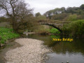
Walk starts from Witton Park car park and follows anti clockwise circular route via Billinge Wood, Houghton Bottoms and Pleasington.
Witton Weavers Reelers Trail
 5.80 mi
+463 ft
-459 ft
3h 05
Moderate
Departure from Livesey (Blackburn with Darwen)
5.80 mi
+463 ft
-459 ft
3h 05
Moderate
Departure from Livesey (Blackburn with Darwen)
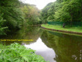
The walk starts from Stockclough Lane and follows an anticlockwise circular route via Stanworth Wood, Abbeyvillage and Tockholes.
Osbaldeston Circular
 4.89 mi
+246 ft
-253 ft
2h 30
4.89 mi
+246 ft
-253 ft
2h 30
 Easy
Departure from Osbaldeston (Lancashire)
Easy
Departure from Osbaldeston (Lancashire)
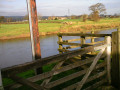
The walk starts from Osbaldestone Green and follows the anticlockwise circular route via banks of River Ribble.
Dinckley Bridge Circular
 6.48 mi
+387 ft
-390 ft
3h 20
Moderate
Departure from Clayton-le-Dale (Lancashire)
6.48 mi
+387 ft
-390 ft
3h 20
Moderate
Departure from Clayton-le-Dale (Lancashire)
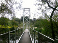
The walk starts from Baker Brow above Ribchester Bridge and follows a clockwise circular route via Dinckley Bridge.
Withnell, Brinscall
 5.82 mi
+213 ft
-217 ft
2h 50
Moderate
Departure from Withnell (Lancashire)
5.82 mi
+213 ft
-217 ft
2h 50
Moderate
Departure from Withnell (Lancashire)
The first section of the walk follows the disused Lancashire Union Railway from Abbey Village to Brinscall which is now a nature reserve. After Brincall the route follows Goit watercourse before leaving the valley and gradually ascends via Brinscall Hall and Windy Harbour to Snape Heights offering good views over the Ribble Valley, The final section descends back to railtrack offering good open views of Darwen Moor.
Sunnyhurst Wood Darwen
 2.46 mi
+184 ft
-184 ft
1h 20
Easy
Departure from Tockholes (Lancashire)
2.46 mi
+184 ft
-184 ft
1h 20
Easy
Departure from Tockholes (Lancashire)
The walk starts from Dean Lane off Tockholes Road and follows anticlockwise the circular route via Earnsdale Reservoir, Sunnyhurst Wood and Darwen Golf Course.
Abbey Village Reservoirs Circular
 6.29 mi
+404 ft
-377 ft
3h 15
Moderate
Departure from Withnell (Lancashire)
6.29 mi
+404 ft
-377 ft
3h 15
Moderate
Departure from Withnell (Lancashire)
The walk starts Abbey Village main St A675 (Bolton Road) and follows clockwise circular route via Abbey Village, Rake Brook, Roddlesworth Lower and Higher Reservoirs.
A riverside ramble through roman Ribchester
3.05 mi
+128 ft
-128 ft
1h 30
Easy
Departure from Ribchester (Lancashire)
A walk taking in beautiful countryside and rich heritage features. A combination of fascinating Roman remains and stunning riverside scenery, including views of the magnificent Pendle Hill, with the White Bull providing the perfect welcome on your return.
For more walks, use our search engine .
The GPS track and description are the property of this route's author. Please do not copy them without permission.

