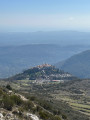
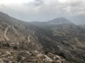
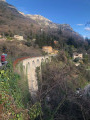
Cavillore Plateau and views over the Gourdon hills

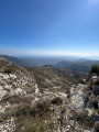
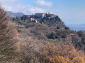
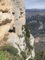
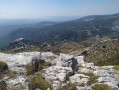
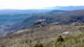
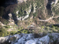
From the mountain village of Gourdon, this surprising walk invites you to discover the Cavillore Plateau. During this circular walk in the hills above the village – listed as one of the “most beautiful villages in France” – the views are stunning, overlooking both the valley and the village itself. And as we’re in alpine pastureland, you might spot a Patou dog along the way, ready to proudly defend the flocks: a genuine mountain atmosphere guaranteed!

Details

70599188
Creation:
Last update:
Last review:
  • Walking
    Activity: Walking
  • ↔
    Distance: 3.23 mi
  • ◔
    Average duration: 2h 20 
  • ▲
    Difficulty: Easy

  • ⚐
    Back to start: Yes
  • ↗
    Ascent: + 978 ft
  • ↘
    Descent: - 978 ft

  • ▲
    Highest point: 3,399 ft
  • ▼
    Lowest point: 2,421 ft

Photos

Description of the walk

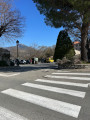
On arrival in Gourdon, the car park is just past the small roundabout.

(S/E) Return to the roundabout and take the road on the right (D12) for about 150 m. Then follow a path on the right which quickly leads onto the Chemin du Colombier. Turn right towards Gourdon Town Hall.

(1) At the junction, turn right onto Chemin de la Carraire, then head left onto a footpath signposted with signs. You’ll come to a crossroads.

(2) Turn right to begin the climb up to the Plateau de Cavillore and, after a few hairpin bends, reach marker 10.

(3) Continue to the left until you reach the junction at marker 11. 

(4) Turn left and head for the viewpoint overlooking the valley and the village of Gourdon. 

(5) Begin the descent via a series of tight hairpin bends and carry on to the first junction.

(6) Turn left and, a little further on, rejoin the path you took on the way up.

(2) Turn right and retrace the route you took on the way up, but in the opposite direction, to return to the car park (S/E). 

Waypoints

  1. S/E : mi 0 - alt. 2,421 ft - Car park
  2. 1 : mi 0.31 - alt. 2,579 ft - Road junction
  3. 2 : mi 0.63 - alt. 2,822 ft - Junction of the circular loop
  4. 3 : mi 1.21 - alt. 3,383 ft - Marker 10 - Aven du Col de Cavillore (1029m)
  5. 4 : mi 1.56 - alt. 3,392 ft - Marker 11
  6. 5 : mi 1.7 - alt. 3,392 ft - Viewpoint
  7. 6 : mi 2.29 - alt. 2,930 ft - Junction
  8. S/E : mi 3.23 - alt. 2,421 ft - Car park

Notes

There’s very little shade, but you’ll still find some trees during the climb.

Worth a visit

If you have time, do visit the very pretty village of Gourdon. 

Reviews and comments

4.7 / 5
Based on 2 reviews

Reliability of the description
5 / 5
Ease of following the route
5 / 5
Route interest
4 / 5
User 26099855

Overall rating : 4.7 / 5

Date of your route : Apr 21, 2026
Reliability of the description : ★★★★★ Very good
Ease of following the route : ★★★★★ Very good
Route interest : ★★★★☆ Good
Very busy route : No

A pleasant walk taken in early April. Lovely views of the coastline and the village of Gourdon. No particular difficulty if you have good walking shoes. Best avoided once the weather starts to get hot.

Machine-translated

Pglja
Pglja

Overall rating : 4.7 / 5

Date of your route : May 05, 2025
Reliability of the description : ★★★★★ Very good
Ease of following the route : ★★★★★ Very good
Route interest : ★★★★☆ Good
Very busy route : Yes

:a lovely walk with a lovely view of Gourdon

Machine-translated

Other walks in the area

For more walks, use our search engine .

The GPS track and description are the property of this route's author. Please do not copy them without permission.