Walk around the Clos d’Aubriac and the Cavillore plateau

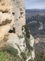
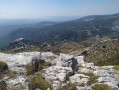
The crossing of the Cavillore karst plateau, the long off-trail but signposted section, and the Pierre Feu valley will delight nature lovers. This walk is best undertaken in clear weather to make the most of the many panoramic views.

Details

69719144
Creation:
Last update:
Last review:
  • Walking
    Activity: Walking
  • ↔
    Distance: 6.50 mi
  • ◔
    Average duration: 4h 20 
  • ▲
    Difficulty: Moderate

  • ⚐
    Back to start: Yes
  • ↗
    Ascent: + 1,519 ft
  • ↘
    Descent: - 1,519 ft

  • ▲
    Highest point: 4,111 ft
  • ▼
    Lowest point: 2,769 ft

Photos

Description of the walk

The walk starts from the car park on the D12, where marker 12 is located.

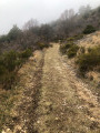
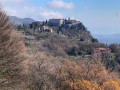
(S/E) Head towards the Plateau de Cavillore. The path climbs gradually towards the plateau, offering views overlooking Gourdon, and joins a junction with a path on the right.

(1) Continue straight on towards Colle de Rougiès via the initial straight section of the GR®51. You’ll reach marker 163.

(2) Turn left towards Colle de Rougiès. Follow the path through the ‘clapiers’ (piles of stones) to marker 46. 

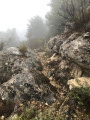
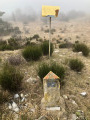
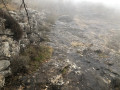
(3) Head left towards Plan Gast. The stony path descends and follows the underground gas pipeline; its specific markings – a concrete marker or a small yellow roof mounted on a 2-metre-high post – can be seen in the photo gallery. Reach a cairn just before a barrier of small rocks.

(4) Turn left onto a grassy track suitable for vehicles and continue to the junction where the track meets the gas pipeline.

(5) Leave the track at this point and follow the gas pipeline markings to the left for about 250 m.

(6) The route of the buried gas pipeline veers off to the left; continue to follow it. Keep an eye out for the yellow markings, which are relatively far apart, and make your way to the Col de l’Êcre.

(7) Carry on straight ahead due south through the woods until you reach the D12.

(8) Cross the road and continue opposite along the gas pipeline; cross a track and carry on straight ahead until you reach the civil aviation boundary wall.

(9) Head to the left of the large wall where marker 40 is located, following the signs for Gourdon. You’ll reach a wide track suitable for vehicles and marker 39.

(10) Turn left onto the track known as Chemin de la Malle. Continue to the start of a footpath on the right.

(11) Leave the track and take this path through the woods, which serves as a shortcut. Back on the track, first turn right then left and rejoin the path – which is barely visible – for a further shortcut:the app is useful here. Rejoin the track at a place called “la Fayette” for a few metres before taking athird shortcut, this time about a hundred metres long.

(12) Back on the track, turn left. Join the D12 and follow it to the right until you reach the hairpin bend.

(13) Leave the road and take the path on the right. You’ll reach a cairn marking a crossroads of paths. 

(14) Turn left and head down through the woods to the Vallon de Pierre Feu.

(15) Head to the right and follow the path alongside the dry stream bed. Return to the D12. 

(16) Turn right, walk alongside the crash barrier for a few metres, then walk carefully along the road to the car park (S/E).


Waypoints

  1. S/E : mi 0 - alt. 2,772 ft - Car park, marker 12
  2. 1 : mi 0.95 - alt. 3,396 ft - Trail junction
  3. 2 : mi 1.73 - alt. 3,514 ft - Crossroads, marker 163
  4. 3 : mi 2.81 - alt. 4,101 ft - Crossroads, marker 46
  5. 4 : mi 2.91 - alt. 3,947 ft - Path junction – track
  6. 5 : mi 3.24 - alt. 3,730 ft - Crossing of track and gas pipeline
  7. 6 : mi 3.37 - alt. 3,684 ft - Continuation of the gas pipeline
  8. 7 : mi 3.77 - alt. 3,625 ft - Col de l’Êcre
  9. 8 : mi 3.97 - alt. 3,547 ft - D12
  10. 9 : mi 4.3 - alt. 3,658 ft - Civil Aviation Wall
  11. 10 : mi 4.72 - alt. 3,619 ft - Marker 39
  12. 11 : mi 4.93 - alt. 3,514 ft - Shortcut to the right
  13. 12 : mi 5.15 - alt. 3,353 ft - Return via the track
  14. 13 : mi 5.28 - alt. 3,314 ft - Hairpin bend, road ends
  15. 14 : mi 5.35 - alt. 3,255 ft - Cairn
  16. 15 : mi 5.6 - alt. 2,972 ft - Pierre Feu Valley
  17. 16 : mi 6.22 - alt. 2,854 ft - D12
  18. S/E : mi 6.5 - alt. 2,769 ft - Roadside car park

Notes

Walking poles and hiking boots are recommended.

There is no water along the route.

There are flocks of sheep and guard dogs: your first instinct should be to walk around the flock.

Do this walk in clear weather.

Worth a visit

The village of Gourdon.

The Aven Fourchu karstic cave near the point (15) is reserved for cavers.

Always be cautious and plan ahead when you're outdoors. Visorando and the author of this route cannot be held responsible for any accidents occurring on this route.

The GR® and PR® markings are the intellectual property of the Fédération Française de Randonnée Pédestre.

Reviews and comments

4.7 / 5
Based on 3 reviews

Reliability of the description
4.3 / 5
Ease of following the route
4.7 / 5
Route interest
5 / 5
Seb-Dhen
Seb-Dhen

Overall rating : 4.7 / 5

Date of your route : May 30, 2026
Reliability of the description : ★★★★☆ Good
Ease of following the route : ★★★★★ Very good
Route interest : ★★★★★ Very good
Very busy route : No

We did this hike today in the opposite direction, starting from the village car park. To avoid the Chemin du Gaz, we took an alternative route from point 8 to point 3 (clockwise), following the old Roman road before joining the marked track leading to the Col de Rougiès.

On this route, expect a distance of around 17 km with 800 m of elevation gain.

This route is a true invitation to escape. At every bend in the path, the landscape changes: the pines release their resinous scent, the broom bushes brighten the slopes with their vibrant colours, whilst the oaks offer welcome shade in places and an almost timeless atmosphere.

The climb, steady and gradual, is easily managed without any major difficulty. Then come the ridges, where the eye is lost in a magnificent panorama. A varied, harmonious and particularly charming route, which leaves a lasting memory of a wonderful break in the heart of nature.

Machine-translated

bernard bb
bernard bb

Thank you @Morbihan56 for this review
and this extra information
It really is a lovely walk
Best wishes, b.

Machine-translated

@Morbihan56
@Morbihan56

Overall rating : 4.3 / 5

Date of your route : Mar 30, 2025
Reliability of the description : ★★★★☆ Good
Ease of following the route : ★★★★☆ Good
Route interest : ★★★★★ Very good
Very busy route : No

Hello,
A very pleasant walk with some stunning views of the sea and mountains all along the route.
We set off from the Gourdon car park via the Aven du Col de Callivore (the climb is a bit more gradual and you can park in the Gourdon car parks without any problems).
At marker 46, it is not possible to descend via the path. There is work being carried out on the gas pipeline and the path is blocked. We continued to marker 47 and descended via the slightly steep path to rejoin the original route at marker 40. This makes a total of 16 km and 660 m of elevation gain.

Machine-translated

bernard bb
bernard bb

Hello GTACAILLE,
A brilliant hike indeed,
Best wishes from a fellow hiker, b.

Machine-translated

GTACAILLE
GTACAILLE

Overall rating : 5 / 5

Date of your route : Mar 20, 2025
Reliability of the description : ★★★★★ Very good
Ease of following the route : ★★★★★ Very good
Route interest : ★★★★★ Very good
Very busy route : No

At marker 3, the descent along the gas pipeline is tricky; there is currently construction work taking place and the route is not recommended

Machine-translated

Other walks in the area

For more walks, use our search engine .

The GPS track and description are the property of this route's author. Please do not copy them without permission.