From Frontignan to Aresquiers beach

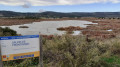
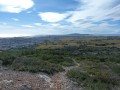
This walk takes you along the Étang d’Ingril and the former salt marshes of Frontignan. You’ll be able to spot plenty of birds here.

This walk may be closed depending on the fire risk level. Remember to check the map.

Details

41508897
Creation:
Last update:
Last review:
  • Walking
    Activity: Walking
  • ↔
    Distance: 8.87 mi
  • ◔
    Average duration: 4h 05 
  • ▲
    Difficulty: Moderate

  • ⚐
    Back to start: Yes
  • ↗
    Ascent: + 13 ft
  • ↘
    Descent: - 13 ft

  • ▲
    Highest point: 16 ft
  • ▼
    Lowest point: 0 ft
  • ⚐ Country: France
  • ⚐ City: Frontignan (34110)
  • ⚑
    Start/End: N 43.445072° / E 3.760413°
  • ❏
    IGN map(s): Ref. 2743ET
  • Hour-by-hour weather

Description of the walk

Start from the Quai des Jouteurs car park in Frontignan.

(S/E) From the car park, turn slightly right onto the path leading to a footbridge and carry on straight ahead until you reach the road bridge spanning the path. Go under the bridge and turn left to reach an information board.

(1) Take the path along the embankment to the first junction.

(2) Turn left and head towards the buildings on the right, walking between them. Immediately afterwards, turn left and walk for about twenty metres.

(3) Ignore the path on the right, which is the return route. Walk along the embankment past the former Frontignan salt marshes until you reach a path marked in yellow.

(4) Turn right and follow the yellow markings until you reach the path running alongside the Étang d’Ingril

(5) Turn left, continuing to follow the yellow markings and staying on the path closest to the lake, until you reach a footbridge.

(6) At the end, turn right. Follow the path, cross the footbridge, go through the car park and pass under the bridge. Take the steps leading up to the road.

(7) Once on the bridge, turn left (be careful, you’re on a cycle path). Cross the bridge over the Canal du Rhône à Sète. Continue left, along the path leading to the beach.

(8) Enjoy the beach, then turn back. Return via the same route until you reach the junction with the path leading from the former salt marshes, which you took on the way out.

(5) Carry on straight ahead, continuing to follow the Étang d’Ingril. Follow the path, which then turns right to run alongside a channel and rejoins a junction you passed on the way out.

(3) Turn left, then leave the buildings on your right and carry on straight ahead, following the other bank of the waterway. You’ll reach a junction you passed on the way out.

(2) Carry on straight ahead, following the reverse route of the outward journey: carry on straight ahead, turn left at the end, go under the road bridge, cross the footbridge and return to the Quai des Jouteurs car park (S/E).

Waypoints

  1. S/E : mi 0 - alt. 3 ft - Quai des Jouteurs car park
  2. 1 : mi 0.23 - alt. 3 ft - Path along the embankment – Étang d’Ingril
  3. 2 : mi 1.07 - alt. 3 ft - Junction common to both outbound and return routes
  4. 3 : mi 1.36 - alt. 3 ft - Junction common to both outward and return journeys
  5. 4 : mi 1.95 - alt. 0 ft - Junction
  6. 5 : mi 2.3 - alt. 3 ft - Junction common to both the outward and return journeys – Étang d’Ingril
  7. 6 : mi 4 - alt. 3 ft - Junction
  8. 7 : mi 4.18 - alt. 7 ft - Bridge - Canal du Rhône à Sète
  9. 8 : mi 4.47 - alt. 7 ft - Aresquiers Beach
  10. S/E : mi 8.87 - alt. 3 ft - Quai des Jouteurs car park

Notes

Avoid this walk after heavy rain. The path is muddy and slippery.

This route passes through multiple protected areas, which may be subject to special regulations:

Reviews and comments

4.7 / 5
Based on 2 reviews

Reliability of the description
5 / 5
Ease of following the route
4.5 / 5
Route interest
4.5 / 5
bernard coulomb
bernard coulomb

Overall rating : 5 / 5

Date of your route : Mar 04, 2026
Reliability of the description : Not used / Not applicable
Ease of following the route : ★★★★★ Very good
Route interest : ★★★★★ Very good
Very busy route : No

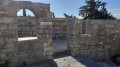
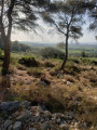
A comprehensive walk to explore this area of former salt marshes. At the beginning of March, with the flamingo colonies settled between points 1 and 5, and mud on the path between points 5 and 6, it is better to return from 6 to 5 following the Visorando trail "Les Aresquiers", which takes you through the forest to discover a drystone shelter and a superb, very long stone trough. Also worth seeing at Les Aresquiers are the "cabins" of these Grand Bleu enthusiasts, between sky and sea.
No tracking issues with GPX associated with MAPS.ME.

Machine-translated

jobebert
jobebert

Overall rating : 4.3 / 5

Date of your route : Nov 27, 2023
Reliability of the description : ★★★★★ Very good
Ease of following the route : ★★★★☆ Good
Route interest : ★★★★☆ Good
Very busy route : No

Two easy walks with no significant elevation gain, ideal for pensioners; the maps are very clear – absolutely brilliant

Machine-translated

Other walks in the area

For more walks, use our search engine .

The GPS track and description are the property of this route's author. Please do not copy them without permission.