


 Country:
 City:
City:


Park at the Nikola Karabatic Sports Hall car park.
(S/E) Take the road leading up towards the heath, then turn left to follow the Chemin de la Carrierasse. Carry on straight ahead until you reach a junction with six letterboxes.
(1) Take the path slightly to the left. Pass close to the Dromasud farm, then veer slightly off the route before the small waterhole to see the Cros drystone shelter on the right.
(2) Then rejoin the route and head straight on to the Croix du Rabassou at a place called La Joconde.
(3) Turn right.
(4) Leave the return path on your right and continue straight ahead. After the short climb, you can admire two drystone shelters on your right: the Capitelle du Fer à Cheval and the Capitelle de l’Olivier d’Yvette.
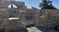
(5) Turn right onto a narrow dirt track, following the sign for “Hameau des capitelles”. Pass the Capitelle de la Brasoucade, then take a detour of about a hundred metres to the left to see another remarkable drystone shelter with a window.
(6) Resume the route to the left, pass the drystone shelter of the Garrigaires on your left and arrive at a junction at a small pass.
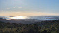
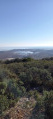
(7) Take the track to the right and head for a beautiful viewpoint overlooking the sea.
(8) Head right towards the fitness trail and arrive near a large three-way junction.
(9) Take the small dirt track leading down to the right. Further on, on the right, you’ll pass another drystone shelter about thirty metres away; then, before rejoining the finishing path, don’t miss the route’s final drystone shelter, which is asymmetrical and adorned with a tree trunk.
(4) Take the path back the way you came, turning left to return to the Croix de Rabassou.
(3) Continue to the left and retrace your steps to return to the car park (S/E).
 Visorando Member

 Moderate
 Difficult
