Country:

 City:



From Perpignan, at the Prades entrance, follow the Rocade (D66), go past the first two roundabouts, heading towards Andorra.
At the third roundabout, turn right towards Cattlar, Molitg and Mosset. You’ll soon reach a crossroad (D619). Follow it to the right to cross the River Têt. Then turn right again and pass two roundabouts. After passing Le Mas Riquer, turn left and cross the Castellane. Pass two streets on your left and you’ll reach a roundabout (this time), consisting of two ‘Stop’ signs and two priority roads! Turn left onto Carrer del Salt Gros, and further on, find a space in the large car park by the cemetery.
(S/E) Continue just a short way along Carrer del Salt Gros and turn right to walk alongside the cemetery on your right-hand side. Head down a track, cross the bridge over the Castellane and reach a fork in the road. Signpost: Prades.
Old and scatteredyellow markings
(1) Turn left, cross a sort of ford, head up to the right onto a badly damaged and very stony track, then, at the next fork, turn left and climb for 60 m along a track. You’ll reach a fork. Leave the track and head up to the right along the path, heading south-west. Further up, you’ll reach a track suitable for vehicles. Follow it to the right for 30 metres until you reach a junction where several tracks meet a road.
Unmarked
(2) Head down opposite, due south, along the tarmac road, until you reach a sharp left-hand bend.
Leave the road and continue straight ahead along a good path that widens (an old track). A little further on, leave this overgrown old track and continue to the right along a good, flat path. After 100 metres, you’ll reach a fork in the path.
Leave the track on the right, follow the track straight ahead, which slopes gently downwards, and, after a short climb, you’ll reach an EDF medium-voltage pylon on your right. Continue downhill and you’ll come to a junction with a concrete road crossing it.
Turn left, heading steeply downhill along this concrete road. You’ll reach a Y-junction where three gravel roads meet, marked by a Stop sign.
(3) Cross the junction and head straight on, following the pretty canal. Further on, you’ll reach a road (Chemin de Canoha). Continue steadily along this road. You’ll come to two old structures for crossing the water intake on your left. Carry on along the road, go round a bend to the right, then look out for the start of a path in the bend to the left that follows.
(4) Head uphill to the right, then, at the fork immediately after, turn left onto a very steep climb. The path then becomes less steep as it turns south-west. You’ll reach a small open area. There’s a signpost for Pi del Rei and a wooden sign nailed to a tree on the right.
(5) Ignore the path leading down to the left. Continue straight on until you reach another fork.
Yellow markings are very sparse
(6) Ignore the path leading down to the left. Continue straight ahead, still climbing. You’ll reach a clearly marked fork. Signpost: Pin del Rei A/R.
(7) Turn left, heading north-west, and you’ll soon reach the Pin del Rei (a remarkable sight). Unfortunately, its age and two years of drought have taken their toll: barkless branches and a damaged trunk!
Take care for the rest of the route.
No signposting. Cairns
(8) Look out for a fairly large cairn to the north-west. Head in that direction and follow a very lovely path through the forest which climbs gently until you reach an inconspicuous fork, near a stone shelter on the right-hand side (alt. 640 m).
Turn left and begin a very steep descent. Cairns help you make your way along the stone terraces. Further down, join a good path. No signposts.
Yellow markings are very sparse
(9) Head up to the right along this good path, which is stony in places. Much higher up, you’ll reach a wooden gate marking the entrance to Llúgols.
(10) Go through this gate (and make sure to close it properly), then pass a house on your right. Immediately after this, turn right (wooden signpost: Saint-Christophe). You’ll soon reach a track; follow it uphill to the left. Go through a gate consisting of two horizontal electrified bars mounted on springs. Turn left, crossing a bridge made of wooden railway sleepers. You’ll very quickly reach a fork in the path (alt. 598 m). There’s a signpost for Conat (vertical arrow pointing upwards).
(11) Continue straight on along a good path which soon begins to descend. Follow it for about 600 m and, after a bend (south-west), you’ll reach a small clearing in the forest (alt. 692 m). Look out for a substantial cairn on the right.
No signposting. Cairns
(12) Climb due north along a path clearly marked on the ground. Cross a valley and turn south-west. Take care. The barely visible path continues on level ground along the edge of the forest (on your right and higher up).
Although marked on the ground, it is not easy to follow. Look out for and follow the numerous cairns. After a climb due west, you will come out onto a track. The chapel is clearly visible, higher up on the right.
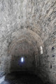
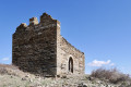
(13) Head up to the right along this stony track, pass a track on the left and arrive at the Chapel of Santa Margarita de Nabilles, which is in a state of disrepair.
(14) Two options:
- either continue along the track;
- or leave the track and head up to the left along a poorly marked path, north-west towards the summit marked by a triangulation point (altitude 886). Vast 360° panorama.
Then descend due north towards a firing range and, further on, rejoin the track you left earlier. Head left up this track and reach a junction where three tracks meet. Go through a removable barbed-wire fence. Please close it properly. Thank you. Turn right onto a wide, motorable track and arrive at a bend in another track (DFCI).
(15) Head down this track to the right. Much further down, leave a track on your right and continue straight ahead for 20 metres until you reach a junction where three tracks meet.
Very sparse yellow markings with no directional signs
(16) Continue to the right, south-east, along the wide track (DFCI) of Pla de Valensó (a vast, unmaintained plateau where cows graze all year round). Further on, reach another junction where three tracks (DFCI) meet, where two fine holm oaks stand.
(17) Turn sharply left, heading due north, onto the track (DFCI). Cortal Freixa (an abandoned sheepfold) is clearly visible to the north, to the right of the DFCI. Ignore a track that climbs to the left. Walk past Cortal Freixa and, 200 m further on, reach a right-hand bend in the track (elevation 794). Take care.
(18) Turn left, heading north-east, onto an old, disused track which very quickly becomes a path. Follow it down and, after a gate, turn left until you reach a cross-track (alt. 732 m).
(19) Turn right and head towards a junction where three tracks meet.
(20) Turn left, due east, onto the DFCI track which descends. You can cut across two bends via the old path, which used to be signposted. You’ll reach an area with a yellow backhoe loader in a hay storage and grazing area. Continue downhill, turn north, then south-east, and, 600 m further on, look out for a signpost on the left: ‘Cattlar’, at the start of a grassy track (alt. 625 m). Take care.
(21) Turn left and head down this track, which ends very quickly. Then follow a steep, stony path, cross a brand-new fence (a passageway has been created on the left-hand side of the path: observed in March 2024) and you will immediately reach a sort of small roundabout where three paths meet (alt. 594 m).
(22) Continue to the right, eastwards, along the steep and very stony path, which eventually leads to a barely marked fork (alt. 430 m). Take care.
Unmarked
(23) Turn right, ignoring the Yellow Cross, and descend along a very rough track. Continue straight down, after three tight hairpin bends, and join the Còrrec de les Eres at a junction of three paths and a track to the right.
(24) Cross the valley floor and head straight ahead, following the retaining wall of the track above. Join the track and follow it to the left until you reach the original fork.
(1) Turn left and cross the bridge over the Castellane, then retrace your steps along the route taken on the way there to reach the large car park at the cemetery (S/E).

 Visorando Member
 Easy

 Moderate
 Association / Club / Walk leader