Pic d’Escreins

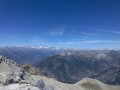
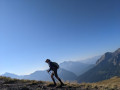
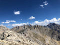
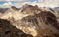
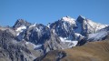
A lovely circular walk where the highest point offers a magnificent 360° view of the Écrins massif, the Queyras and Mont Blanc.

Details

302417
Creation:
Last update:
Last review:
  • Walking
    Activity: Walking
  • ↔
    Distance: 10.28 mi
  • ◔
    Average duration: 8h 55 
  • ▲
    Difficulty: Difficult

  • ⚐
    Back to start: Yes
  • ↗
    Ascent: + 4,839 ft
  • ↘
    Descent: - 4,810 ft

  • ▲
    Highest point: 8,950 ft
  • ▼
    Lowest point: 5,837 ft

Photos

Description of the walk

Access: from Guillestre via the D902 road to Vars, turn left towards the Val d’Escreins, pass close to the Basse-Rua refuge and continue to the car park.

(S/E) At the end of the car park, cross the Rif-Bel via the wooden bridge and turn left towards the Pic d’Escreins (signposted). Cross the meadow along the nature trail towards the refuge, where you can see the ruins of Basse-Rua, then continue along the path on the right, marked in red and yellow, to reach the forest. Climb through the woodland along a very pleasant path.

(1) Leave the path leading down to the refuge on your left and continue along this track, which then becomes steeper and more rugged.

(2) Take care, but the path is well-maintained with handrails and metal steps. You’ll already start to catch some views. Continue along the path, sometimes through the woodland, sometimes out in the open on a balcony-like ledge, and cross numerous ravines to reach a junction.

(3) Carry on to the right and, after a stretch in the open, pass the Crête d’Agnès and reach the Crête de Cugulet.

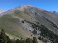
(4) Carry on to the right; there’s another 80 metres of ascent or so, and you’ll reach the highest point.

(5) After taking in the magnificent 360° panorama to the full, head back down the same route to the signpost on the ridges.

(4) Head straight along the Cugulet ridge (marked with orange circles) on a relatively exposed path, climbing up to the summit of Cugulet (leaving the path you arrived on to your left). On the map, a path climbs directly to the right up the eastern side. As this seemed too exposed to me, I preferred to carry on a little further and do a round trip via the western side, climbing to the right.

(6) From the summit, head back down the path and climb up the opposite slope to the summit of Combe-Chauve, where you’ll find a cross and Notre-Dame-de-Combe-Chauve, a pink marble statue that watches over the Guillestrois and Mont-Dauphin.

(7) Head back down via a path through the woodland until you reach a forest track.

(8) At this junction, turn left, following the yellow markings, towards the Cabane de Cugulet.

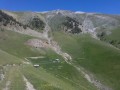
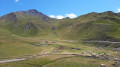
(9) In this summer grazing area, you’ll be able to spot plenty of marmots. Go round the enclosure at the top and cross the meadow to rejoin an ascending path, clearly marked towards the Crêtes d’Agnès. Continue along this lovely ridge walk and return to the crossroads you passed on the way up.

(3) Head back down via the route you took on the way up to reach the car park (S/E).

Waypoints

  1. S/E : mi 0 - alt. 5,837 ft - Val d’Escreins car park
  2. 1 : mi 0.66 - alt. 6,211 ft - Trail junction
  3. 2 : mi 1.11 - alt. 6,745 ft - Cables and metal staircases
  4. 3 : mi 2.44 - alt. 7,523 ft - Pic d’Escreins signpost
  5. 4 : mi 3.5 - alt. 8,711 ft - Crêtes de Cugulet, turn right
  6. 5 : mi 3.75 - alt. 8,806 ft - Pic d'Escreins
  7. 6 : mi 5.07 - alt. 8,235 ft - Cugulet summit
  8. 7 : mi 5.31 - alt. 8,127 ft - Combe-Chauve summit
  9. 8 : mi 6.15 - alt. 7,221 ft - Forest track junction
  10. 9 : mi 6.86 - alt. 7,228 ft - Bergerie Cabane de Cugulet
  11. S/E : mi 10.28 - alt. 5,840 ft - Val d’Escreins car park

Notes

Make sure you have sturdy footwear, a hat and water.
Refreshments are available at the Basse-Rua mountain refuge.

Worth a visit

Val d’Escreins Discovery Trail
Ruins of the former summer village of Escreins, ravaged by fire in 1916 and permanently abandoned.
The chapel was restored in 1982.
A profusion of wild flowers: orchids, carnations, gentians, buttercups…
Marmots, chamois.
The statue of Notre-Dame-de-Combe-Chauve is the work of Marc Combe, a former operator of the Guillestre pink marble quarry. To install this statue at an altitude of 2,483 metres, it had to be cut into two parts, airlifted by helicopter and reassembled on site.

Reviews and comments

4.6 / 5
Based on 3 reviews

Reliability of the description
4.3 / 5
Ease of following the route
4.7 / 5
Route interest
4.7 / 5
MICHEL.SOL
MICHEL.SOL

Overall rating : 5 / 5

Date of your route : Jul 27, 2022
Reliability of the description : ★★★★★ Very good
Ease of following the route : ★★★★★ Very good
Route interest : ★★★★★ Very good
Very busy route : No

Hello everyone, a long hike for a brilliant view. Don’t underestimate the good hundred metres you’ll have to climb on the way back via the Cugulet huts… It really takes it out of your legs, even with the marmots!

Machine-translated

bernardino
bernardino ★

Hello, and many thanks for your comment.
It’s true that this peak is remarkable and offers a superb view, as you point out.
Thank you for letting me know about the missing sign; I’ll make a note of this in the description.
However, your comment on the estimated time is entirely subjective, just like the one suggested by the Visorando app. As you know, walking times vary depending on individual perceptions and the walkers themselves, but a hike with over 1,600 metres of elevation gain isn’t within every walker’s capabilities. I don’t think it’s the estimated time that will put off the average walker, but rather the combination of elevation gain and distance.
Best of luck with your future hikes and your reviews.

Machine-translated

icathou
icathou
• Edited:

Overall rating : 4 / 5

Date of your route : Aug 12, 2021
Reliability of the description : ★★★★☆ Good
Ease of following the route : ★★★★☆ Good
Route interest : ★★★★☆ Good
Very busy route : No

A lovely walk, though only part of it is circular, and retracing your steps along the same route back is a bit of a slog. However, the estimated duration is overestimated, which might put some people off. Duration: 7 to 8 hours maximum, including a few breaks and a picnic.
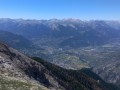
The sign saying “Pic d’Escreins – 00:30 minutes” is no longer there; the view from the summit of Combe Chauve over the Durance Valley is magnificent, and the circular return route via the mountain pasture is pleasant.

Machine-translated

KevkRando
KevkRando

Overall rating : 4.7 / 5

Date of your route : Aug 14, 2017
Reliability of the description : ★★★★☆ Good
Ease of following the route : ★★★★★ Very good
Route interest : ★★★★★ Very good

Hello,
This is a very good walk. However, I have a comment regarding the description:
The route as a whole is rated as difficult. However, the first part of the route (from the start to point no. 3) is, in my opinion, very difficult, if not dangerous. In fact, there are two ravines where you almost have to climb to continue along the route. There are other sections at the start of the walk that are very difficult but manageable. The rest of the walk is as described.
Thank you!

Machine-translated

Other walks in the area

For more walks, use our search engine .

The GPS track and description are the property of this route's author. Please do not copy them without permission.