A short but lovely walk around Vesqueville

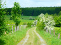
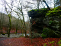
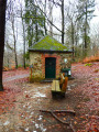
A short, peaceful walk around Vesqueville. It crosses fields and woodland and is quite varied. Very pleasant and easy to follow.

Details

n°66968459
Creation:
Last update:
Last review:
  • Walking
    Activity: Walking
  • ↔
    Distance: 3.97 mi
  • ◔
    Average duration: 2h 05 
  • ▲
    Difficulty: Easy

  • ⚐
    Back to start: Yes
  • ↗
    Ascent: + 253 ft
  • ↘
    Descent: - 243 ft

  • ▲
    Highest point: 1,814 ft
  • ▼
    Lowest point: 1,519 ft

Description of the walk

Start from the car park at the kerb, opposite No. 14, Rue de Lavacherie.

(S/E) With your back to No. 14, turn left, then take the first turn right then left at the next junction. Follow Rue Fayet, then take thefirst street on the left until you reach a fork in the road.

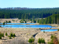
(1) Carry on to the left (Rue de la Scierie), walk alongside a pond on your right and reach a track on the right.

(2) Take this track and head into the woodland. Walk alongside the ponds, then carry on straight ahead until you reach the edge of the forest.

(3) Follow the path on the right which enters the forest, then turn left at the next junction. Continue straight on until you reach a road.

(4) Cross the road by first turning left then right, and follow the path until you reach a cross-country track.

(5) Carry on to the left until you reach a fork.

(6) Carry on almost straight ahead, leave the forest and continue to the end of the field on your right.

(7) Take the small path on the left through the fields and reach a road.

(8) Carry on left along this road until you reach the next fork.

(9) Turn right and head for No. 14 Rue de Lavacherie (S/E).

Waypoints

  1. S/E : mi 0 - alt. 1,604 ft - 14 Rue de Lavacherie
  2. 1 : mi 0.35 - alt. 1,535 ft - Junction (Rue de la Scierie)
  3. 2 : mi 0.64 - alt. 1,562 ft - Vehicle-accessible track
  4. 3 : mi 1.03 - alt. 1,627 ft - Edge of the forest
  5. 4 : mi 1.83 - alt. 1,745 ft - Route
  6. 5 : mi 2.43 - alt. 1,811 ft - Cross-country track
  7. 6 : mi 2.73 - alt. 1,736 ft - Junction
  8. 7 : mi 3.02 - alt. 1,654 ft - Narrow path to the left
  9. 8 : mi 3.67 - alt. 1,663 ft - Route
  10. 9 : mi 3.83 - alt. 1,624 ft - Junction
  11. S/E : mi 3.97 - alt. 1,604 ft - 14 Rue de Lavacherie

Notes

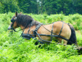
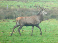
The walk is fairly flat but pleasant, with varied scenery (woodland, lakes, fields).

Reviews and comments

5 / 5
Based on 1 review

Reliability of the description
5 / 5
Ease of following the route
5 / 5
Route interest
5 / 5
Pierre 6970
Pierre 6970

Overall rating : 5 / 5

Date of your route : Dec 30, 2024
Reliability of the description : ★★★★★ Very good
Ease of following the route : ★★★★★ Very good
Route interest : ★★★★★ Very good
Very busy route : No

A walk taken on 29 December 2024 in a light frost. A varied and pretty landscape. In the wooded section, the path was muddy.

Machine-translated

Other walks in the area

For more walks, use our search engine .

The GPS track and description are the property of this route's author. Please do not copy them without permission.