From Monteil to the Bois des Sapées

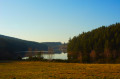
Set amongst plateaus, valleys and woodland, come and discover a small but varied selection of Pilat’s landscapes.

Details

1740117
Creation:
Last update:
Last review:
  • Walking
    Activity: Walking
  • ↔
    Distance: 7.50 mi
  • ◔
    Average duration: 4h 05 
  • ▲
    Difficulty: Moderate

  • ⚐
    Back to start: Yes
  • ↗
    Ascent: + 725 ft
  • ↘
    Descent: - 741 ft

  • ▲
    Highest point: 3,323 ft
  • ▼
    Lowest point: 2,881 ft

Photos

Description of the walk

Park in the car park at Marlhes church.

(S/E) From the church square, head up Rue de l’Abreuvoir. Further on, cross the Route de Saint-Genest and take Rue de la Red Cross, which is slightly to the right opposite. This turns into a track after the houses. Stay on the main track.

(1) Turn right at the fir tree nursery (cross). Stay on the main path; the others lead into animal enclosures.
Leave Les Montagnes on your right and join the access road to the hamlet.

(2) Head downhill, turning left towards La Forie. Continue to the right at the first junction, then turn left immediately. Cross the bridge in front of the house.

(3) Follow the path which climbs up to the left. Be careful, there are streams. Turn right at the T-junction and you’ll arrive in Monteil.

(4) Carry on to the right along the Route du Monteil and head down towards La Faye.

(5) At the junction, take the second road on the right towards La Grange. Pass La Grange (on your right).

(6) Turn onto the track on the right at the cross, just after the hamlet. Stay on the main track. At the junction with the road (D501), continue to the right to enter Marlhes.

(7) Turn left onto Rue de l’Orme and carry on straight ahead. Turn left at the junction with Rue de l’Aubépine, pass Écotay and continue in the same direction. Start the climb, leaving Les Granges on your left, and at the cross, keep to the right towards Suc de Rondet.

(8) Turn right onto the path. At the junction with the Route du Guenard (D501), head up the road to the left for a good hundred metres and rejoin the path on the other side.

(9) Please note: on the right there is a path leading down to the small lake (Lac des Sapées), but it does not appear on the IGN map. Ignore it and follow the path climbing opposite, entering the forest. Turn left at the next fork.

(10) At the signpost, turn right towards Marlhes and Maison de l’Eau. Stay on the main forest track by continuing straight ahead; please note that, once again, many forest tracks do not appear on the IGN map.

(11) Turn right at the signpost for Maison de l’Eau, following the edge of the forest. Be careful not to take the path leading to the forest lodge, which is further towards the centre.
Follow the yellow and white markings along the edge of the forest and ignore the paths on the left. Cross through the forest and turn left at the next fork (elevation 920). The path descends towards a stream.

(12) Walk past the Maison de l’Eau (Maison du Parc/de la Réserve) and join the Route des Forêts.
At the junction with the Route de Marlhette, turn right.

(13) After two bends, at the cross, turn slightly right onto the path. Walk past La Lune and continue along the Chemin des Templiers until you reach the Route de Riotord (D501), which you should cross carefully to reach the point at (S/E).

Waypoints

  1. S/E : mi 0 - alt. 3,091 ft
  2. 1 : mi 0.53 - alt. 3,077 ft - Fir tree nursery / Cross
  3. 2 : mi 1.06 - alt. 2,982 ft - Access road to Les Montagnes, on the left
  4. 3 : mi 1.4 - alt. 2,884 ft - La Forie
  5. 4 : mi 1.63 - alt. 2,999 ft
  6. 5 : mi 2 - alt. 2,966 ft - La Faye
  7. 6 : mi 2.39 - alt. 3,094 ft - Cross, on the right
  8. 7 : mi 3.41 - alt. 3,107 ft - Marlhes, on the left
  9. 8 : mi 4.21 - alt. 3,228 ft - Path on the right
  10. 9 : mi 4.7 - alt. 3,166 ft - Lac des Sapées junction
  11. 10 : mi 5.08 - alt. 3,320 ft - Sign, on the right
  12. 11 : mi 5.57 - alt. 3,261 ft - Bois de Labourier, on the right
  13. 12 : mi 6.56 - alt. 2,963 ft - Maison de l’Eau
  14. 13 : mi 7.14 - alt. 3,041 ft - Cross, path on the right
  15. S/E : mi 7.5 - alt. 3,091 ft

Notes

(S/E) possible from Marlhes – easier to park on the Place de l’Église.
Very wet path with streams occasionally crossing the path.
Watch out for forestry work.
Black ice possible, particularly in the forest in winter.

Worth a visit

Maison de l’Eau.
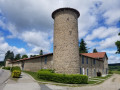
Marlhes village centre: wash house, church

Reviews and comments

4.8 / 5
Based on 2 reviews

Reliability of the description
5 / 5
Ease of following the route
4.5 / 5
Route interest
5 / 5
PiMi42
PiMi42

La Maison de la Béate in Le Monteil is a private property; there is no public car park nearby. It would be best to start the walk in the village of Marlhes (point 3), where there is a car park on the Place du Millénaire, a water point and shelter available in the walkers’ hall behind the church. All amenities are nearby. Walkers are welcome!

Machine-translated

flashette69
flashette69

Overall rating : 4.7 / 5

Date of your route : Jul 31, 2021
Reliability of the description : ★★★★★ Very good
Ease of following the route : ★★★★☆ Good
Route interest : ★★★★★ Very good
Very busy route : Yes

A lovely walk – perfect for families. We set off from the church in Marlhes and had a picnic on a table near the starting point. A lovely village with a hikers’ hall.

Machine-translated

marcofirm
marcofirm

Overall rating : 5 / 5

Date of your route : Jun 24, 2020
Reliability of the description : ★★★★★ Very good
Ease of following the route : ★★★★★ Very good
Route interest : ★★★★★ Very good
Very busy route : Yes

A lovely walk
The residents of Monteil called out to us, telling us
that we shouldn’t park here, as they themselves had trouble finding a space
It would be a good idea to move the starting point to the village of Marlhes
Otherwise, with GPS, there’s no problem following the route

Machine-translated

Other walks in the area

For more walks, use our search engine .

The GPS track and description are the property of this route's author. Please do not copy them without permission.