Short circular loop starting from Escout

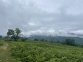
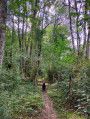
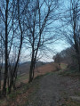
A short walk, 1 hour 15 minutes including breaks and photo stops, ideal for families, with a lovely spot for a picnic near the Croix de Peyrecor.

Details

14751667
Creation:
Last update:
Last review:
  • Walking
    Activity: Walking
  • ↔
    Distance: 2.73 mi
  • ◔
    Average duration: 1h 35 
  • ▲
    Difficulty: Easy

  • ⚐
    Back to start: Yes
  • ↗
    Ascent: + 400 ft
  • ↘
    Descent: - 400 ft

  • ▲
    Highest point: 1,273 ft
  • ▼
    Lowest point: 869 ft
  • ⚐ Country: France
  • ⚐
    Area: Pyrenees
  • ⚐ City: Escout (64870)
  • ⚑
    Start/End: N 43.188729° / W 0.550753°
  • ❏
    IGN map(s): Ref. 1545ET, 1545SB, 1546OT
  • Hour-by-hour weather

Photos

Description of the walk

Park at Place Cailleau in the village of Escout.

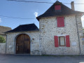
(S/E) Head west along Rue Labiorbe for about a hundred metres. Turn right at thesecond junction onto Route de Peyrecor. Continue to the last houses in Escout.

(1) Stay on Route de Peyrecor and, a little further on, cross the Ruisseau de l’Escou. Climb gently along a tarmac road; it’s safe as very few people use it. Pass a hairpin bend before emerging from the woods. Carry on straight ahead. You’ll reach a junction with a track suitable for vehicles.

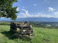
(2) Turn right and carry on to reach the highest point: the Croix de Peyrecor tumulus, visible on the right.

(3) Carry on a little further and you’ll soon spot a second dolmen, the Peyrecor dolmen.
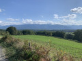
Carry on straight ahead and, at the next junction, ignore the path on the right to reach a viewpoint.

(4) Retrace your steps and turn left at the junction you passed a few minutes earlier. Cross the small road and follow the wide path which descends gently to the old Escout cemetery, marked by a large grey gate set high up.

(5) Turn right and head towards thefirst houses in Escout. Turn slightly right, cross the Escou again, then continue right along Rue Lamarque to easily reach the car park at Place Cailleau (S/E).

Waypoints

  1. S/E : mi 0 - alt. 873 ft - Place Cailleau car park
  2. 1 : mi 0.12 - alt. 869 ft - The last houses in Escout
  3. 2 : mi 0.82 - alt. 1,168 ft - Junction on a road
  4. 3 : mi 0.96 - alt. 1,234 ft - Tumulus
  5. 4 : mi 1.28 - alt. 1,273 ft - 180° view
  6. 5 : mi 2.32 - alt. 909 ft - Cemetery
  7. S/E : mi 2.73 - alt. 873 ft - Place Cailleau car park

Notes

Note: this route follows aPR® trail and is therefore marked in yellow.

Always be cautious and plan ahead when you're outdoors. Visorando and the author of this route cannot be held responsible for any accidents occurring on this route.

The GR® and PR® markings are the intellectual property of the Fédération Française de Randonnée Pédestre.

Reviews and comments

4.6 / 5
Based on 3 reviews

Reliability of the description
4.7 / 5
Ease of following the route
4.7 / 5
Route interest
4.3 / 5
jdecor
jdecor

Overall rating : 5 / 5

Date of your route : Jan 13, 2025
Reliability of the description : ★★★★★ Very good
Ease of following the route : ★★★★★ Very good
Route interest : ★★★★★ Very good
Very busy route : Yes

The path down past the cross seemed muddy to us, so we decided to take a detour via the second cross (elevation 391) – a curious concrete structure – and the village of Escou.

Machine-translated

Chriss 33
Chriss 33

Overall rating : 4.7 / 5

Date of your route : Sep 20, 2024
Reliability of the description : ★★★★★ Very good
Ease of following the route : ★★★★★ Very good
Route interest : ★★★★☆ Good
Very busy route : No

A lovely walk, rewarded with a 180° view of the Pyrenees mountain range and the dolmen opposite; the only downside is the climb, which follows a winding road and is rather tedious – though the descent along a stony path is much more enjoyable!

Machine-translated

Almera
Almera

A short, easy walk with a lovely view from the cross and the dolmen. I didn’t see the second dolmen, as mentioned in the guidebook.

Machine-translated

cricri84
cricri84

Overall rating : 4 / 5

Date of your route : Sep 24, 2023
Reliability of the description : ★★★★☆ Good
Ease of following the route : ★★★★☆ Good
Route interest : ★★★★☆ Good
Very busy route : No

A lovely, fairly short and easy walk, ideal for a family outing. The view from the dolmen and the cross over Escout and the valley is lovely. It’s not signposted at all, so you’ll need the GPX track (there are a few signs here and there). However, there’s no point heading towards the mast on the track; we didn’t see the viewpoint (track + description). There are some lovely houses on the way back to Escout.

Machine-translated

Other walks in the area

For more walks, use our search engine .

The GPS track and description are the property of this route's author. Please do not copy them without permission.