


 Country:
 City:
City:



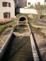
Park in the car park along the RN 19 behind the bus station, near the old lock.
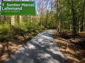
(S/E) Take the towpath on this side of the Haute-Saône Canal, known as the ‘Coulée Verte’. Follow the Coulée Verte until you reach Essert.
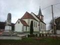
(1) Before the bridge, turn right onto the road leading up towards the village. You’ll come out onto Rue Delattre de Tassigny at the school. Turn right onto it and head towards the church.
(2) Walk past the church and turn right, following the sign for the Chemin de l’Ouvrage de Essert.
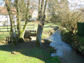
You’ll come to a wash house with a stone trough, then the River Doucette.
(3) Cross the River Doucette. Follow Rue du Sergent-Chef Leiris. Continue uphill until you reach the Notre-Dame du Mont du Vœux Chapel. Why not take the opportunity to visit it?
(4) Turn right onto the ‘Randonnée des Forts’ or ‘Combattes’ footpath. A little further on, you’ll come to a footpath junction.
(5) Leave this wide path, which leads directly to the fort. Take the path on the right, looking out for the arrows on a tree trunk on the left (Red Circle). Follow this gently ascending path until you reach the fort’s viewing platform.
(6) Continue past:
- either past the entrance to take a look at the inner courtyard,
- or straight ahead, passing over the entrance.
Go round the fort by taking the path furthest to the right, walking through the forest along part of the Way of St James. After skirting the edge of the forest, you’ll come out onto a fairly wide forest track.
(7) Turn right onto it and walk past the hamlet of Le Tremblet.
(8) Keep heading north-east along this wide track. You’ll come to a right-angled bend.
(9) Turn left to cross the River Doucette (Douce) once more. As you leave the bridge, turn right and take the path below the Haute-Saône canal. Walk up the street until you reach the crossroads you passed on the way out.
(1) Turn left onto the Coulée Verte and follow the same route as on the way out to return to the starting car park (S/E).

 Visorando Member

 Local authority
 Difficult
 Moderate
