The Four Valleys Route in Jauldes

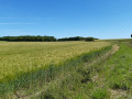
Your walk through the heart of Jaulde’s countryside will allow you to discover authentic examples of local heritage in a peaceful and colourful setting.

Details

3377192
Creation:
Last update:
Last review:
  • Walking
    Activity: Walking
  • ↔
    Distance: 10.47 mi
  • ◔
    Average duration: 5h 00 
  • ▲
    Difficulty: Moderate

  • ⚐
    Back to start: Yes
  • ↗
    Ascent: + 236 ft
  • ↘
    Descent: - 210 ft

  • ▲
    Highest point: 495 ft
  • ▼
    Lowest point: 308 ft
  • ⚐ Country: France
  • ⚐ City: Jauldes (16560)
  • ⚑
    Start/End: N 45.785049° / E 0.257506°
  • ❏
    IGN map(s): Ref. 1731SB
  • Hour-by-hour weather

Photos

Description of the walk

(S/E) From the Town Hall car park, head towards Coulgens then turn right towards the church. After the war memorial behind the church, turn left. Then turn right and immediately left to go round the cemetery. Walk past the memorial to 19 March 1962.

(1) Cross the D 45 and follow the small road opposite. Take the first path on the left (elevation 121). Pass under a high-voltage power line and you’ll come to a crossroads.

(2) Turn right and pass under the high-voltage power line again. The track is an ancient Roman road that crosses the village from north to south. Carry straight on.

(3) At the second junction, veer to the right. You’ll come out onto a road; follow it to the left. Ignore a road coming from the left.

(4) Just before the entrance to the village of L’Aiguille, turn left twice. Follow the old Roman road from Saintes to Limoges westwards for 1.5 km. Ignore the first path on the left.

(5) At the second junction, turn left at the crossroads. Head due south and ignore all side roads.

(6) Cross a small road and continue along the path opposite. Go straight on and ignore a turn-off on the left.

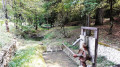
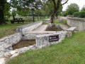
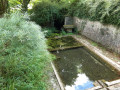
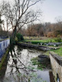
(7) At the next junction, take the path on the right. In the village of Treillis, carry on straight ahead and cross a small road. At the end of the alley, turn right and pass a wash house (possible stop).

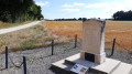
(8) After the washhouse, leave the road and turn right towards the Stèle des Américains. At the next junction, turn right again.

(9) Turn left after the monument and rejoin the old Roman road. Continue straight on, heading west-south-west.

(10) At the end of the path, turn right and then immediately left.

(11) At the next junction, turn left. Cross the D 88 and follow a path (not shown on the IGN map) which heads diagonally to the left. Carry straight on (south-south-east) and ignore all side paths.

(12) You’ll cross aGRP® path (signposted) and continue south. Stay on the path, pass under a high-voltage power line and ignore all junctions until you reach a tarmac road.

(13) Follow the road to the left and leave it immediately to take a track on the right. Further on, ignore a track cutting across at right angles on the right. You’ll come out onto a road; follow it to the left for about fifty metres.

(14) Take thefirst right and pass through the village of l’Âge. On leaving the village, take thefirst track on the left. At the end, follow a wider track on the left and leave it immediately afterwards to take another track on the left (north-west).

(15) At the next junction, turn left again.

::16 At the T-junction, turn right. At the next junction (elevation 151), turn left onto a path. Leave the Bois de Fayolle.

(17) At the crossroads, follow a path to the right. Continue straight on (east-south-east), ignoring all side paths. You’ll reach the village of Jauldes and, in the centre, turn right to return immediately to the starting point (S/E).

Waypoints

  1. S/E : mi 0 - alt. 407 ft - Town Hall car park
  2. 1 : mi 0.3 - alt. 413 ft - Les Loges
  3. 2 : mi 0.96 - alt. 420 ft - Crossroads. Ancient Roman road
  4. 3 : mi 1.37 - alt. 361 ft - Junction
  5. 4 : mi 2.05 - alt. 354 ft - Start of the path on the left. Ancient Roman road
  6. 5 : mi 2.99 - alt. 407 ft - Crossroads
  7. 6 : mi 3.45 - alt. 397 ft - A short road
  8. 7 : mi 3.79 - alt. 417 ft - Crossroads
  9. 8 : mi 4.23 - alt. 420 ft - Junction after the wash house
  10. 9 : mi 4.79 - alt. 413 ft - American Memorial
  11. 10 : mi 5.44 - alt. 440 ft - Junction
  12. 11 : mi 6.01 - alt. 413 ft - Crossroads
  13. 12 : mi 6.89 - alt. 328 ft - Crossroads
  14. 13 : mi 7.69 - alt. 364 ft - A short road
  15. 14 : mi 8.18 - alt. 377 ft - Village of the Aged
  16. 15 : mi 8.64 - alt. 443 ft - Junction
  17. 16 : mi 8.84 - alt. 482 ft - T-junction
  18. 17 : mi 9.06 - alt. 469 ft - Crossroads
  19. S/E : mi 10.47 - alt. 407 ft - Town Hall car park

Notes

Starting point: Jauldes Town Hall square.
Signposting: Pink.
Shade / sun.
Not recommended for families.

Contact details
Town Hall: 05 45 20 61 06 / Tourist Office: 05 45 95 16 84

Extract from information sheet No. 008PA “Walks between Touvre and Charente”.

Worth a visit

Places to see along the way:

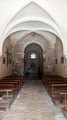
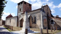
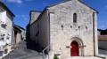
(S/E) Under the trees in front of the church, a display panel recounts the history of this building, dedicated to Saint Martin, as well as the anecdote about the dispute between the inhabitants of Jauldes and their neighbours from Briauds…

(2) This area has many ‘combes’. By the way, do you know what a ‘combe’ is? A ‘combe’ is a small valley.

(8) At the junction of the parishes of Jauldes, Coulgens and Aussac-Vadalle, one is immersed in the tragic event that marked the history of the parish during the Second World War: the mid-air explosion of a bomber aircraft on 19 June 1944.

(14) In the Middle Ages, the village of L’Âge was the seat of a priory attached to the Benedictine Abbey of Saint-Cybard in Angoulême.

Through the branches, one can make out the ruins of Fayolle Castle (a square tower) dating from the 16th century, situated at the highest point of the village (151 m). The castle was renowned for the sumptuous decoration of its apartments, particularly its ‘golden chamber’.

Nearby is the Combe à Roux leisure area – ideal for picnics and featuring play areas.

Reviews and comments

4.7 / 5
Based on 2 reviews

Reliability of the description
5 / 5
Ease of following the route
4.5 / 5
Route interest
4.5 / 5
matmarlulu
matmarlulu

Overall rating : 5 / 5

Date of your route : Jun 12, 2026
Reliability of the description : ★★★★★ Very good
Ease of following the route : ★★★★★ Very good
Route interest : ★★★★★ Very good
Very busy route : No

A lovely, varied route; it might be worth doing it the other way round when it’s hot, as the final stretch is monotonous and in the sun. There’s plenty of shade along the rest of the route.

Machine-translated

alexandregr
alexandregr

Overall rating : 4.3 / 5

Date of your route : Jun 02, 2024
Reliability of the description : ★★★★★ Very good
Ease of following the route : ★★★★☆ Good
Route interest : ★★★★☆ Good
Very busy route : Yes

A route combining footpaths, single track and country lanes. A very pleasant ride through some beautiful countryside.
The signposting isn’t always very clear, but the GPX track is spot on.

Machine-translated

Other walks in the area

For more walks, use our search engine .

The GPS track and description are the property of this route's author. Please do not copy them without permission.