Fitness trail along the Sarsouille in Oyonnax

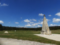
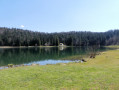
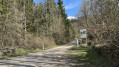
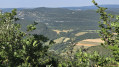
A refreshing walk along the Sarsouille, ideal for a Sunday family outing or an evening stroll to unwind after a day’s work. It feels like a little slice of Canada in winter under the snow, or amidst the wild garlic in spring. Peace and quiet guaranteed on the outskirts of town.

Details

274957
Creation:
Last update:
Last review:
  • Walking
    Activity: Walking
  • ↔
    Distance: 3.27 mi
  • ◔
    Average duration: 1h 45 
  • ▲
    Difficulty: Easy

  • ⚐
    Back to start: Yes
  • ↗
    Ascent: + 299 ft
  • ↘
    Descent: - 299 ft

  • ▲
    Highest point: 2,159 ft
  • ▼
    Lowest point: 1,844 ft

Photos

Description of the walk

Park at the end of Chemin du Petit Moulin.

(S/E) Turn right onto the path leading down to the river. Cross the bridge and turn left to follow the Sarsouille to a junction.

(1) Continue to the left along the river (to the right would be the way back).

(2) When you reach the tarmac road, turn right and cross a bridge. Follow the tarmac road until you reach a junction with a car park.

(3) At the junction, take a dirt track situated between the two tarmac roads in front of you. Follow the fitness trail to its final station, which is a tunnel in a meadow.

(4) At the end of the field, take the path that climbs to the right and then descends. At the bottom of the descent on the path, head straight down a track until you reach the tarmac road.

(5) Cross the tarmac road and take the path opposite, which curves sharply to the right and leads back down towards the river through the communal gardens.

(1) Turn left and follow the same route as on the way there to return to the car park (S/E).

Waypoints

  1. S/E : mi 0 - alt. 1,860 ft - Chemin du Petit Moulin
  2. 1 : mi 0.38 - alt. 1,946 ft - Junction of the circular loop
  3. 2 : mi 1.05 - alt. 2,080 ft - Junction at the end of the path / tarmac road
  4. 3 : mi 1.67 - alt. 2,123 ft - Car park
  5. 4 : mi 2.43 - alt. 2,057 ft - Junction
  6. 5 : mi 2.58 - alt. 1,959 ft - Junction between footpath and tarmac road
  7. S/E : mi 3.27 - alt. 1,860 ft - Chemin du Petit Moulin

Reviews and comments

4.7 / 5
Based on 2 reviews

Reliability of the description
5 / 5
Ease of following the route
4.5 / 5
Route interest
4.5 / 5
Virginie240
Virginie240

Overall rating : 4.3 / 5

Date of your route : Aug 16, 2024
Reliability of the description : ★★★★★ Very good
Ease of following the route : ★★★★☆ Good
Route interest : ★★★★☆ Good
Very busy route : No

A really lovely walk, done with a dog (on a lead). A refreshing stroll in the heat. The only downside was at the end of the route – it was impossible to find our way, and it took us a while to realise we had to take the stairs to get back to the path leading to the car park.

Machine-translated

Kryss
Kryss
• Edited:

Overall rating : 5 / 5

Date of your route : Aug 19, 2023
Reliability of the description : ★★★★★ Very good
Ease of following the route : ★★★★★ Very good
Route interest : ★★★★★ Very good
Very busy route : No

A lovely, easy walk that’s easy to get to, with no difficult sections and very well signposted. Dogs must be kept on a lead, but there aren’t many people around on weekdays in August. Much of the route is shaded, which is very pleasant in hot weather. Picnic areas blend in with the surroundings. A lovely, relaxing experience.

Machine-translated

Other walks in the area

For more walks, use our search engine .

The GPS track and description are the property of this route's author. Please do not copy them without permission.