Country:
 City:
City:


Church car park (inside the church you’ll find three statues listed as historic monuments, as well as some very old stained-glass windows).
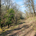
(S/E) Head towards the town hall, where you can admire the wayside cross that once stood in front of the old town hall, now the library. Turn right towards the Mas de Sounat, passing the community centre; a steep climb lies ahead. At the top, at the crossroads, turn right towards Pech de l’Église; do not enter the housing estate. At the edge of the meadow, take a path that descends into the valley. This path leads down to the Route de Caillac (a long descent through an oak wood).
(1) As you approach the road, on the right, you’ll find the Fontaine de Gouche. This fountain still holds water, but in winter it overflows into the meadows; the water covers the few steps which, in summer, allow you to enter beneath the carved rock. At the edge of this water source, note a hollowed-out stone which must have served some purpose. At the road, walk back up about two metres and carefully cross the D23 just above the small bridge to descend into the woodland via a very narrow path. Follow the stream which crosses the meadows towards Caillac. Here too, in winter, rainwater flows into the meadows.
(2) At the junction with a wider path, turn left then right to head towards Caillac.
(3) After a hundred metres, turn right towards the Labouissière washhouse or fountain. This fountain still bears the remains of a structure with a tunnel and vaults designed to channel the water flowing down from the hamlet of Tirily. Here too, in winter, there is still water. Unfortunately, in summer, it all runs dry. These architectural remains remind us that this spot was once used for washing clothes and, no doubt, for collecting water.
(4) Continuing along the path, pass by the Fontaine Grande, another water source closer to the village. Reach the end of the path at Place Lasfargues. Here stands a tower; we are now in the village centre. Cross the D9 carefully and head up the Coustalou between several old houses.
(5) You’ll reach the junction with the Chemin des Cènevières; this is where the remains of the old Crayssac gate stand – the town once had two such gates, the other being located near the library at the junction with the current Route de Caillac. If you look into the small garden opposite, you can make out a hut covered in slate tiles, hidden by the vegetation. Continue up the Coustalou – a name that certainly fits – where an old house with a portico supported by stone columns overlooks the path. At the junction, a cross stands against the boundary wall of the house on the right.
(6) After the crossroads, continue uphill until you reach the junction with the path leading to the paragliding take-off site, which you should leave on your left. The road continues to the right and passes by the foot of a charming house that once belonged to a painter well known to all the older residents of Crayssac, Mademoiselle David. Some of her paintings adorn the interiors of homes in Crayssac.
(7) Pass in front of the Mas de Bastide cross, the most intricately carved cross in the village. The hamlet is named after the craftsman who made the cross: Monsieur Bastide. Continue straight on towards the campsite until you reach the Croix de Plasie junction, where the cross is the spitting image of the one you saw at the junction of the Route de la Fontaine de Sagnes and the Mas de Bastide.
(8) At this junction, take the first right onto the Route de la Fontaine de Sagnes. A few metres further down, you’ll reach the fountain, which contains water even in summer, and discover the remains of the water tower built in the 1920s or 1930s. At that time, this water tower supplied four fountains in the village and a ‘crane’ designed to fill vats brought in by carts.
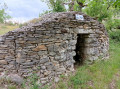
(9) At a fork in the road, take the left-hand descent and pass through the Mas de Bousquet. At a narrow passage on the right, you can admire a gariotte, though only one side is visible. Cross meadows still used for hay, straw and horses. Turn left and head towards the modern-style school. It is there, opposite the school, that the crane is located; the mechanism no longer exists, but a pipe and the brick framework of the pillar that supported the pump still remain
(10) Turn right and follow the D23 to the church car park (S/E).
 Visorando Member
 Moderate