Paradisgartenweg (Paradise Garden Trail) from the Gimpelwaldhütte

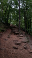
A lovely path through woods, fields, ponds and valleys, said to have been used by the monk Firminy, who would meditate whilst walking. As you walk, imagine the landscape in which this medieval monk might have walked.

Details

94604849
Creation:
Last update:
Last review:
  • Walking
    Activity: Walking
  • ↔
    Distance: 4.65 mi
  • ◔
    Average duration: 2h 25 
  • ▲
    Difficulty: Easy

  • ⚐
    Back to start: Yes
  • ↗
    Ascent: + 348 ft
  • ↘
    Descent: - 354 ft

  • ▲
    Highest point: 1,112 ft
  • ▼
    Lowest point: 856 ft
  • ⚐ Country: Germany
  • ⚐ City: Hornbach 
  • ⚑
    Start/End: N 49.179033° / E 7.361049°
  • ❏
    IGN map(s): Ref. 3713ET
  • Hour-by-hour weather

Description of the walk

You can park next to the Gimpelwaldhütte (forest hut). The access road is tarmac from the main road (at the bottom of the valley).

Follow the signs for Paradisgartenweg and its sun icon all along the way. Other signs also point you towards villages and other landmarks.

If in doubt, follow the “Waldhütte” signs to be sure of finding your car.

Waypoints

  1. S/E : mi 0 - alt. 988 ft - Gimpelwaldhütte
  2. 1 : mi 3.22 - alt. 879 ft - Pond
  3. S/E : mi 4.65 - alt. 988 ft - Gimpelwaldhütte

Notes

All along the trail there are huts, wooden deckchairs, viewing points and picnic tables, allowing everyone to enjoy this meditative walk at their own pace. For families and those who wish to take their time, there are plenty of opportunities to rest along the way and enjoy the views of the 14th-century Firminy monastery.

The path is not suitable for pushchairs.

Bring a jumper, as temperatures can vary between the sunshine and the forest shade in mid-season.

Worth a visit

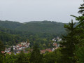
Panoramic views of the surrounding landscape thanks to the climbs leading to the top of the hill.

You can walk around a pretty forest pond halfway along the route.

Reviews and comments

5 / 5
Based on 1 review

Ease of following the route
5 / 5
Route interest
5 / 5
jpsgauthier
jpsgauthier

Overall rating : 5 / 5

Date of your route : Jul 13, 2026
Ease of following the route : ★★★★★ Very good
Route interest : ★★★★★ Very good
Very busy route : No

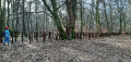
We’re definitely on the German side; there are plenty of signposts, and lots of spots where you can stop and take in the surrounding countryside, including wooden tables, benches and sun loungers for two people.
The walk round the pond in the heart of the forest doesn’t add much to the hike, apart from slowing you down a bit before you can pick up the pace again for the final stretch.

Machine-translated

Other walks in the area

For more walks, use our search engine .

The GPS track and description are the property of this route's author. Please do not copy them without permission.