The lime kilns in the marsh

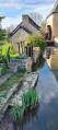
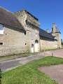
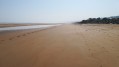
This walk takes you into the heart of the marshes, an area rich in birdlife. You will also pass by old lime kilns steeped in history, as well as the Beau Moulin, a listed building.

Details

n°46933090
Creation:
Last update:
Last review:
  • Walking
    Activity: Walking
  • ↔
    Distance: 4.46 mi
  • ◔
    Average duration: 2h 05 
  • ▲
    Difficulty: Easy

  • ⚐
    Back to start: Yes
  • ↗
    Ascent: + 39 ft
  • ↘
    Descent: - 43 ft

  • ▲
    Highest point: 79 ft
  • ▼
    Lowest point: 10 ft
  • ⚐ Country: France
  • ⚐ City: Trévières (14710)
  • ⚑
    Start/End: N 49.309502° / W 0.904849°
  • ❏
    IGN map(s): Ref. 1412OT
  • Hour-by-hour weather

Description of the walk

Park in the Halle car park.

(S/E) Take Rue Octave Mirbeau, heading north-east, continue along the D30, pass the petrol station, cross the Pont de la Barre, and carry on for about sixty metres.

(1) Turn left onto Rue des Monts until you reach the D198.

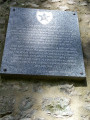
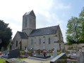
(2) Carry on to the left, skirting the churchyard, until you reach the next fork in the road. Stop there to discover a hidden cul-de-sac that winds its way through the grass. This leads to some old lime kilns steeped in history.

(3) Afterwards, retrace your steps to rejoin the road and carry on along the D198. Continue to the next major junction.

(4) Turn left onto the D124 towards Trévières, cross the River Aure and you’ll come to a Stop sign.

(5) Turn right onto the D29 and proceed with caution until you reach the bend in this road.

(6) Turn left onto Rue du Beau Moulin, which runs alongside the Tortonne, and proceed to a junction marked by a Stop sign. At this junction, on the right-hand side, you will find Le Beau Moulin, a listed historic monument.

(7) Cross the road and carry on straight ahead until you reach Chemin Buhot on the left.

(8) Head up this lane. Once you reach the wayside cross, continue along Rue du Calvaire to enter Trévières and carry on until you reach Rue de la Gloriette, which is signposted as a one-way street.

(9) Turn onto this street and follow it to the junction with Rue Bernard Anquetil. Turn left and carry on straight ahead until you reach the Place de la Halle de Trévières (S/E).

Waypoints

  1. S/E : mi 0 - alt. 39 ft - Place de la Halle de Trévières
  2. 1 : mi 0.35 - alt. 23 ft - Pont de la Barre
  3. 2 : mi 1.57 - alt. 43 ft - Église Saint-Pierre (Aignerville)
  4. 3 : mi 1.65 - alt. 30 ft - The lime kilns
  5. 4 : mi 2.25 - alt. 13 ft - D124
  6. 5 : mi 2.58 - alt. 13 ft - D29 road - Aure (rivière) - Affluent de la Vire
  7. 6 : mi 2.87 - alt. 10 ft - Rue du Beau Moulin - Tortonne (rivière) - Affluent de l'Aure
  8. 7 : mi 3.41 - alt. 20 ft - Le Beau Moulin
  9. 8 : mi 3.6 - alt. 30 ft - Chemin Buhot
  10. 9 : mi 4.16 - alt. 33 ft - Rue de la Gloriette
  11. S/E : mi 4.46 - alt. 36 ft - Place de la Halle de Trévières

Worth a visit

Reviews and comments

4.3 / 5
Based on 2 reviews

Reliability of the description
4 / 5
Ease of following the route
5 / 5
Route interest
4 / 5
Philippe69
Philippe69

Overall rating : 3.7 / 5

Date of your route : May 27, 2024
Reliability of the description : ★★★☆☆ Average
Ease of following the route : ★★★★★ Very good
Route interest : ★★★☆☆ Average
Very busy route : No

An easy but rather uninteresting walk; it follows small roads for the most part, with a section of a few hundred metres along a county road.

Machine-translated

Mocassin
Mocassin

Overall rating : 5 / 5

Date of your route : Apr 08, 2024
Reliability of the description : ★★★★★ Very good
Ease of following the route : ★★★★★ Very good
Route interest : ★★★★★ Very good
Very busy route : No

A short but very unusual walk – there really are a lot of storks, both in flight and on the ground, or in the many magnificent nests, which are either on a house chimney or in a nest built especially for them.

Machine-translated

Other walks in the area

For more walks, use our search engine .

The GPS track and description are the property of this route's author. Please do not copy them without permission.