Les Gosnons

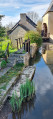
This walk takes you along the Chemin des Gosnons, in the heart of the Trévières marshes. You can also explore the village of Mandeville, as well as the path linking it to Trévières, known as the Chemin de la Croix des Champs. Please note that this path is difficult to navigate in winter due to damp conditions and mud.

Details

n°50824732
Creation:
Last update:
Last review:
  • Walking
    Activity: Walking
  • ↔
    Distance: 3.40 mi
  • ◔
    Average duration: 1h 40 
  • ▲
    Difficulty: Easy

  • ⚐
    Back to start: Yes
  • ↗
    Ascent: + 138 ft
  • ↘
    Descent: - 138 ft

  • ▲
    Highest point: 177 ft
  • ▼
    Lowest point: 16 ft
  • ⚐ Country: France
  • ⚐ City: Trévières (14710)
  • ⚑
    Start/End: N 49.309491° / W 0.904448°
  • ❏
    IGN map(s): Ref. 1412OT
  • Hour-by-hour weather

Description of the walk

Starting point in the centre of Trévières, beneath the market hall. Parking available nearby.

(S/E) Head north and take the Chemin de la Mare au Tas. Ignore a road on the right and head downhill.

(1) At the bottom, turn sharply right (the path towards the Pont des Gosnons is a dead end). Go straight on, ignoring the path on the left leading to Les Gosnons, and head back up to the D29.

(2) Follow the road to the left and pass through the hamlet of Le Nouet.

(3) Cross the D29 with care and take the first small road on the right, towards Val de la Rue. Ignore a road on the left and turn right to reach a ‘give way’ sign near the Mandeville village hall.

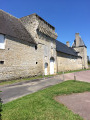
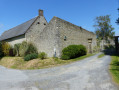
(4) Turn right twice and walk alongside the building on your right. Continue straight on, west-north-west, for about 1.5 km. Pass a farm on your left and arrive at a Fork in the road near a housing estate.

(5) Turn left. Join the D29 and follow it to the left as far as the church.

(6) Carry on straight ahead to reach the market hall and car park (S/E).

Waypoints

  1. S/E : mi 0 - alt. 39 ft - Trévières Market Hall
  2. 1 : mi 0.8 - alt. 20 ft - Turn right
  3. 2 : mi 1.48 - alt. 72 ft - D29
  4. 3 : mi 1.63 - alt. 69 ft - Fork in the road – Rue Val la Rue
  5. 4 : mi 2.03 - alt. 171 ft - Mandeville Village Hall
  6. 5 : mi 3.07 - alt. 79 ft - T-junction
  7. 6 : mi 3.31 - alt. 49 ft - Église Saint-Aignan (Trévières)
  8. S/E : mi 3.4 - alt. 39 ft - Trévières Market Hall

Reviews and comments

5 / 5
Based on 1 review

Reliability of the description
5 / 5
Ease of following the route
5 / 5
Route interest
5 / 5
Goultard
Goultard

Overall rating : 5 / 5

Date of your route : Aug 05, 2024
Reliability of the description : ★★★★★ Very good
Ease of following the route : ★★★★★ Very good
Route interest : ★★★★★ Very good
Very busy route : No

A really lovely walk – a real pleasure to do! Thank you very much! It’s lovely to take a dog along so they can have a swim in the Aure

Machine-translated

Other walks in the area

For more walks, use our search engine .

The GPS track and description are the property of this route's author. Please do not copy them without permission.