Via the summit of Atxuela

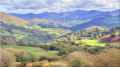
A lovely circular route following part of the Haute Route des Pyrénées, passing beneath the summit of Atxuela.

Details

17612743
Creation:
Last update:
Last review:
  • Walking
    Activity: Walking
  • ↔
    Distance: 4.37 mi
  • ◔
    Average duration: 2h 55 
  • ▲
    Difficulty: Moderate

  • ⚐
    Back to start: Yes
  • ↗
    Ascent: + 1,083 ft
  • ↘
    Descent: - 1,099 ft

  • ▲
    Highest point: 2,635 ft
  • ▼
    Lowest point: 1,588 ft

Photos

Description of the walk

To reach the start, cross the border at Dantxaria, climb to the Col d’Otxondo, descend for about 500 metres and turn right onto the NA-4453 towards Orabidea. Continue to the start, which is located at a bend where the roadside has been cleared to form a parking area.

(S/E) Take theGR®11south-eastwards, along the ridge. The path runs past several sets of pidgeon hunting huts until it reaches a Y-junction.

(1) Keep to the right, staying on theGR®11until you reach a track suitable for vehicles.

(2) Head straight ahead, leaving theGR®11which branches off to the right, and climb to the summit of Atxuela.

(3) Head back down towards the north-west until you cross the track again. Continue to the left, heading west, downhill to a track.

(4) Atxuelako Lepoa Pass.

(5) Turn right towards the north, then north-west, and continue downhill to a three-way junction.

(6) Turn right onto a hillside path which rejoins the track.

(7) Turn right and head down to a farm.

(8) Pass a gate on the right to begin a descent along a tarmac road to the bottom of the valley.

(9) Take the road branching off to the left to return to the car park (S/E).

Waypoints

  1. S/E : mi 0 - alt. 1,660 ft - Car park on the side of the NA-4453
  2. 1 : mi 1.02 - alt. 2,352 ft - Y-junction at the top of the pidgeon hunting hut line
  3. 2 : mi 1.47 - alt. 2,628 ft - Junction with a track suitable for vehicles
  4. 3 : mi 1.63 - alt. 2,621 ft - Summit - Atxuela
  5. 4 : mi 1.88 - alt. 2,559 ft - Col d’ - Atxuelako Lepoa
  6. 5 : mi 2.34 - alt. 2,211 ft - Vehicle-accessible track
  7. 6 : mi 2.56 - alt. 1,978 ft - Hillside path
  8. 7 : mi 2.84 - alt. 1,969 ft - Vehicle track on the right
  9. 8 : mi 3.15 - alt. 1,788 ft - Gate crossing
  10. 9 : mi 3.36 - alt. 1,722 ft - Path on the left
  11. S/E : mi 4.37 - alt. 1,660 ft - Return to the car park

Notes

During the wood pigeon hunting season, this route is not recommended.

There is no water along the route.

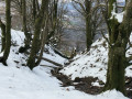
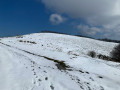
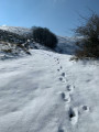
Compared to a previous version, the route has been revised after being walked in snowy conditions, as certain sections had become unsuitable under such conditions.

Worth a visit

If you continue along the road, you’ll pass the Kortariko Gasna cheese dairy.

Always be cautious and plan ahead when you're outdoors. Visorando and the author of this route cannot be held responsible for any accidents occurring on this route.

The GR® and PR® markings are the intellectual property of the Fédération Française de Randonnée Pédestre.

Reviews and comments

5 / 5
Based on 2 reviews

Reliability of the description
5 / 5
Ease of following the route
5 / 5
Route interest
5 / 5
Madeleine64
Madeleine64

Overall rating : 5 / 5

Date of your route : Aug 16, 2026
Reliability of the description : ★★★★★ Very good
Ease of following the route : ★★★★★ Very good
Route interest : ★★★★★ Very good
Very busy route : No

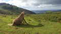
A lovely walk with beautiful views and plenty of wildlife (pottoks, sheep, etc.). The route is clearly described and easy to follow. Note that at point 8, the gate is locked with a padlock; simply walk past the barn, where a path leads back down to the tarmac track below. It’s a quiet route, which was very pleasant during these summer weeks. Thanks to the author

Machine-translated

ROBERT Jean-Claude
ROBERT Jean-Claude

Overall rating : 5 / 5

Date of your route : Feb 12, 2022
Reliability of the description : ★★★★★ Very good
Ease of following the route : ★★★★★ Very good
Route interest : ★★★★★ Very good
Very busy route : No

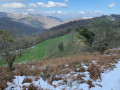
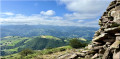
A lovely circular route with stunning 360° views. I really enjoy these walks in the Bastan.
I extended the route a little by continuing on to Larrondo (an extra 1.5 km and an additional 100 metres of elevation gain).
Robert Jean-Claude.

Machine-translated

Other walks in the area

For more walks, use our search engine .

The GPS track and description are the property of this route's author. Please do not copy them without permission.