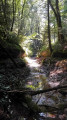
Through woods and meadows around the Palentin farm in Déservillers

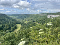
A walk through woods and meadows around Déservillers with views of the Alps.

Details

n°20551080
Creation:
Last update:
Last review:
  • Walking
    Activity: Walking
  • ↔
    Distance: 7.33 mi
  • ◔
    Average duration: 4h 00 
  • ▲
    Difficulty: Moderate

  • ⚐
    Back to start: Yes
  • ↗
    Ascent: + 741 ft
  • ↘
    Descent: - 748 ft

  • ▲
    Highest point: 2,940 ft
  • ▼
    Lowest point: 2,467 ft

Photos

Description of the walk

To reach the start, follow the D9 which links Déservillers to Labergement-du-Navois. On leaving Déservillers, take Rue du Stade, pass the farm and take the first right. Park near the animal shelters.

(S) Take the path until you reach a fork.

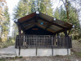
(1) Follow the unpaved track to the right, then a grassy path at the end of the field. The Ferme de Palentin is in the meadow on the right.

(2) Turn left and head back into the woods to join a dirt track, which you should follow until you reach a tarmac road.

(3) Turn left, walk past the picnic table (hunting car park), then turn right onto the Route de Reugney.

(4) Before the left-hand bend, take the forest track on the right for about 150 metres, then turn sharply right again and continue straight on until you reach a dirt track

(5) Turn right to return along a dirt track heading towards the village of Labergement du Navois.

(6) When you reach the crossroads, carry on to the left. Further on, pass a road on your left and continue for about 200 m.

(7) Turn right, leaving the village ahead of you. Follow the tarmac road uphill.

(8) Ignore the path on the right and continue along the road. At the next junction, keep right and head towards the edge of the woods.

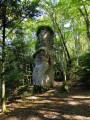
(9) Turn right and walk alongside the woodland at the edge of the field: on a clear day, there is a stunning view of part of the Alps and Mont Blanc. Continue until you reach an old piece of farm machinery standing near a yellow marker.

(10) Take this path marked in yellow on the left and join a section of tarmac road.

(11) Turn right and return to the car park (S/E).

Waypoints

  1. S/E : mi 0 - alt. 2,628 ft - Animal shelters, car park
  2. 1 : mi 0.53 - alt. 2,625 ft - Junction, turn right
  3. 2 : mi 1.03 - alt. 2,815 ft - Turn left at the fork
  4. 3 : mi 1.31 - alt. 2,854 ft - Tarmac road, on the left
  5. 4 : mi 2.4 - alt. 2,930 ft - Forest track to the right
  6. 5 : mi 3.4 - alt. 2,910 ft - White path, on the right
  7. 6 : mi 3.91 - alt. 2,740 ft - Crossroads, turn left
  8. 7 : mi 4.85 - alt. 2,503 ft - Junction, turn right
  9. 8 : mi 5.68 - alt. 2,720 ft - Continue along the road
  10. 9 : mi 6.47 - alt. 2,825 ft - Edge of the woods, on the right
  11. 10 : mi 6.82 - alt. 2,789 ft - Yellow signpost, on the left
  12. 11 : mi 7.05 - alt. 2,608 ft - Tarmac section, on the right
  13. S/E : mi 7.33 - alt. 2,625 ft - Animal shelters, car park

Notes

No signposting.

Worth a visit

Stunning views of part of the Alps and Mont Blanc on a clear day.
Picnic table between (3) and (4).

Reviews and comments

3.3 / 5
Based on 4 reviews

Reliability of the description
3 / 5
Ease of following the route
3 / 5
Route interest
3.8 / 5
cnu25
cnu25

Hello @854808... thank you for your feedback and have a nice day

Machine-translated

User 854808

Overall rating : 4 / 5

Date of your route : Mar 09, 2026
Reliability of the description : ★★★★☆ Good
Ease of following the route : ★★★★☆ Good
Route interest : ★★★★☆ Good
Very busy route : No

Hello, easy hike with a group of elderly people. Just a little difficulty climbing back up onto the plateau. Thank you.

Machine-translated

Carrieres Gérard
Carrieres Gérard

Overall rating : 2 / 5

Date of your route : Jan 26, 2025
Reliability of the description : ★☆☆☆☆ Very disappointing
Ease of following the route : ★☆☆☆☆ Very disappointing
Route interest : ★★★★☆ Good
Very busy route : No

Can’t find a place to go for a hike!!!

Machine-translated

cnu25
cnu25

Hello simonb … sorry about the vegetation, but when the route was marked out in April there was little or none at all … so you could see the paths. The same goes for the tracks left by the forestry tractors … nature and people both alter the course of the walks.
I hope you had a good day all the same... cnu25

Machine-translated

simonb
simonb

Overall rating : 2.7 / 5

Date of your route : Jun 12, 2022
Reliability of the description : ★★★☆☆ Average
Ease of following the route : ★★☆☆☆ Disappointing
Route interest : ★★★☆☆ Average
Very busy route : No

Hello,
I’d like to make a few comments about this walk. You need to be a good walker and know how to read a map properly, as there are no signposts. Between the 886 and 853 elevation points, the path has disappeared, overgrown by vegetation. After the 869 elevation point, on the way to the 801 elevation point, the path is also overgrown with vegetation, wedged between two tracks left by forestry tractors.
Thank you

Machine-translated

jean-luc et odile
jean-luc et odile

Overall rating : 4.3 / 5

Date of your route : Apr 21, 2022
Reliability of the description : ★★★★☆ Good
Ease of following the route : ★★★★★ Very good
Route interest : ★★★★☆ Good
Very busy route : No

A lovely walk, but the route takes you along a lot of tarmac – it was misty, so never mind the view of the Alps

Machine-translated

Other walks in the area

For more walks, use our search engine .

The GPS track and description are the property of this route's author. Please do not copy them without permission.