Circular walk in the Grand Bois d’Amancey via the Norvaux viewpoint

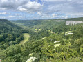
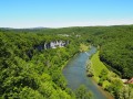
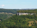
A short, easy family walk. A gentle descent takes you to the Comboyer spring, then along a lovely forest path you reach the Norvaux viewpoint with a breathtaking view of the valley. A playground awaits you a little further on, complete with a picnic table and a small shelter.
This route is suitable for pushchairs, provided you avoid the nature trail and complete the circular route via the white path.

Details

n°4511163
Creation:
Last update:
Last review:
  • Walking
    Activity: Walking
  • ↔
    Distance: 2.78 mi
  • ◔
    Average duration: 1h 25 
  • ▲
    Difficulty: Easy

  • ⚐
    Back to start: Yes
  • ↗
    Ascent: + 197 ft
  • ↘
    Descent: - 187 ft

  • ▲
    Highest point: 1,998 ft
  • ▼
    Lowest point: 1,788 ft

Photos

Description of the walk

The start is at the crossroads. There are plenty of parking spaces available.

(S/E) Take the road on the left and continue for a few hundred metres.

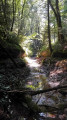
(1) Turn left onto a descending path and follow the sign for the Comboyer spring. Once you have crossed the stream in front of the spring, turn right and head slightly uphill along the valley side.
Carry on to the viewpoint overlooking the Norvaux ravine.

(2) Enjoy the view of this unspoilt valley, then head back along the path behind you to the playground.

(3) Cross the playground and walk past the small shelter to re-enter the woods. Follow this path until you reach a junction with a wider, gravel path, which you’ll come to as you round a bend.

(4) Turn left and stay on this path until you reach the car park where you started (S/E).

Waypoints

  1. S/E : mi 0 - alt. 1,972 ft - Crossroads
  2. 1 : mi 0.47 - alt. 1,906 ft - Entrance to the nature trail
  3. 2 : mi 1.08 - alt. 1,824 ft - Belvédère de Norvaux
  4. 3 : mi 1.2 - alt. 1,857 ft - Play area and shelter
  5. 4 : mi 1.58 - alt. 1,818 ft - Vehicle-accessible track
  6. S/E : mi 2.78 - alt. 1,972 ft - Crossroads

Notes

You can start from the car park at (3), if you’d like to make use of the playground and picnic area before setting off on the trails.

Following the storms, trees are blocking the path, but they can easily be bypassed.

(2) The viewing point is secure, but please keep an eye on children when approaching the site.

Worth a visit

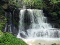
The Comboyer spring emerges at the foot of the rocks.

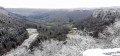
The Norvaux viewpoint overlooks the gorge of the same name.

Much of the walk, from (1) to (4), follows a nature trail dotted with information boards and marked in yellow and blue.

Reviews and comments

4.3 / 5
Based on 2 reviews

Reliability of the description
4 / 5
Ease of following the route
4 / 5
Route interest
5 / 5
Lola du Doubs
Lola du Doubs

Overall rating : 3.7 / 5

Date of your route : Aug 13, 2024
Reliability of the description : ★★★☆☆ Average
Ease of following the route : ★★★☆☆ Average
Route interest : ★★★★★ Very good
Very busy route : No

The starting point of the walk was very poorly explained. The starting point is not in Amancey but on the outskirts of Amancey. The walk description stated ‘at the crossroads’, but once there, it was unclear which roads were meant, where exactly they were in relation to Amancey, or in which direction to go.
Once we’d found the starting point, thanks to our phone’s GPS, the walk was very easy and offered some lovely views.

Machine-translated

pnuninger
pnuninger

Thank you very much for this review. It’s true that the routes can be adapted to suit everyone’s tastes. These are just suggestions.
Enjoy your walks

Machine-translated

GMR25
GMR25

Overall rating : 5 / 5

Date of your route : Sep 06, 2023
Reliability of the description : ★★★★★ Very good
Ease of following the route : ★★★★★ Very good
Route interest : ★★★★★ Very good
Very busy route : No

A lovely little walk – very short and easy, but interesting and enjoyable. From the Comboyer spring, you can continue downhill and do a round trip to the Pomme Gaude spring.

Machine-translated

Other walks in the area

For more walks, use our search engine .

The GPS track and description are the property of this route's author. Please do not copy them without permission.