Oppidum of Ambrussum

Exploring the Ambrussum archaeological site. Entry to the site and the museum is free. Check the museum’s opening hours online. The oppidum is always open. The site belongs to the municipality of Lunel.

Details

n°51939913
Creation:
Last update:
Last review:
  • Walking
    Activity: Walking
  • ↔
    Distance: 1.82 mi
  • ◔
    Average duration: 0h 55 
  • ▲
    Difficulty: Easy

  • ⚐
    Back to start: Yes
  • ↗
    Ascent: + 115 ft
  • ↘
    Descent: - 115 ft

  • ▲
    Highest point: 177 ft
  • ▼
    Lowest point: 39 ft
  • ⚐ Country: France
  • ⚐ City: Villetelle (34400)
  • ⚑
    Start/End: N 43.719471° / E 4.14678°
  • ❏
    IGN map(s): Ref. 2843OT
  • Hour-by-hour weather

Photos

Description of the walk

Park in the designated car park.

(S/E) Walk to the museum, which marks the start of the route. Each ruin is explained on numbered information boards. Start with number 1, which describes the coaching inn, then continue along the path until you reach a junction.

(1) Turn onto the path leading uphill to the right until you come to an ancient Roman road with clearly visible cart-wheel ruts.

(2) Take this track, which continues to climb until you reach a junction.

(3) Take a path on the right which then curves to the left.

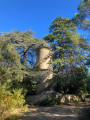
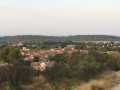
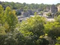
(4) At the junction, take a short detour to the left to explore the remains of a Roman house, then further on the ruins of a watchtower and the viewpoint overlooking the heath. Return to the starting point of the detour.

(4) Continue along the path until you come across more Roman houses.
Head towards the rampart and the metal staircase leading over it. Walk along the base of the rampart; the fortification has been partially restored. The path reaches the heath and turns right. Further on, at a junction, turn left. Follow this main path until you see the sign marking the exit from the archaeological site.

(5) Follow the path which climbs to the left. Explore the remains of the forum and return to the junction of paths from the outward journey.

(3) Head back down to the fork in the Roman road.

(2) Turn right onto the path leading down to the River Vidourle. Admire the Ambroix Bridge, the last remaining arch of a bridge that once had eleven arches in Roman times. Return to the path and the museum.

(1) Visit the museum (free of charge) and return to the car park (S/E).

Waypoints

  1. S/E : mi 0 - alt. 62 ft - Car park available
  2. 1 : mi 0.2 - alt. 49 ft - Path junction
  3. 2 : mi 0.36 - alt. 92 ft - Roman paved road – Vidourle (river)
  4. 3 : mi 0.49 - alt. 148 ft - Path junction
  5. 4 : mi 0.53 - alt. 161 ft - Starting point for a round trip – Oppidum of Ambrussum (Villetelle)
  6. 5 : mi 1.12 - alt. 118 ft - Roman south gate of the site
  7. S/E : mi 1.82 - alt. 62 ft - Car park available

Notes

The walking time should be extended to allow time to read the fifteen information boards and explore the ruins.

Reviews and comments

4.8 / 5
Based on 2 reviews

Reliability of the description
5 / 5
Ease of following the route
5 / 5
Route interest
4.5 / 5
User 22834769

Overall rating : 5 / 5

Date of your route : Nov 01, 2026
Reliability of the description : ★★★★★ Very good
Ease of following the route : ★★★★★ Very good
Route interest : ★★★★★ Very good
Very busy route : No

A short walk to explore the oppidum – I held my 84-year-old mum’s hand on the stony bits, but she coped really well. lol. At this time of year there are very few people around, even at the weekend; best avoided in summer as it’s a heath… There’s a lovely 360° view when you’re right at the top, and the museum is free.

Machine-translated

laetitia30
laetitia30

Overall rating : 4.7 / 5

Date of your route : Feb 22, 2026
Reliability of the description : ★★★★★ Very good
Ease of following the route : ★★★★★ Very good
Route interest : ★★★★☆ Good
Very busy route : Yes

A short outing that feels more like a stroll than a long hike... but sometimes that's just what you need! 😄
The route is short and accessible, perfect for stretching your legs without needing walking poles or energy bars.
Ideal for warming up, a leisurely outing or simply enjoying some time outdoors without any pressure.
Choose this if you're looking for something easy and fun, but less so if you want a bit of a challenge.

Machine-translated

Other walks in the area

For more walks, use our search engine .

The GPS track and description are the property of this route's author. Please do not copy them without permission.