


Oban - Kerrera
Details
Creation:
Last update:
–
–
-
 Activity: Walking
 -
 Distance: 2.51 mi
 -
 Average duration: 1h 15
 -
 Difficulty: Not specified
 -
-
 Back to start: No
 -
 Ascent: + 66 ft
 -
 Descent: - 36 ft
 -
-
 Highest point: 56 ft
 -
 Lowest point: 0 ft
-
 Country:
United Kingdom
Country:
United Kingdom
-
 City:
Argyll and Bute
City:
Argyll and Bute -
 Start: N 56.414843° / W 5.472742°
 -
 End: N 56.394036° / W 5.515106°
 -


 Hour-by-hour weather


Waypoints
- S : mi 0 - alt. 3 ft - Start on George Street, A85
- 1 : mi 0.01 - alt. 0 ft - Turn sharp left onto Corran Esplanade, A85
- 2 : mi 0.16 - alt. 3 ft - Turn slight right onto Aird's Place, A85
- 3 : mi 0.2 - alt. 10 ft - At roundabout, take exit 2 onto Shore Street
- 4 : mi 0.28 - alt. 13 ft - Turn left onto Campbell Street
- 5 : mi 0.28 - alt. 13 ft - Turn left onto Shore Street
- 6 : mi 0.45 - alt. 33 ft - Turn slight right onto C34
- 7 : mi 0.49 - alt. 33 ft - Keep right onto Alma Crescent, C34
- 8 : mi 0.55 - alt. 26 ft - Turn slight left onto Alma Crescent, C34
- 9 : mi 0.76 - alt. 26 ft - Turn left onto Gallanach Road, C34
- 10 : mi 1.13 - alt. 26 ft - Turn slight right onto Gallanach Road, C34
- 11 : mi 2.22 - alt. 10 ft - Keep left onto Gallanach Road, C34
- E : mi 2.51 - alt. 20 ft
Other walks in the area
Return trip to the castle at Craignure
 Visorando Member
 2.92 mi
+217 ft
-203 ft
1h 30
2.92 mi
+217 ft
-203 ft
1h 30
 Easy
Departure from Argyll and Bute
Easy
Departure from Argyll and Bute
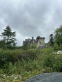
To pass the time before catching the ferry, take a short walk with views of Torosay Castle and Craignure Bay. Access to the forest path is public and the route is easy. The reward: superb views of the bay during the walk and a view of Craignure Castle.
Loch Tearnait
 6.73 mi
+535 ft
-531 ft
3h 35
6.73 mi
+535 ft
-531 ft
3h 35
 Moderate
Departure from Highland
Moderate
Departure from Highland
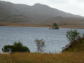
The first objective of the walk is Loch Tearnait, a lovely mountain loch. The second objective is to stay on a wide, dry path… essential after several days of incessant rain in this part of Scotland. Thethird objective is to explore the slopes to the south of the local summit.
Old Ardtornish Castle
 4.23 mi
+154 ft
-118 ft
2h 05
Moderate
Departure from Highland
4.23 mi
+154 ft
-118 ft
2h 05
Moderate
Departure from Highland
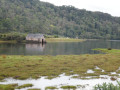
A charming starting point with a lovely free car park, a souvenir shop and a shop selling local produce from the surrounding farms.And then a walk where you’re likely to encounter nothing but nature and the ferries on the Sound of Mull!
Loch Teacuis
 4.05 mi
+318 ft
-259 ft
2h 10
Moderate
Departure from Highland
4.05 mi
+318 ft
-259 ft
2h 10
Moderate
Departure from Highland
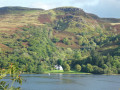
The walk starts in the middle of nowhere. It is advisable to park at the quarry. The proposed walk is deliberately limited to a “good”, motorable forest track and offers lovely views of the loch, the opposite shore and, towards the end, the junction with the central part of Loch Sunart.The end point is a slipway for forestry vehicles.Please note: the route is not circular … you’ll need to allow for at least double the distance to get back to your car.
Strontian Lead Mines via Ariundle Oakwoods
 6.43 mi
+843 ft
-837 ft
3h 40
Moderate
Departure from Highland
6.43 mi
+843 ft
-837 ft
3h 40
Moderate
Departure from Highland
The magnificent Ariundle Nature Reserve offers the chance to explore a forest of centuries-old oak trees. Information boards indicate that this forest was already mentioned in the very first recorded censuses, probably dating back to the15th century. The two sections through the Strontian River valley are also a feast for the eyes.
For more walks, use our search engine .
The GPS track and description are the property of this route's author. Please do not copy them without permission.

