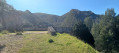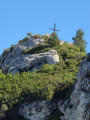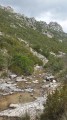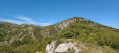
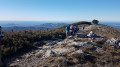
Mont Carpiagne and Mont Saint-Cyr, two giants of Marseille

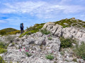
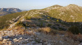
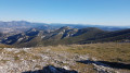
A lovely walk through the hills overlooking Marseille and the Calanques massif. In winter, in clear weather, the view stretches as far as the first snow-capped peaks of the Alps. Take care on a few tricky sections during the descent following the summit of Carpiagne.

Details

n°2200547
Creation:
Last update:
Last review:
  • Walking
    Activity: Walking
  • ↔
    Distance: 6.86 mi
  • ◔
    Average duration: 5h 00 
  • ▲
    Difficulty: Moderate

  • ⚐
    Back to start: Yes
  • ↗
    Ascent: + 2,123 ft
  • ↘
    Descent: - 2,123 ft

  • ▲
    Highest point: 2,106 ft
  • ▼
    Lowest point: 262 ft
  • ⚐ Country: France
  • ⚐ City: Marseille (13000)
  • ⚑
    Start/End: N 43.280552° / E 5.482138°
  • ❏
    IGN map(s): Ref. 3145ET
  • Hour-by-hour weather

Photos

Description of the walk

We park in the car park at the very end of the Chemin du Vallon de la Barasse.

(S/E) We take the track leading towards the shooting range. After a steep climb, we reach the crossroads at the entrance to this valley.

(1) We take the path on the left. This marks the start of the first section of the Vallon de Luinant.

(2) We continue the climb towards the 212-metre mark, passing a path on the left, before reaching another crossroads further on.

(3) We turn right, ignoring the path on the left. Once again, we reach a four-way junction.

(4) We take the path on the left. We continue the climb to reach the ridge linking Mont Carpiagne and Mont Lantin.

(5) We head off to the right towards the west and, after a final climb, reach Mont Carpiagne, the giant of the day.

(6) We begin the descent towards Col Sabatier, taking the path on the right shortly after the summit. Take care here – this path offers a rather steep and challenging descent.

(7) Once at the pass, we continue straight ahead along a narrow, very steep but fortunately relatively short path leading to the summit of Mont Saint-Cyr.

(8) We head due north along the Saint-Cyr ridge. We begin the descent by following this beautiful ridge and then reach the junction at the Source des Eaux Vives.

(9) We turn right to reach this spring.

(10) We then follow the path that runs alongside the Vallon de la Barasse stream until we reach the first crossroads we passed on the way there.

(1) We turn left and retrace our steps along the route we took on the way there to return to the car park at Chemin du Vallon de la Barasse (S/E).

Waypoints

  1. S/E : mi 0 - alt. 262 ft - Car park at the end of Chemin de la Barasse
  2. 1 : mi 0.83 - alt. 528 ft - Crossroads at the end of the circular loop
  3. 2 : mi 1.15 - alt. 715 ft - Junction
  4. 3 : mi 1.72 - alt. 945 ft - Continuing along the Luinant valley
  5. 4 : mi 2.22 - alt. 1,178 ft - Junction and path on the left
  6. 5 : mi 2.86 - alt. 1,729 ft - Ridge leading to Mont Carpiagne
  7. 6 : mi 3.34 - alt. 2,103 ft - Mont Carpiagne
  8. 7 : mi 3.75 - alt. 1,683 ft - Col Sabatier
  9. 8 : mi 4.03 - alt. 1,985 ft - Mont saint-Cyr
  10. 9 : mi 4.71 - alt. 1,601 ft - Path on the right
  11. 10 : mi 5 - alt. 1,198 ft - (in winter) - Source des Eaux Vives
  12. S/E : mi 6.86 - alt. 262 ft - Car park at the end of Chemin de la Barasse

Worth a visit

(5) Ridge: note the panoramic view to the south over the Carpiagne military camp and, in the distance, Cassis and its cliffs.
(6) Mont Carpiagne: at the summit, enjoy a splendid 360° view: the Calanques, Marseille, Sainte-Victoire and the whole of the eastern part of the Cassis region as far as Mont Caume. In winter, the snow-capped mountains to the north.
Undoubtedly one of the most beautiful panoramic views in the region.

Reviews and comments

4.6 / 5
Based on 14 reviews

Reliability of the description
4.4 / 5
Ease of following the route
4.6 / 5
Route interest
4.7 / 5
nicou13470
nicou13470
• Edited:

Overall rating : 3.7 / 5

Date of your route : Mar 12, 2023
Reliability of the description : ★★★☆☆ Average
Ease of following the route : ★★★☆☆ Average
Route interest : ★★★★★ Very good
Very busy route : No

This walk is absolutely stunning, but it’s very difficult to manage without the help of two people – we’d never have found THE right paths
There are few, if any, signposts.

Machine-translated

phildaix
phildaix
• Edited:

Overall rating : 5 / 5

Date of your route : Mar 01, 2023
Reliability of the description : ★★★★★ Very good
Ease of following the route : ★★★★★ Very good
Route interest : ★★★★★ Very good
Very busy route : No

The walk was as lovely as ever, with breathtaking views. The problem today is that it’s misty, but you can just about make them out… and in any case, the rocks are impressive.
And, as always, the dog walkers…

Machine-translated

Geronimoz
Geronimoz
• Edited:

Overall rating : 5 / 5

Date of your route : Nov 08, 2022
Reliability of the description : ★★★★★ Very good
Ease of following the route : ★★★★★ Very good
Route interest : ★★★★★ Very good
Very busy route : No

Hello,

NB: this is my first comment here.

For this one, in November outside the holiday season, the weather forecast was rather uncertain, with the possibility of cloud below 1,000 metres but no rain, and winds forecast to be fairly light. That was all fine by me.
A word of warning to walkers who aren’t sure of their bearings: this walk is very easy for those who know how to find their way and are used to the mountains; there are loads of landmarks, so the map is almost useless, but if you aren’t paying attention or don’t know how to find your way… there’s nothing we can do for you ^^

A really very easy walk, both in terms of navigation and the route itself.
A very pleasant view, although I prefer wild scenery to the city; however, I wanted to discover the Calanques in a different way to simply walking through them straight away, and I certainly got what I was after.

The circular route took about 4 hours, including a 30- , mmm, at St Cyr. That’s about 3 hours to 3 hours 10 minutes of leisurely walking.

You could indeed rate the difficulty as “moderate”, as you say – at least for less experienced walkers, who’ll need to stick to the suggested route for this circular route, particularly for the slightly steep section between Carpiagne and St Cyr. Otherwise, it’s a gentle stroll and I’d happily rate it “Easy”. But difficulty ratings for walks are often quite a personal matter… it’s hard to be entirely objective.
The only minor annoyance I encountered was on the return path between the (dry) spring and the junction on the way back. Others have already mentioned this.
I never go hiking in shorts and always have long-sleeved tops to hand, so I’m fine, but for those without trousers or long sleeves, good luck The scorpion broom will give you a real treat.
Bring a machete (I’m joking, mind you – don’t actually do that ^^)
Watch out for snakes – I came across two without being able to tell for sure whether they were vipers or grass snakes. But that’s to be expected.

A slight variation could be to make the circular loop a bit earlier by taking the path that climbs slightly to the right at the spring, leading to the Luinant valley. But that will make the ‘déjà vu’ section of the outward journey even longer, and I’m not sure if that path is in better condition. Everyone can do as they please.
Personally, I enjoyed the slightly wilder nature of this final stretch.

The GPX track is fine; there’s mobile coverage almost all the way, except for a short stretch in the valleys.

There were a few people at the top who’d come from Marseille. In the La Barrasse valley, there were two dog walkers at the start, but otherwise not a soul in sight.

A really lovely walk in any case, and very easy for me.

Drawbacks: Gunfire from the military training ground and noise from the city. The former could be heard in the distance right from the start, whilst the latter was only noticeable at the top.

Machine-translated

Stepo13
Stepo13
• Edited:

Overall rating : 5 / 5

Date of your route : Feb 12, 2022
Reliability of the description : ★★★★★ Very good
Ease of following the route : ★★★★★ Very good
Route interest : ★★★★★ Very good
Very busy route : No

A lovely walk with clear signposting and not too much of a challenge – the steep climbs are quite short!

Machine-translated

kevcoq
kevcoq
• Edited:

Overall rating : 4.3 / 5

Date of your route : Jul 24, 2021
Reliability of the description : ★★★★★ Very good
Ease of following the route : ★★★★★ Very good
Route interest : ★★★☆☆ Average
Very busy route : No

A fairly easy hike completed in 3 hours 20 minutes.
The view is lovely from the climb up Mont Carpiagne right through to the descent after Mont Saint-Cyr. Before and after that (~50 per cent of the route), the view consists of valleys and scrubland.
In places, thorny bushes encroach slightly onto the path, and on the descent from Mont Saint-Cyr, there’s a stretch of about a kilometre where the path is very narrow due to the thorny vegetation – not very pleasant in shorts.

Machine-translated

cyriliryc
cyriliryc
• Edited:

Overall rating : 5 / 5

Date of your route : May 06, 2021
Reliability of the description : ★★★★★ Very good
Ease of following the route : ★★★★★ Very good
Route interest : ★★★★★ Very good
Very busy route : No

I set off on my walk at 9 am and only came across four people along the way.
The climb up to Mont Carpiagne, which is steep in places, follows pleasant, narrow paths surrounded by heath.
The view from the summit is simply magical – a full 360° panorama! A wonderful reward after all that effort.
The descent, which is often rocky, can be tricky in places.
The signposting is clear, and using Visorando as a last resort ensures you’ll never get lost.
I completed the circular route in 3 hours 20 minutes, walking at a brisk pace, including a snack break and time for photos.
I highly recommend this walk!

Machine-translated

aluman
aluman
• Edited:

Overall rating : 4 / 5

Date of your route : Apr 06, 2021
Reliability of the description : ★★★★☆ Good
Ease of following the route : ★★★★☆ Good
Route interest : ★★★★☆ Good
Very busy route : Yes

A good route that’s all uphill for the first 4 km. After that, all you have to do is enjoy the view.
For those who are interested, from point 8, you can carry on straight on to the Croix Saint Marcel and then head back down to the Source des Eaux Vives.

Machine-translated

JiPi13
JiPi13
• Edited:

Overall rating : 4.3 / 5

Date of your route : Apr 06, 2021
Reliability of the description : ★★★★☆ Good
Ease of following the route : ★★★★☆ Good
Route interest : ★★★★★ Very good
Very busy route : No

A lovely circular walk with a breathtaking view from the summit of Mont Carpiagne. It may be a little longer than stated and have a slightly greater elevation gain (13 km and 780 m).

Machine-translated

Litorne13
Litorne13
• Edited:

Overall rating : 3.7 / 5

Date of your route : Feb 20, 2021
Reliability of the description : ★★★☆☆ Average
Ease of following the route : ★★★★☆ Good
Route interest : ★★★★☆ Good
Very busy route : Yes

In fact, it’s the route itself that’s very poorly signposted – it’s perfect up to point 3, but after that the paths disappear and you start to wonder if you’re heading in the right direction.

Once we reached Mont Carpiagne, there was a magnificent view of the whole of Marseille, Cassis, Carpiagne and the rest. After a bite to eat, we continued the walk, but we couldn’t find the Col Sabatier or Mont St Cyr; again, due to a lack of signposting, I think we descended too early and ended up back at point 3.

I still think, in terms of difficulty, I’d classify it as a challenging hike because you really need to be fit!
It’s a shame we weren’t able to complete the full circular loop.
Kind regards, Richard

Machine-translated

Autrautruche
Autrautruche
• Edited:

Overall rating : 4.7 / 5

Date of your route : Sep 27, 2020
Reliability of the description : ★★★★☆ Good
Ease of following the route : ★★★★★ Very good
Route interest : ★★★★★ Very good
Very busy route : No

A magnificent walk with no major technical difficulties; you just need to be able to climb 600 metres in elevation. It took me just under 3 hours and 30 minutes.
The descent must be quite off the beaten track; I struggled to find it, and the branches of the bushes were starting to encroach on the path. You should wear thick, covering clothing on this walk (which I didn’t) or take a different route down.
This hike should be avoided when it’s too windy because of the sections along the ridges, but that’s just common sense.
I asked myself the same question as in the previous comments regarding the signs for the firing range. I met some people who told me it was fine today; otherwise, I would have turned back.
I was a bit unsure at point 6 (I really wanted to go straight up the slope). I couldn’t see the path at point 8 and had to go back to find it using the GPS track (it’s overgrown with scrub), and I had to search a bit for the path on the descent, but without any major difficulties.
All in all, a well-signposted walk that’s definitely worth the effort.

Machine-translated

FRANCOBEASALVUCCI
FRANCOBEASALVUCCI
• Edited:

Overall rating : 4.7 / 5

Date of your route : Mar 05, 2020
Reliability of the description : ★★★★☆ Good
Ease of following the route : ★★★★★ Very good
Route interest : ★★★★★ Very good

Thank you for this lovely walk, with such a beautiful view to reward us at the summit.
It’s not always easy to find your way at the junctions, but with the map and a bit of common sense, you’ll manage just fine.

Machine-translated

hypnovel
hypnovel
• Edited:

Overall rating : 5 / 5

Date of your route : Jan 20, 2020
Reliability of the description : ★★★★★ Very good
Ease of following the route : ★★★★★ Very good
Route interest : ★★★★★ Very good

The mistral picked up as we reached the ridge at point 4; it was hard to stay on our feet. So we decided not to push on to Mont Lantin. It was just as well the path isn’t a balcony up there, as the gusts of wind were sending us zigzagging about. The view from the summit of Mont Carpiagne is superb. We found shelter behind some rocks for our picnic at the Col Sabatier. The descent from Mont St Cyr is gently sloping, so we missed the turn-off (at point 8) leading to the Fontaine des Eaux Vives. No matter – once we reached point 359, there’s a path leading back there. It’s a lovely walk with plenty of water at this time of year… do be careful, as you’ll be skirting close to the water throughout the Barasse valley. I highly recommend this walk. It’s a shame that where we parked the car there were stripped-out car wrecks, but that’s got nothing to do with the walk itself.

Machine-translated

Gestas serge
Gestas serge
• Edited:

Overall rating : 5 / 5

Date of your route : Dec 09, 2019
Reliability of the description : ★★★★★ Very good
Ease of following the route : ★★★★★ Very good
Route interest : ★★★★★ Very good

The walk is beautiful and very enjoyable. However, the return journey along the river was a bit tricky as the path is narrow and flanked by prickly, overgrown bushes.

Machine-translated

florencefebvre
florencefebvre
• Edited:

Overall rating : 5 / 5

Date of your route : Oct 07, 2019
Reliability of the description : ★★★★★ Very good
Ease of following the route : ★★★★★ Very good
Route interest : ★★★★★ Very good

A lovely route very close to the town. I took a slight detour on the way back via the Col de Galvaudan and the cross. After that, the path is well signposted (sky-blue markings) to take you back to either St Marcel or La Barasse.

Machine-translated

Other walks in the area

For more walks, use our search engine .

The GPS track and description are the property of this route's author. Please do not copy them without permission.