Montmiral

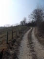
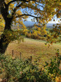
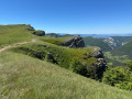
A superb walk in Montmiral, with magnificent views and paths perfect for a brisk stroll through the rolling hills of the Drôme!!!

Details

20727
Creation:
Last update:
Last review:
  • Horse riding
    Activity: Horse riding
  • ↔
    Distance: 8.16 mi
  • ◔
    Duration according to the author: 2 hrs 
  • ▲
    Difficulty: Easy

  • ⚐
    Back to start: Yes
  • ↗
    Ascent: + 1,411 ft
  • ↘
    Descent: - 1,404 ft

  • ▲
    Highest point: 1,542 ft
  • ▼
    Lowest point: 925 ft

Photos

Description of the walk

Start from the car park at Montagne church.

(S/E) From the car park, go round the church, passing to the right of it, and head up the tarmac road. You’ll pass a house on your left; take the grassy path to the left after the farm. This path runs between fields. Head downhill along the path. At the crossroads, carry on straight ahead and head downhill to reach the River La Joyeuse.

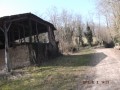
(1) Once at the bottom, turn right; this path leads to a small bridge, followed by a lovely little path perfect for a jog. Pass close to a building (Les Combes) and, a few metres further on, follow the path on the left. This is followed by a brilliant path which climbs quite steeply; pass between some sheds where there are lots of cows and, above all, black pigs! Carry on until you reach the road.

(2) Turn right and follow the road. At the top of the short hill, take the sandy path on your left and head for the junction about 70 metres before the D52 (which links Montmiral to Montagne).

(3) Turn left and you’ll find some superb dirt tracks. At the end of this good track, you’ll arrive at a housing estate in Montmiral, which you’ll walk through (there are loads of dogs, but they’re either friendly or tied up).

(4) Once you’ve come down from the housing estate, turn left after the rubbish bins, follow the road for a short while, then take the first right. Pass through the hamlet of Les Chevalières (cheese dairy) and head downhill (it’s a bit steep!!!) to the bottom. This is followed by a superb dirt track climb to tackle at full gallop!!! It’s brilliant. At the road, turn left and head towards the cemetery.

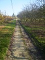
(5) Carry on by turning left after the cemetery onto a grassy path that descends and leads between some walnut trees. This is followed by another brilliant, flat grassy path that bends to the right; then, continuing straight on, you’ll come to a long, stony climb.

(6) Once at the top, turn left, pass between the houses and rejoin the road. Turn right at the first stony path leading downhill. Walk down gently (be careful, it’s steep!) and at the bottom, turn left onto the road, then right, and you’ll reach a junction in the hamlet of Tôt.

(7) Carry on straight ahead, cross a small bridge and turn left at the rubbish bins. You’ll rejoin the famous Chemin de la Tradac, where you continue straight on, following the Joyeuse for about 2.5 km until you reach the crossroads you took at the start.

(1) Turn left to walk the path in the opposite direction and return to the car park at Montagne church (S/E).


Waypoints

  1. S/E : mi 0 - alt. 1,486 ft - Montagne church car park
  2. 1 : mi 1 - alt. 1,014 ft - La Joyeuse, on the right
  3. 2 : mi 1.96 - alt. 1,316 ft - Road, on the right
  4. 3 : mi 2.65 - alt. 1,516 ft - Crossroads, turn left
  5. 4 : mi 3.65 - alt. 1,362 ft - Turn left after the rubbish bins
  6. 5 : mi 4.58 - alt. 1,240 ft - Cemetery
  7. 6 : mi 5.36 - alt. 1,194 ft - On the left, between the houses
  8. 7 : mi 6.03 - alt. 951 ft - The hamlet of Tôt
  9. S/E : mi 8.16 - alt. 1,486 ft - Montagne church car park

Reviews and comments

3.7 / 5
Based on 5 reviews

Reliability of the description
3 / 5
Ease of following the route
4 / 5
Route interest
4 / 5
mhp26
mhp26

Hello, thank you for your feedback. The circular route was indeed created in 2013, so there must have been some changes since then. However, are you sure about point 1? I’m not sure if it’s accessible by car?! Unless that’s changed as well.

Machine-translated

User 1223878
• Edited:

Overall rating : 4 / 5

Date of your route : May 18, 2025
Reliability of the description : ★★★★☆ Good
Ease of following the route : ★★★★☆ Good
Route interest : ★★★★☆ Good
Very busy route : No

A lovely circular route – best avoided on rainy days or the day after it has rained.
However, the starting point is no longer suitable as the field has been privatised.
It’s easier to park around the “Ferme du Facteur Enchantée”, i.e. at point 1 on the route.

Machine-translated

duchier
duchier

Overall rating : 3.3 / 5

Date of your route : Aug 27, 2018
Reliability of the description : ★★★☆☆ Average
Ease of following the route : ★★★★☆ Good
Route interest : ★★★☆☆ Average

The starting point is hard to find

What’s missing: walk past the church on the right

We did the walk in the wrong direction because the junctions weren’t very clearly marked

Machine-translated

gazok54
gazok54 ★

Thank you all.
It must be said that the description of this old walk no longer meets our current approval criteria.
A few tweaks by the author and the addition of a few waypoints, and this walk would be perfect.
Let’s wait for the author to read your comments.

Machine-translated

vincenmarino
vincenmarino

Overall rating : 3.3 / 5

Date of your route : Nov 12, 2017
Reliability of the description : ★☆☆☆☆ Very disappointing
Ease of following the route : ★★★★☆ Good
Route interest : ★★★★★ Very good

A splendid 360° view. However, we did the route the wrong way round because at the first junction there were no signs indicating whether to turn right or left. On the off chance, we turned left; there was indeed a bridge to cross, but there was another one on the other side as well, which we only realised on the way back... Luckily, there were signposts and a map!:

Machine-translated

mums
mums

Overall rating : 3.3 / 5

Date of your route : May 20, 2015
Reliability of the description : ★★★☆☆ Average
Ease of following the route : ★★★★☆ Good
Route interest : ★★★☆☆ Average

poorly written explanations
unnecessary passages
but a generally enjoyable circular loop

Machine-translated

DUTOUR
DUTOUR

Overall rating : 4.3 / 5

Date of your route : Mar 09, 2014
Reliability of the description : ★★★★☆ Good
Ease of following the route : ★★★★☆ Good
Route interest : ★★★★★ Very good

A lovely walk, although the directions on arriving at Montmiral (after the rubbish skips, take the path on the left and then turn right after the cheese dairy) wasn’t very clear, which led to us going a little astray. Fortunately, we quickly got back on track by cutting across the fields under the astonished gaze of the cows, and were able to find our way again after asking for directions – luckily we came across some people from a nearby farm.

A lovely walk that I highly recommend!

Machine-translated

Other walks in the area

For more walks, use our search engine .

The GPS track and description are the property of this route's author. Please do not copy them without permission.