Montagne de Reims – Le Cadran

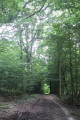
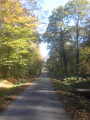
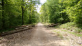
An easy walk. Particularly suitable in wet weather as it follows a tarmac or gravel path for almost the entire route (can also be done by mountain bike). The entire route is through woodland, except for the section through the village.

Details

n°3102828
Creation:
Last update:
Last review:
  • Walking
    Activity: Walking
  • ↔
    Distance: 8.47 mi
  • ◔
    Average duration: 4h 10 
  • ▲
    Difficulty: Moderate

  • ⚐
    Back to start: Yes
  • ↗
    Ascent: + 335 ft
  • ↘
    Descent: - 335 ft

  • ▲
    Highest point: 896 ft
  • ▼
    Lowest point: 558 ft
  • ⚐ Country: France
  • ⚐ City: Sermiers (51500)
  • ⚑
    Start/End: N 49.129001° / E 3.990978°
  • Accessible from the train station Gare de Germaine.
  • ❏
    IGN map(s): Ref. 2713E, 2812O, 2813O
  • Hour-by-hour weather

Photos

Description of the walk

Park in the small car park opposite the Maison Forestière du Cadran.

(S/E) Walk through the copse separating you from the Route Forestière du Cadran and turn left, heading north-east, to follow this track for approximately 4.5 km.

(1) Turn right, then after about 350 m, turn right again onto theGRP® de la Montagne de Reims (yellow and red markings). Continue along this path, which will soon begin to descend gently. You’ll reach the first houses of the hamlet of Les Haies.

(2) Leave theGRP® path, which branches off to the right, and carry on straight ahead to cross the hamlet. Walk alongside the railway line on your left until you reach the junction with the D71 (Rue de Louvois).

(3) Turn right towards the village of Germaine. Ignore the streets on either side until you reach the church, which is situated on the edge of the D271. Turn right and proceed to the junction by the Town Hall (with the washhouse on your right).

(4) Carry on straight ahead along Rue de Courtagnon, which will quickly take you out of the village and into the forest.

(5) Cut across theGRP® de la Montagne de Reims trail and carry on straight ahead to the car park at the start (S/E).

Waypoints

  1. S/E : mi 0 - alt. 892 ft - Car park
  2. 1 : mi 2.69 - alt. 883 ft - Junction
  3. 2 : mi 4.98 - alt. 591 ft - Les Haies – Leaving the °°GRP®°°
  4. 3 : mi 5.7 - alt. 558 ft - D71, on the right
  5. 4 : mi 6.33 - alt. 732 ft - Town Hall – Enter the woods
  6. 5 : mi 7.15 - alt. 823 ft - Cut across the GRP
  7. S/E : mi 8.47 - alt. 892 ft - Car park

Notes

(S/E) If the ground is muddy, head south to go round the clump of trees, then turn left onto the forest track.

Reviews and comments

4.7 / 5
Based on 1 review

Reliability of the description
5 / 5
Ease of following the route
5 / 5
Route interest
4 / 5
virgule
virgule

Overall rating : 4.7 / 5

Date of your route : Jun 28, 2020
Reliability of the description : ★★★★★ Very good
Ease of following the route : ★★★★★ Very good
Route interest : ★★★★☆ Good
Very busy route : No

Anyone fancy giving their thoughts on this route? Right then, I’ll give mine. It’s an ideal route if you like woodland and are worried about getting lost, as it’s dead simple.
Lots of relaxing straight stretches.

You can get to the route by TER train from Germaine station. A real change of scenery guaranteed.

Machine-translated

virgule
virgule

Hello,

if you’re in the area on a Saturday morning, do pop into Le Cerf à trois pattes, a community-run café and grocery shop. It’s a lovely place. It’s located behind Germaine Town Hall.

https://www.facebook.com/lecerfa3pattes/

Further information: Germaine is served by the Epernay–Reims TER service.

Machine-translated

Other walks in the area

For more walks, use our search engine .

The GPS track and description are the property of this route's author. Please do not copy them without permission.