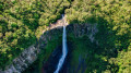
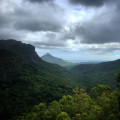
Montagne Cocotte as seen from the Alexandra Falls car park

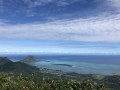
A short round-trip hike with an easy first section along a forest track. The second section is more technical (very narrow path, dense vegetation, steep gradients, a stream to cross) and therefore more challenging in wet weather. A stunning 360° view of the whole of Mauritius from the summit.

Details

n°111251873
Creation:
Last update:
Last review:
–
  • Walking
    Activity: Walking
  • ↔
    Distance: 2.65 mi
  • ◔
    Average duration: 1h 30 
  • ▲
    Difficulty: Moderate

  • ⚐
    Back to start: Yes
  • ↗
    Ascent: + 328 ft
  • ↘
    Descent: - 328 ft

  • ▲
    Highest point: 2,530 ft
  • ▼
    Lowest point: 2,195 ft

Description of the walk

Park in a large, free car park near the“Alexandra Falls” waterfall.

(S/E) Set off eastwards and follow a forest track.

(1) Turn right onto a path that leads into dense vegetation. Head uphill, ignore a path on the left and reach the summit.

(2) Return via the same route in the opposite direction to the car park (S/E).

Waypoints

  1. S/E : mi 0 - alt. 2,201 ft - Car park - Alexandra Falls
  2. 1 : mi 0.99 - alt. 2,326 ft - Forest track x Footpath
  3. 2 : mi 1.33 - alt. 2,530 ft - Montagne Cocotte (780 m)
  4. S/E : mi 2.65 - alt. 2,201 ft - Car park - Alexandra Falls

Notes

Make sure you have the route saved on your phone or watch, as the vegetation is dense on the second section.

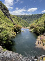
This hike can be combined with the Alexandra Falls (and Cascade des Galets) waterfall hike.

Worth a visit

Magnificent 360° views of Mauritius from the summit.

Other walks in the area

For more walks, use our search engine .

The GPS track and description are the property of this route's author. Please do not copy them without permission.