


LZ Playa Blanca Plus Coast
Details
Creation:
Last update:
-
 Activity: Walking
 -
 Distance: 10.06 mi
 -
 Average duration: 6h 20
 -
 Difficulty: Not specified
 -
-
 Back to start: Yes
 -
 Ascent: + 1,939 ft
 -
 Descent: - 1,929 ft
 -
-
 Highest point: 1,729 ft
 -
 Lowest point: 85 ft
-
 Country:
Canary Islands
Country:
Canary Islands
-
 City:
Yaiza
City:
Yaiza -
 Start/End: N 28.865284° / W 13.79632°
 -


 Hour-by-hour weather


Waypoints
- S/E : mi 0 - alt. 98 ft - Start on Calle Las Palmeras
- 1 : mi 0.08 - alt. 118 ft - Turn sharp right onto Avenida de Papagayo
- 2 : mi 0.09 - alt. 121 ft - Turn slight left onto Avenida de Papagayo
- 3 : mi 0.4 - alt. 144 ft - Turn right onto M-3404
- 4 : mi 0.6 - alt. 131 ft - Turn sharp right
- 5 : mi 1.35 - alt. 404 ft - Turn left
- 6 : mi 4.38 - alt. 686 ft - Keep right
- 7 : mi 4.43 - alt. 646 ft - Keep left
- 8 : mi 4.43 - alt. 646 ft - Turn sharp left
- 9 : mi 5.14 - alt. 367 ft - Turn left
- 10 : mi 5.3 - alt. 469 ft - Turn left
- 11 : mi 5.87 - alt. 217 ft - Turn right
- 12 : mi 8.19 - alt. 197 ft - Keep left
- 13 : mi 8.19 - alt. 200 ft - Turn right
- 14 : mi 8.27 - alt. 233 ft - Turn slight left
- 15 : mi 8.39 - alt. 203 ft - Turn slight right
- 16 : mi 8.7 - alt. 187 ft - Keep right
- 17 : mi 8.74 - alt. 187 ft - Keep right
- 18 : mi 9.27 - alt. 138 ft - Turn right onto M-3404
- S/E : mi 10.06 - alt. 95 ft
Other walks in the area
Hacha Grande summit, canyons and secret beaches
 Visorando Member
 13.77 mi
+2,851 ft
-2,841 ft
8h 50
13.77 mi
+2,851 ft
-2,841 ft
8h 50
 Difficult
 Departure from Yaiza (Province de Las Palmas)
On the program: peaks, canyons, goats, secret beaches, wells and a quiet beach. If you finish this hike at the end of the day, at sunset, you'll be under a rosy sky that is gradually studded with stars. Apart from its length, the ascent to Hacha Grande is the main difficulty, as the trail is sometimes hard to see.
Route of Los Ajaches Natural Park and its beaches
 6.54 mi
+436 ft
-440 ft
3h 25
6.54 mi
+436 ft
-440 ft
3h 25
 Moderate
Departure from Yaiza (Province de Las Palmas)
Moderate
Departure from Yaiza (Province de Las Palmas)
Magnificent white sand beaches, some of which are sheltered from the wind. Please note that the dirt access road is very dusty.
Montana Roja
2.65 mi
+463 ft
-463 ft
1h 35
Difficult
Departure from Yaiza (Province de Las Palmas)
It is best to park in Calle de Francia, but be careful of the yellow no-parking signs.
The circular route can be difficult for people with balance problems, and there can be very strong winds at the summit. Good shoes are necessary.
It is possible to take a detour and walk through the crater, which offers magnificent views of the volcano's ridge.
Barrancos and wild beaches around Femés
 8.54 mi
+2,057 ft
-2,070 ft
5h 45
Moderate
Departure from Yaiza (Province de Las Palmas)
8.54 mi
+2,057 ft
-2,070 ft
5h 45
Moderate
Departure from Yaiza (Province de Las Palmas)
An easy walk through hardly visited valleys, including three almost deserted beaches. Good trail for most of the way.
⚠️However, a passage looks very impressive before you start, but the path is well marked and it will only be a problem for people who are very prone to vertigo.
4 beaches path in Playa Quemada - Lanzarote
 3.94 mi
+951 ft
-942 ft
2h 40
Moderate
Departure from Yaiza (Province de Las Palmas)
3.94 mi
+951 ft
-942 ft
2h 40
Moderate
Departure from Yaiza (Province de Las Palmas)
Starting from the village of Playa Quemada, this short hike provides access to 4 hardly visited beaches. There's nothing complicated about the route, apart from a few overhangs above the cliffs, which can be impressive, especially on windy days. The 4 beaches in question are Playa Quemada, Playa de la Arena, Playa del Paso and Playa la Casa. The latter holds a little surprise in store.
The Montaña Tinasoria route in La Geria
5.80 mi
+1,063 ft
-1,070 ft
3h 35
Moderate
Departure from Yaiza (Province de Las Palmas)
A truly exotic route in La Geria, a protected landscape characterised by thousands of small semi-circular walls (“zocos”) sheltering vines growing in the black volcanic ash. The ridge of Montaña Tinasoria, which is very easy to walk along, offers a superb 360° view.
Tour of Islote del Mojon from El Golfo
 4.64 mi
+338 ft
-328 ft
2h 25
4.64 mi
+338 ft
-328 ft
2h 25
 Easy
Departure from Yaiza (Province de Las Palmas)
Easy
Departure from Yaiza (Province de Las Palmas)
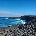
The village of El Golfo, on the island of Lanzarote, was miraculously spared the eruptions of 1730 to 1736. As the lava spread all around the village, right up to the first houses, the highest ground was bypassed by the molten rock. The result is a landscape in which the different phases of the island's volcanism are clearly visible, thanks in particular to the Islotes (Islands) that still stand out against the ocean of lava.
Coastal Route : El Goflo to El Paso Beach
 3.55 mi
+292 ft
-272 ft
1h 55
Moderate
Departure from Yaiza (Province de Las Palmas)
3.55 mi
+292 ft
-272 ft
1h 55
Moderate
Departure from Yaiza (Province de Las Palmas)
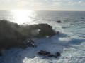
The Ruta del Litoral is a trail that runs along the west coast of Lanzarote, right by Timanfaya National Park.
It crosses the malpais, an area of volcanic rock created by the eruptions of 1730-1736 and 1824, between El Golfo and Playa de la Madera.
Here, I suggest you take the first part of this coastal trail from El Golfo to Playa del Paso, where swimming is prohibited. The waves, the cliffs, the lava show and the desert landscape are just some of the reasons to discover this place.
For more walks, use our search engine .
The GPS track and description are the property of this route's author. Please do not copy them without permission.

