The Montaña Tinasoria route in La Geria

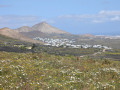
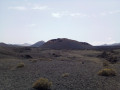
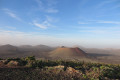
A truly exotic route in La Geria, a protected landscape characterised by thousands of small semi-circular walls (“zocos”) sheltering vines growing in the black volcanic ash. The ridge of Montaña Tinasoria, which is very easy to walk along, offers a superb 360° view.

Details

71540280
Creation:
Last update:
Last review:
  • Walking
    Activity: Walking
  • ↔
    Distance: 5.80 mi
  • ◔
    Average duration: 3h 35 
  • ▲
    Difficulty: Moderate

  • ⚐
    Back to start: Yes
  • ↗
    Ascent: + 1,063 ft
  • ↘
    Descent: - 1,070 ft

  • ▲
    Highest point: 1,818 ft
  • ▼
    Lowest point: 787 ft

Description of the walk

Park in the car park on Calle Joaquín Rodríguez, a little to the east of the centre of the village of Uga.

(S/E) Turn left as you leave the car park, leave Calle la Recontra on your left and head out of the village. Follow Calle de los Arenales to the left for about 200 m. Take the dirt track leading uphill to the right and you’ll come to another road. Follow this to the left with care for about 150 m.

(1) Take a wide, signposted dirt track to the right. The track winds its way through the picturesque landscape of La Geria.

(2) After about 2 km on this track, look out for the first return path, which climbs slightly to the right, and carry on straight ahead. Carry on straight ahead again when you reach another track coming in from the right.

(3) Ignore a return path on the right (barely visible, in a small valley with a dry stream) and carry on straight ahead. Climb up to a pass between Montaña Guardilama (on the left) and Montaña Tinasoria (on the right).

(4) Turn right onto a track closed to vehicles by a barrier, heading towards an abandoned building, which you leave on your right. Climb up the wide, very easy ridge to the summit. You can also take a narrower path that crosses the top of the caldera, then veer slightly left towards the summit of Montaña Tinasoria (this is the route marked on the attached map).

(5) Enjoy the sweeping views, including the south of the island and a small section of the island of Fuerteventura. Continue along the ridge as you descend.

(6) At a small pass, continue across the ridge, climbing slightly. The path becomes a narrow track that winds between the zocos before descending back onto the wide path taken on the way out through the valley spotted earlier (the track fades a little towards the end, but the descent down the wide path is very obvious).

(3) Turn left to retrace part of this path in the opposite direction to the outward journey. Ignore the first path on the left. Return to the junction you passed on the outward journey.

(2) Take the path on the left, which climbs through the ash (the going is a bit tough in places). The track narrows to a path, then becomes somewhat overgrown. Continue without difficulty in the same southerly direction, through the ash, passing above a farm which you’ll leave on your right. A little further on, you’ll reach the wide access track leading to this farm. Follow this track uphill (still heading south) and ignore the first track on the right.

(7) You’ll reach a small pass below Montaña Tinasoria and turn right. The path crosses another small caldera with old traces of cultivation, then reaches the village of Uga (S/E).


Waypoints

  1. S/E : mi 0 - alt. 794 ft - Car park on Calle Joaquín Rodríguez in Uga
  2. 1 : mi 0.49 - alt. 965 ft - Dirt track with signposts
  3. 2 : mi 1.74 - alt. 1,230 ft - Common junction for both the outward and return journeys
  4. 3 : mi 2 - alt. 1,424 ft - Common junction for both the outward and return journeys
  5. 4 : mi 2.28 - alt. 1,535 ft - Pass between Montañas Guardilama and Tinasoria
  6. 5 : mi 2.94 - alt. 1,818 ft - Highest point: Montaña Tinasoria
  7. 6 : mi 3.2 - alt. 1,644 ft - Small pass on the ridge
  8. 7 : mi 4.49 - alt. 1,270 ft - Return route via a small caldera
  9. S/E : mi 5.8 - alt. 791 ft - Car park on Calle Joaquín Rodríguez in Uga

Notes

Avoid doing this route in strong winds (which are quite common on Lanzarote) – you’ll struggle to stay on your feet on the ridge! Also avoid this route in poor visibility, as the paths are difficult to see in two places (no problems finding your way in clear weather). 

There are plenty of ‘bodegas’ in the area where you can taste and buy the traditional wine of La Geria.

Reviews and comments

4.6 / 5
Based on 3 reviews

Reliability of the description
4.7 / 5
Ease of following the route
4.7 / 5
Route interest
4.3 / 5
claroc27
claroc27
• Edited:

Overall rating : 4.7 / 5

Date of your route : Mar 23, 2026
Reliability of the description : ★★★★★ Very good
Ease of following the route : ★★★★☆ Good
Route interest : ★★★★★ Very good
Very busy route : No

A lovely, easy walk that’s easy to follow thanks to the map and description. No difficulties at all. The route takes you through the vineyards. There’s a lovely view at the top. There was no one else on the path. Be careful in summer as there’s no shade: make sure you wear plenty of sun protection and remember to take enough water. It took me 2 hours and 20 minutes to complete the circular walk.

Machine-translated

User 6200720

Overall rating : 4.3 / 5

Date of your route : Feb 01, 2026
Reliability of the description : ★★★★☆ Good
Ease of following the route : ★★★★★ Very good
Route interest : ★★★★☆ Good
Very busy route : No

Gentle slope on an easy walking path that passes through the vineyards.
Lovely viewpoint at the top with views of the sea on either side and the craters in between.
Interesting to see how the vines are cultivated and protected from the wind.

Machine-translated

zouzou 69
zouzou 69

Overall rating : 4.7 / 5

Date of your route : Dec 25, 2025
Reliability of the description : ★★★★★ Very good
Ease of following the route : ★★★★★ Very good
Route interest : ★★★★☆ Good
Very busy route : No

Completed in December, very windy, with a downpour on the descent.
Wine tour in the vineyards of La Geria. 360° viewpoint with views of the Fire Mountains and Fuerteventura. Facing Montana Guardilama (same route at the start) but a little lower and less crowded. We were alone.

Machine-translated

Other walks in the area

For more walks, use our search engine .

The GPS track and description are the property of this route's author. Please do not copy them without permission.