


London: Paddington Run (Regent's Park)
Details
Creation:
Last update:
–
–
-
 Activity: Walking
 -
 Distance: 3.17 mi
 -
 Average duration: 1h 30
 -
 Difficulty: Not specified
 -
-
 Back to start: Yes
 -
 Ascent: + 20 ft
 -
 Descent: - 20 ft
 -
-
 Highest point: 121 ft
 -
 Lowest point: 85 ft
-
 Country:
United Kingdom
Country:
United Kingdom
-
 City:
City of Westminster
City:
City of Westminster -
 Start/End: N 51.519167° / W 0.17346°
 -


 Hour-by-hour weather


Waypoints
- S/E : mi 0 - alt. 102 ft - Start on North Wharf Road
- 1 : mi 0.04 - alt. 98 ft - Turn sharp right
- 2 : mi 0.24 - alt. 98 ft - Turn right
- 3 : mi 0.25 - alt. 98 ft - Turn right onto North Wharf Road Footbridge
- 4 : mi 0.27 - alt. 95 ft - Turn right onto Grand Union Canal (Paddington Arm) towpath
- 5 : mi 0.62 - alt. 98 ft - Keep left onto Grand Union Canal towpath
- 6 : mi 0.64 - alt. 98 ft - Turn right
- 7 : mi 0.77 - alt. 98 ft - Keep left
- 8 : mi 1.04 - alt. 115 ft - Turn right onto Aberdeen Place
- 9 : mi 1.17 - alt. 121 ft - Turn right
- 10 : mi 1.51 - alt. 115 ft - Keep right onto Regent's Canal Towpath
- 11 : mi 1.57 - alt. 112 ft - Turn left
- 12 : mi 1.61 - alt. 115 ft - Turn sharp right onto Park Road
- 13 : mi 1.68 - alt. 108 ft - Turn left onto Hanover Gate
- 14 : mi 1.78 - alt. 108 ft - Turn right onto Outer Circle
- 15 : mi 1.78 - alt. 105 ft - Turn left
- 16 : mi 1.81 - alt. 105 ft - Turn right
- 17 : mi 1.87 - alt. 98 ft - Turn right
- 18 : mi 2.17 - alt. 95 ft - Turn sharp right
- 19 : mi 2.26 - alt. 92 ft - Turn left
- 20 : mi 2.27 - alt. 92 ft - Keep right onto Baker Street
- 21 : mi 2.34 - alt. 89 ft - Turn right onto Melcombe Street
- 22 : mi 2.65 - alt. 98 ft - Turn left onto Lisson Grove
- 23 : mi 2.68 - alt. 102 ft - Turn left onto Bell Street
- 24 : mi 2.95 - alt. 105 ft - Turn left onto Edgware Road
- 25 : mi 2.96 - alt. 102 ft - Turn right
- 26 : mi 2.98 - alt. 102 ft - Turn slight left
- 27 : mi 2.99 - alt. 102 ft - Turn right
- 28 : mi 2.99 - alt. 102 ft - Turn left
- 29 : mi 3 - alt. 102 ft - Turn right onto Harrow Road
- 30 : mi 3.11 - alt. 102 ft - Turn left onto North Wharf Road
- 31 : mi 3.17 - alt. 102 ft - Turn right onto Rosewood Walk
- S/E : mi 3.17 - alt. 102 ft
Other walks in the area
A walk through London’s iconic landmarks
 Visorando Member3.65 mi
+39 ft
-79 ft
1h 45
Visorando Member3.65 mi
+39 ft
-79 ft
1h 45
 Easy
Easy
 Departure from City of Westminster (Greater London)
Set off to explore London’s bustling streets on a charming city walk. The route takes in several iconic locations, from famous monuments to picturesque alleyways. It’s a lovely way to soak up London’s energy, combining history, culture and relaxing breaks along the way.
Thames Path From Waterloo To Greenwich
 8.18 mi
+197 ft
-210 ft
3h 55
Easy
Departure from London Borough of Lambeth (Greater London)
8.18 mi
+197 ft
-210 ft
3h 55
Easy
Departure from London Borough of Lambeth (Greater London)
There is so much to discover when you walk along the Thames in London. From Waterloo to Greenwich, encounter London’s most famous landmarks and hidden gems, from ancient sites to modern developments. Take a walk down the history lane along the iconic River Thames to see London from a different perspective.
Richmond's Green Trail - Barnes to Hampton
 Association / Club / Walk leader16.15 mi
+223 ft
-207 ft
7h 35
Association / Club / Walk leader16.15 mi
+223 ft
-207 ft
7h 35
 Moderate
Departure from London Borough of Hammersmith and Fulham (Greater London)
Moderate
Departure from London Borough of Hammersmith and Fulham (Greater London)
This last walk describes a route from one end of the Borough of Richmond-upon-Thames to the other. It traverses many of the borough's parks and commons and shows how they can be linked by footpaths to form an impressive 15-mile country-style walk we proudly present as "Richmond's Green Trail".
From Stamford Brook to Embankment via the Thames
 10.26 mi
+174 ft
-151 ft
4h 50
Moderate
Departure from London Borough of Hounslow (Greater London)
10.26 mi
+174 ft
-151 ft
4h 50
Moderate
Departure from London Borough of Hounslow (Greater London)
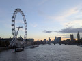
These two London Underground stations are less than a few kilometres apart, which is shorter than the open-air route that follows the course of the Thames, first on the north side on the left bank and then on the south side on the right bank between Hammersmith Bridge, Battersea Power Station, the London Eye and Jubilee Bridge.Although mainly urban, the route does offer a few tree-lined sections, particularly in the two parks it passes through.
London Bridge to Canary Wharf
 4.42 mi
+128 ft
-89 ft
2h 10
Moderate
Departure from London Borough of Southwark (Greater London)
4.42 mi
+128 ft
-89 ft
2h 10
Moderate
Departure from London Borough of Southwark (Greater London)
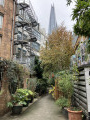
A walk off the beaten path from central London to Canary Wharf.
The Thames Path from Putney to Barnes
4.24 mi
+33 ft
-36 ft
2h 00
Easy
Departure from London Borough of Hammersmith and Fulham (Greater London)
This linear London walk follows the River Thames upstream between Putney Bridge and Barnes Bridge.
Barnes to Richmond along the Thames Path
6.18 mi
+30 ft
-30 ft
2h 50
Easy
Departure from London Borough of Richmond upon Thames (Greater London)
The Thames Path provides easy walking and interesting surroundings. The section from Barnes to Richmond covered by this walk also includes the option to Visit Kew Gardens and enjoy the riverside 'attractions' at Richmond.
Barnes Common, riverside and nature reserve
4.13 mi
+33 ft
-30 ft
1h 55
Easy
Departure from London Borough of Richmond upon Thames (Greater London)
This walk has as its focal point the Leg o’ Mutton Nature Reserve (Formally Leg o’ Mutton" reservoir). The walk uses some of the intriguing network of paved footpaths lined with small terraced houses and cottages, which is characteristic of this part of Barnes and Mortlake. Next the Flood Wall Walkway provides excellent river views and leads on to the towpath. The return via pond, green and Mill Hill gives a taste of the village aspect of Barnes, also of the rural scenery of the Common.
For more walks, use our search engine .
The GPS track and description are the property of this route's author. Please do not copy them without permission.

