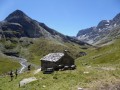
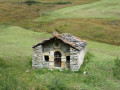
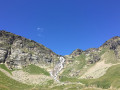
Vincendières as seen from the Averole refuge

A very scenic route allowing you to descend from the Refuge d’Avérole whilst avoiding the track, offering a superb view of the Pointe du Charbonnel and its glacier. This route isn’t long but it does require sure-footedness.

Details

n°107971127
Creation:
Last update:
Last review:
–
  • Walking
    Activity: Walking
  • ↔
    Distance: 6.25 mi
  • ◔
    Average duration: 4h 15 
  • ▲
    Difficulty: Moderate

  • ⚐
    Back to start: No
  • ↗
    Ascent: + 1,608 ft
  • ↘
    Descent: - 2,831 ft

  • ▲
    Highest point: 8,094 ft
  • ▼
    Lowest point: 5,919 ft

Description of the walk

(S) Head north-east behind the refuge, following the path to the signpost at 2,320 m.

(1) Turn left onto the balcony path, heading north-west, and join the GR®, which climbs up from the track leading to the refuge.

(2) Continue straight ahead:there are no markings in some sections.

(3) Go round the rocky ridge from above: you’ll find yourself 100 m above the track, which you’ll rejoin by following the azimuth: the markings are unreliable at this point. Then follow the GR® markings again and continue along the balcony path.

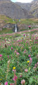
(4) Pass above the chalets at Mottuaz d’Amont. Take the track up to an altitude of 2,430 m and reach a superb cirque. Cross the footbridge over the Ré Bruyant and arrive at Les Pécherses.

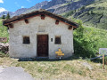
(5) Follow the track to the left to descend towards Les Vincendières. You’ll reach a junction opposite a small building.

(6) Continue downhill to the left. Once you reach the second left-hand bend, leave the track and take the path towards the Planors chalets, heading towards them.

(7) Keep going in the same direction to rejoin the track further down.

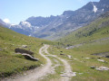
(8) Turn right and follow the track, taking two very wide hairpin bends. Pass Le Béchet and then Le Petit Béchet.

(9) Cut left to avoid a long bend in the track and rejoin it further down one last time.

(10) Head off to the left again and complete the descent to reach the Route d’Avérole, opposite the stream of the same name.

(11) Head left and walk carefully along this road until you reach the car park in the hamlet of Vincendières (E).

Waypoints

  1. S : mi 0 - alt. 7,241 ft - Refuge d'Avérole
  2. 1 : mi 0.41 - alt. 7,631 ft - Signpost
  3. 2 : mi 0.94 - alt. 7,592 ft - GR® junction
  4. 3 : mi 1.41 - alt. 8,045 ft - Rocky outcrop
  5. 4 : mi 2.51 - alt. 7,598 ft - Mottuaz d’Amont
  6. 5 : mi 3.44 - alt. 7,838 ft - Les Pécherses
  7. 6 : mi 3.84 - alt. 7,543 ft - Crossroads
  8. 7 : mi 4.1 - alt. 7,392 ft - Le Planors
  9. 8 : mi 4.25 - alt. 7,215 ft - Back on the trail
  10. 9 : mi 5.08 - alt. 6,703 ft - Shortcut to the left
  11. 10 : mi 5.36 - alt. 6,188 ft - Back on the trail
  12. 11 : mi 5.81 - alt. 5,919 ft - Route d’Avérole
  13. E : mi 6.25 - alt. 6,017 ft - Les Vincendières

Notes

Shoes with good soles.

Worth a visit

View of the Pointe du Charbonnel.

The superbly restored alpine chalets.

Always be cautious and plan ahead when you're outdoors. Visorando and the author of this route cannot be held responsible for any accidents occurring on this route.

The GR® and PR® markings are the intellectual property of the Fédération Française de Randonnée Pédestre.

Other walks in the area

For more walks, use our search engine .

The GPS track and description are the property of this route's author. Please do not copy them without permission.