The three churches of Trizac

In Trizac, this walk invites you to discover a remarkable religious heritage amidst the landscapes of the Auvergne Volcanoes. Between the Romanesque church of Saint-Beauzire and the mountain chapels of Lieuchy and La Chassagne, the route traces the spiritual and rural history of Haute-Auvergne. It is a trail combining nature, architecture and local traditions, in an authentic and peaceful setting.

Details

97631777
Creation:
Last update:
Last review:
  • Walking
    Activity: Walking
  • ↔
    Distance: 7.23 mi
  • ◔
    Average duration: 4h 05 
  • ▲
    Difficulty: Moderate

  • ⚐
    Back to start: Yes
  • ↗
    Ascent: + 866 ft
  • ↘
    Descent: - 883 ft

  • ▲
    Highest point: 3,232 ft
  • ▼
    Lowest point: 2,631 ft

Description of the walk

Start at the Town Hall Square.

(S/E) Walk down past the church and turn right into Rue des Tiolets. After about 100 metres, turn left into Rue des Tilleuls. Continue to the D30 Route de Saignes.

(1) Turn right until the next junction.

(2) Turn left towards Vrauzans. Stay on this road until you reach the last houses.

(3) Leave the road and take the path on the right leading to Lieuchy.

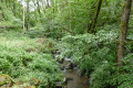
(4) At the chapel, take the road that goes downhill and continues along a path leading to the Ruisseau de Varleix.

(5) Head up to the right into the Chauvel forest. At the top of the climb, you’ll reach the road above the hamlet of Chauvel. Do not head towards the houses in Chauvel.

(6) Turn left and follow this road through Lachassagne (chapel) and then Laurichesse. Continue until you reach the track leading to Lacoste.

(7) Turn right towards Lacoste. After the last houses, take the road on the right and you’ll come to a path on the left before the junction with the D678.

(8) Take this small track leading to the village of Leybros.

(9) When you reach the road, turn right, then left to reach Leybros. Continue along the road until you reach a crossroads.

(10) Turn right, then take the small path on the right. At the Fork in the road, continue straight ahead until you reach another crossroads.

(11) Turn left until you reach the next junction, near the cemetery. Continue straight on along the cemetery wall and follow the D678 to the Fork in the road ahead. Turn left onto Rue du Centre, cross the village and head up to the right onto Place de la Mairie (S/E).


Waypoints

  1. S/E : mi 0 - alt. 3,166 ft - Town Hall Square - Église Saint-Beauzire (Trizac)
  2. 1 : mi 0.25 - alt. 3,110 ft - End of the road
  3. 2 : mi 0.9 - alt. 3,114 ft - Junction
  4. 3 : mi 1.45 - alt. 2,976 ft - Leaving Vrauzans
  5. 4 : mi 2.37 - alt. 2,900 ft - Lieuchy
  6. 5 : mi 2.8 - alt. 2,638 ft - Varleix (ruisseau) - Affluent du Marilhou
  7. 6 : mi 3.64 - alt. 2,825 ft - Top of the climb
  8. 7 : mi 4.75 - alt. 3,002 ft - Fork in the road towards Lacoste
  9. 8 : mi 5.32 - alt. 2,723 ft - Crossroads
  10. 9 : mi 5.78 - alt. 3,054 ft - Top of the path
  11. 10 : mi 6.06 - alt. 3,156 ft - Junction
  12. 11 : mi 6.6 - alt. 3,150 ft - Path
  13. S/E : mi 7.23 - alt. 3,169 ft - Town Hall Square - Église Saint-Beauzire (Trizac)

Notes

Signpost: The 3 Churches, route no. 5, Yellow.

Worth a visit

Saint-Beauzire Church.

Fountain in the Town Hall Square.

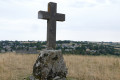
Vrauzans Cross.

12th-century house in Vrauzans.

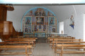
Lieuchy Chapel.

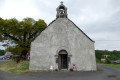
Lachassagne Chapel.

Other walks in the area

For more walks, use our search engine .

The GPS track and description are the property of this route's author. Please do not copy them without permission.