Country:

 City:
City:


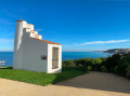
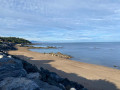
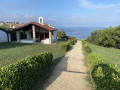
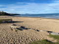
The route starts from the Kirolak car park in Bidart (trinquet, covered fronton, sports hall). Access this point via Rue de la Gare, starting from the Uhabia roundabout on the D810. Park either alongside the Kirolak or on the slightly overhanging verge. There are few spaces available for vehicles taller than 1.80 m (see ‘Practical Information’ section).
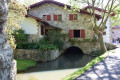
(S/E) Walk alongside the Kirolak towards the tennis courts to reach the Voie Verte, turn right onto it and follow the path. After crossing the Uhabia via the footbridge, turn left to begin the walk around the Uhabia retention basin. The Uronea Chapel is situated approximately halfway along this route, behind a cluster of plane trees.
(1) Continue to complete the walk round the retention basin until you reach the small footbridge on your left. Cross it and carry on along the Voie Verte until you see a level crossing on your right. Turn left and walk uphill for a few dozen metres. At the junction, take the Chemin de Bizkarenea straight ahead – signposted ‘dead end’ – which climbs as a footpath. At the top of the climb, turn right onto the dirt track, passing the first wooden gate, and you’ll come out onto Rue Oyamburu.
(2) Take this street after turning left. Continue to the crossroads. Take Rue de Capera straight ahead, also signposted “dead end”. Take care: two- and four-wheeled vehicles sometimes come down the steeply cut section of this road, so proceed with caution. The final section, which is gravelled, is for pedestrians only. After a few steps, you’ll come out onto a pavement running alongside the D810. Go round the large roundabout, veering to the right to join “La Vélodyssée”, a cycle path running parallel to and slightly below the RD810. Pass in front of a wayside cross overlooking the Erretegia valley, which slopes down to the beach of the same name. Continue until you are walking alongside a wooden fence on your left.
(3) At the end of this fence, turn left onto a wide dirt track marked with red and white signs (GR®) heading towards the sea. Carry on straight ahead, initially avoiding the signposted path leading downhill to the left. Carry on until you reach a bench surrounded by railings, situated on the roof of a Second World War bunker (which once offered a panoramic view of over 180° across the ocean). By going round all the barriers, it is possible to reach the roof of the artillery casemate, but the view is hardly any better from there.
Turn back and this time take the path on the right, marked white and red, which leads down into the Erretegia valley. Keep turning right until you reach the road, cross it and walk down for a few metres before taking the path on the left, marked in white and red, which leads up a fairly steep climb with some high steps (see Practical Information) and comes out onto the Corniche de la Falaise.
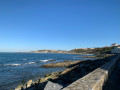
(4) Turn right and continue along this path. Cross the section closed to traffic and begin the descent. Shortly after the “Etche Ben” property, temporarily leave the white-and-red markings and turn sharply left onto the Promenade du Belvédère. At the end of this, cross the road, walk past the Tourist Office and head right to the corner of the car park just after the municipal police station. Go down the few steps to Square Pili Taffernaberry with its view of the mountains. Head back towards the village square between the church, the town hall (Herriko Etchea) and the fronton. Walk past a bar, cross the road and turn slightly right onto Rue de la Madeleine, which leads to the site of the Sainte-Madeleine Chapel overlooking the ocean.
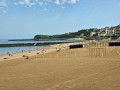
(5) At the far end, to the left of the esplanade, take the path with steps (see Practical Information) which joins the road (closed to traffic but not to two-wheelers) leading to Plage du Centre. Walk along the beach, staying on the stone-paved path. After passing the bar-restaurant, look out for the first steps of the staircase on the left.
(6) Take these steps to reach the viewpoint above the Lafargenia car park. Cross the car park diagonally, veering to the left, to reach Rue de l’Uhabia. Turn right onto this street and follow it downhill until you come to Rue Camboenea on your right. Follow this street to its end.
(7) Turn into Rue des Embruns, the first on the right, and walk along the left-hand side of the rear of the Embruns healthcare centre building. The alleyway leads to a footpath that takes you to Embruns beach, separated from Uhabia beach by the mouth of the coastal river of the same name. Turn your back on the beach and cross diagonally to the right across the small square with its dune-themed décor (red and white markings). Take the narrow passage between two properties and turn immediately right; follow the concrete path, passing the Bella Gorri beach restaurant, and head towards the banks of the Uhabia to reach the footbridge spanning it a few metres upstream.
(8) Cross this footbridge and then walk the full length of the Uhabia beach car park. At the far end, turn right, passing the lifeguard station. Shortly afterwards, you’ll come across the red-and-white markings again, indicating, on your left, the first steps of a path which you should take, keeping to the right until you emerge onto Rue de Parlementia.
(9) Follow the road uphill after turning right and continue along this street until you see the Saint-Joseph Chapel on your right, overlooking the ocean.
(10) Walk down the path running parallel to the chapel to the viewpoint, take the path below, marked with red and white, and join the Parliamentia Beach promenade. Follow this for just under 200 metres and look out for the steps on your left leading up to the Koskenia site (yellow marker). Take this path to reach the site and its remarkable panoramic views, then follow Rue de Koskénia for a very short stretch through Guéthary.
(11) At the railway line, turn right twice to come out onto the Terrasse P. Lious overlooking the ocean. At the far end, on the corner, go down the few steps leading to the Sentier des Baleines to reach the beach. Turn right to rejoin the Promenade until, to the right of the Bahia Beach restaurant, you reach Chemin Barognenia.
(10) Walk up this road until you reach Rue de Parlementia. Follow it briefly to the right and cross the footbridge over the railway line, which runs parallel to the D810. Follow the D810 and cross it, then turn left onto Chemin Gachonenea, which ends as a footpath.
(12) At the end of this path, turn left onto Rue Lukuchenea. At the junction, turn left onto Rue Mundustenea (second on the left; ignore Chemin de Mouchichipy).
(13) Walk down to the railway line, cross the level crossing and turn left immediately afterwards to follow the signposted footpath. Follow this path and, at its end, veer left then turn right into the Zirlinga car park, which runs parallel to the D810. Walk the entire length of the car park and, at its end, join the start of the Voie Verte.
(14) Follow this path, which runs alongside the River Uhabia, to return to the starting point at the Kirolak car park (S/E).


 Visorando Member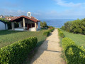
 Easy
Easy 
 Association / Club / Walk leader