Ithurbidea circular route in Bidart and Guéthary

This circular route, named after a path it follows, climbs from the Uhabia Greenway towards the wooded hills of Bidart, before returning to the southern coastline with its remarkable viewpoints overlooking the ocean.

Details

62296238
Creation:
Last update:
Last review:
  • Walking
    Activity: Walking
  • ↔
    Distance: 5.36 mi
  • ◔
    Average duration: 2h 50 
  • ▲
    Difficulty: Easy

  • ⚐
    Back to start: Yes
  • ↗
    Ascent: + 449 ft
  • ↘
    Descent: - 456 ft

  • ▲
    Highest point: 207 ft
  • ▼
    Lowest point: 3 ft

Photos

Description of the walk

Start from the Kirolak car park in Bidart (trinquet, covered fronton, sports hall).
Reach this point via Rue de la Gare, starting from the Uhabia roundabout on the RD810.
Park either alongside the Kirolak or on the slightly overhanging verge.
There are few spaces available for vehicles taller than 1.80 m (see Practical Information).

(S/E) Walk alongside the Kirolak towards the tennis courts to reach the Voie Verte, turn right onto it and follow it across the two footbridges until you reach a level crossing on your right.
Cross the level crossing and pass the hamlet of Errotaberria to reach a semi-cylindrical underpass beneath the motorway.

(1) Take this passage under the motorway. It is safe to cross except after periods of heavy rain (see Practical Information). At the exit, continue straight on until you reach the junction with the Route d’Oihara.
Cross this road (visibility is reduced) and turn onto Chemin de Ttipitoenea opposite, which winds its way up through a pine forest.
Carry on until you reach Route d’Ahetze (RD655). Turn right and follow this road for about 200 m. Due to traffic (take care), it is best to walk single file on the left-hand verge.

(2) At the second junction, turn right onto Chemin de Dorrea. Follow this for about 700 m.

(3) Turn right in front of a large gate flanked by two stone walls to enter the woodland along the dirt track known as Ithurbidea. Pass some sports accommodation, turn left at the T-junction, then cross via a wide underpass beneath the A63 motorway to emerge in the Xuxuena neighbourhood.

(4) Turn left shortly afterwards onto Chemin de Mundustenea. At the end of this path, veer slightly left, past the masonry cross, onto Chemin de Lukuchenea. Follow this path downhill to a turning area marked on the road surface.

(5) Take the footpath slightly below, which widens into Chemin Gachouchenea. You’ll come out onto Avenue d’Espagne (RD810); turn right, follow the road and cross it. Take the footbridge over the railway line and, once you’ve crossed it, head slightly to the left for about fifty metres.

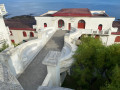
(6) Head straight ahead, downhill, onto Chemin d’Atalaya. At the end of this path, take a short detour to the right to explore the site of the Chapelle Saint-Joseph.
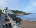
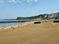
Then head down the winding coastal path (marked white and red) to the Promenade de la Plage. Walk along Bidart’s Parlementia Beach, then enter the Guéthary coastline.
Head back up to the left between two blocks of flats, taking the Sentier des Baleines, which leads to the small harbour of Guéthary. Cross the harbour and continue along the Jetée des Alcyons.

(7) A few metres before the end of the jetty, look out for the Coastal Path markings on the left, which begin with a few steps. Follow this path uphill through the copse to the Chemin des Falaises. Turn left to join the Chemin du Port. Walk back over this road and past the Guetharia and Itasasoan blocks of flats.
Do not take the bridge over Guéthary station; turn left onto the Chemin du Phare, or Chemin de Koskenia, and follow it to the end.

(8) From the Koskenia site, head back down the wide steps to the beach; follow the beach for a short while before turning right up the steep Chemin de Barognegnia and joining Rue de Parlementia, the junction you passed on the way out.

(6) Turn left and follow Rue de Parlementia for about 300 metres to reach the viewpoint overlooking Uhabia Beach.

(9) Continue down the slope and, on the left, look out for the signpost for the coastal path leading down between two properties. Take this path and you’ll emerge onto Uhabia Beach. Turn right, walk past the lifeguard station, then cross the car park in its entirety until you reach the Uhabia stream.

(10) Turn right onto the path that runs alongside the Uhabia River under the bridge on Avenue d’Espagne (RD810) and rejoin the start of the Voie Verte, which you should follow to the car park (S/E).

Waypoints

  1. S/E : mi 0 - alt. 13 ft - Kirolak car park (sports hall) - Uhabia (fleuve)
  2. 1 : mi 0.61 - alt. 20 ft - Passage under the A63 motorway
  3. 2 : mi 1.27 - alt. 194 ft - Junction of Rte d’Ahetze and Ch. Dorrea
  4. 3 : mi 1.68 - alt. 180 ft - Start of the Chemin d’Ithurbidea
  5. 4 : mi 2.39 - alt. 82 ft - Mundustenea Path
  6. 5 : mi 2.73 - alt. 66 ft - Footpath below
  7. 6 : mi 3.08 - alt. 105 ft - Junction of the circular loop
  8. 7 : mi 3.67 - alt. 16 ft - End of the Jetée des Alcyons
  9. 8 : mi 4.04 - alt. 98 ft - Koskenia site
  10. 9 : mi 4.48 - alt. 102 ft - Panoramic view above the Uhabia
  11. 10 : mi 4.82 - alt. 16 ft - Along the - Uhabia (fleuve)
  12. S/E : mi 5.36 - alt. 13 ft - Kirolak car park

Notes

The route follows a few local roads with very little traffic. The names of these roads (Basque place names) are often signposted and are indicated in the route description.

Gates prevent vehicles taller than 1.80 m from accessing the Kirolak car parks. A few parking spaces without gates are available in front of the Ur Onea Chapel (N43.43383 / W1.587561), on the left-hand side of Rue de la Chapelle, which can be reached from the RD810. You can rejoin the route by going round the retention basin (see map).

There are no water points along the route, apart from the numerous bars and restaurants on the two seafronts you pass through.

During wet weather, numerous puddles form beneath the first underpass beneath the A63 motorway (Errotaberria). These can make crossing the underpass uncomfortable. To get round this, continue along the Greenway to the left, go under the large bridge and then return by following the motorway below until you reach the exit of the underpass. This detour is approximately 900 m.

Worth a visit

Reviews and comments

4.1 / 5
Based on 4 reviews

Reliability of the description
4.3 / 5
Ease of following the route
4.5 / 5
Route interest
3.5 / 5
User 3567753

Overall rating : 4.3 / 5

Date of your route : Oct 13, 2025
Reliability of the description : ★★★★★ Very good
Ease of following the route : ★★★★★ Very good
Route interest : ★★★☆☆ Average
Very busy route : No

The second part of the route with sea views is simply magnificent. The only downside is that this walk is mainly on tarmac, crossing the railway line and the busy D810 road twice.

Machine-translated

User 2975765

Overall rating : 5 / 5

Date of your route : Jul 02, 2025
Reliability of the description : ★★★★★ Very good
Ease of following the route : ★★★★★ Very good
Route interest : ★★★★★ Very good
Very busy route : No

A circuit where everything flows nicely: seaside, forest, town, paths... You still need to stay focused on the route, though 🤭
It was great

Machine-translated

godillot49
godillot49

Overall rating : 5 / 5

Date of your route : Feb 10, 2025
Reliability of the description : ★★★★★ Very good
Ease of following the route : ★★★★★ Very good
Route interest : ★★★★★ Very good
Very busy route : Yes

.

Machine-translated

Margzouk
Margzouk
• Edited:

Overall rating : 2 / 5

Date of your route : Mar 04, 2025
Reliability of the description : ★★☆☆☆ Disappointing
Ease of following the route : ★★★☆☆ Average
Route interest : ★☆☆☆☆ Very disappointing
Very busy route : No

I’m still trying to work out what’s so great about this circular pattern…
If you’re keen on tunnels, motorways and housing estates full of lavish villas belonging to right-wing types, go for it!
Otherwise, give it a miss and start the circular walk at stage 6, as the only highlight of this walk is definitely the view of the coastline...
Very disappointed with the route as a whole.

Machine-translated

Other walks in the area

For more walks, use our search engine .

The GPS track and description are the property of this route's author. Please do not copy them without permission.