


Refine your search for walks in les Quatre Termes 1893m
les Quatre Termes 1893m walks


 Le Teillon as seen from Peyroules
 Visorando Member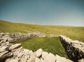
 8.72 mi
 +2,949 ft
 -2,956 ft
 6h 35
6h 35
 Difficult
 Departure from Peyroules (Alpes-de-Haute-Provence)
A route with a fairly steep climb, rewarding you, once at the summit, with a 360° view of the Southern Alps stretching all the way to the sea. Includes a visit to a chapel and the old village of Peyroules. Above 1,700 metres, there is no longer a clearly marked path; you’ll need to navigate using the GPX file, cairns and tracks on the ground.
Walks near les Quatre Termes 1893m
Castellane - Senez
 11.17 mi
+2,454 ft
-2,270 ft
7h 15
Difficult
Departure from Castellane (Alpes-de-Haute-Provence)
11.17 mi
+2,454 ft
-2,270 ft
7h 15
Difficult
Departure from Castellane (Alpes-de-Haute-Provence)
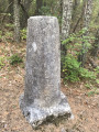
Route Napoléon via theGR®® 406 – Stage 4/6: Castellane – Senez
Saint-Auban - Le Mas
 8.61 mi
+1,444 ft
-1,827 ft
5h 15
8.61 mi
+1,444 ft
-1,827 ft
5h 15
 Moderate
Departure from Saint-Auban (Alpes-Maritimes)
Moderate
Departure from Saint-Auban (Alpes-Maritimes)
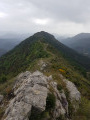
The final stage of the hike in the Haut-Estéron region; this route mainly follows tracks through the woodland before reaching the ridge of Mount Charamel, which is well worth the detour in its own right: the view is sublime. You then descend gently back down to the village of Le Mas.
Senez - La Clappe
11.85 mi
+2,703 ft
-1,837 ft
7h 50
Difficult
Departure from Senez (Alpes-de-Haute-Provence)
Route Napoléon via theGR®® 406 - Stage 5/6: Senez - La Clappe.
Amirat - Saint-Auban
 9.15 mi
+2,989 ft
-2,461 ft
6h 50
Difficult
Departure from Amirat (Alpes-Maritimes)
9.15 mi
+2,989 ft
-2,461 ft
6h 50
Difficult
Departure from Amirat (Alpes-Maritimes)
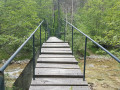
Second stage of the journey through the Haut-Estéron region. This stage takes you to Saint-Auban via the pretty villages of Gars and Briançonnet, then over the somewhat steep Col de l’Escoussier; a variety of landscapes and a trek through wild countryside await!
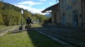
From Allons station to Fugeret station
 8.90 mi
+1,975 ft
-2,349 ft
5h 50
Moderate
Departure from Allons (Alpes-de-Haute-Provence)
8.90 mi
+1,975 ft
-2,349 ft
5h 50
Moderate
Departure from Allons (Alpes-de-Haute-Provence)
This allows you to use the ‘Train des Pignes’ as a means of exploring the area whilst hiking, by changing valleys. The route runs partly through former farmland and partly through mixed woodland (with remarkable trees during the descent towards Fugeret).
Three sections, three landscapes:1/ from the station to the village of Allons,2/ from the village to La Basse d’Annot,3/ from the ridge to Fugeret station.
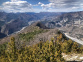
Gueydan Bridge – Entrevaux via the summit of La Lette
 10.68 mi
+3,665 ft
-3,845 ft
8h 05
Difficult
Departure from Saint-Benoît (Alpes-de-Haute-Provence) (Alpes-de-Haute-Provence)
10.68 mi
+3,665 ft
-3,845 ft
8h 05
Difficult
Departure from Saint-Benoît (Alpes-de-Haute-Provence) (Alpes-de-Haute-Provence)
A beautiful, challenging route that keeps you on the ridgelines. The C-shaped configuration of the Var means that throughout this ascent you can admire the river’s banks on both the north and south sides. At the end of the hike, wander through the narrow streets lined with old walls in this magnificent village.
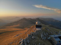
From Blieux to the Mont Chiran Observatory via the Mourre de Chanier
 10.30 mi
+4,626 ft
-1,542 ft
8h 45
10.30 mi
+4,626 ft
-1,542 ft
8h 45
 Very difficult
Departure from Blieux (Alpes-de-Haute-Provence)
Very difficult
Departure from Blieux (Alpes-de-Haute-Provence)
First stage of the circular route from the village of Blieux to the Mont Chiran Observatory. You’ll climb gradually towards the ridges to tackle the day’s peaks: the Mourre de Chanier (1,930 m), the highest point of the stage, the Petit Mourre (1,873 m) and the Grand Mourre (1,898 m), before reaching the Mont Chiran Observatory (1,905 m). The panoramic views stretch out over Lake Sainte-Croix, the Verdon and the surrounding mountain ranges, including the Mercantour. Arrival at the observatory marks the end of this first day, with a welcome water source for the campsite.