The Serpillette circular in Saint-Crespin-sur-Moine

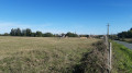
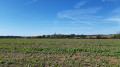
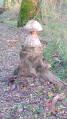
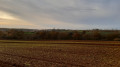
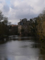
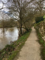
A signposted trail stretching over 11 km through the countryside on one side and a path along the River Moine on the other. You will also have the opportunity to stroll around the village of Saint Crespin-sur-Moine, where you can see the former Maison du Mineur et des Énergies and the Chapelle des Ecluseaux.

Details

24229290
Creation:
Last update:
Last review:
  • Walking
    Activity: Walking
  • ↔
    Distance: 5.79 mi
  • ◔
    Average duration: 2h 50 
  • ▲
    Difficulty: Moderate

  • ⚐
    Back to start: Yes
  • ↗
    Ascent: + 243 ft
  • ↘
    Descent: - 243 ft

  • ▲
    Highest point: 305 ft
  • ▼
    Lowest point: 98 ft

Photos

Description of the walk

From Clisson, take the D149 towards Torfu, then the D762 towards Montigné-sur-Moine and the D60 towards Saint-Crespin-sur-Moine. Park in the car park at the Maison du Mineur et des Énergies.

Blue signposts

(S/E) Walk down the Chemin de Gaudu and turn left at the junction. Continue to the D223, then cross it. Carry on straight ahead to cross a stream. Ignore the first path on the left until you reach a second one.

(1) Take this path to the village of Serpillette. Follow the small road uphill and cross the D147 to reach Les Audinières and then Beauchêne (castle).

(2) Carry on straight ahead at the castle access road until you reach the D64.

(3) Cross it. 100 metres further on, take the path on your left which winds through the vineyards and carry on until you reach the D223, which you cross.

(4) Continue along the road towards the hamlet of Les Paralisières. Once you reach the hamlet, turn right towards “Le Pâtis” and take the first left towards the next hamlet, La Grenouillère. You’ll come to a junction with a track after the next bend.

(5) Turn left, then left again, and carry on straight ahead towards the D64.

(6) Follow it carefully on your left for 150 m, then turn right onto a path that will take you to the Calvaire des Moulins.

(7) There, turn right and continue for 50 m before turning left. First turn right then left, and continue to the end of the track where you’ll find the Calvaire de la Marzelle.

(8) Turn left and follow the road to the cemetery and the Ecluseaux Chapel.

(9) At the chapel, turn right and continue along Rue de Bellevue. Carry on for 500 m, passing through wooded paths running parallel to the River Moine. Ignore a path on the right and take the first path on the left at the bend.
Turn left to head back up to the car park (S/E).

Waypoints

  1. S/E : mi 0 - alt. 190 ft - Maison du mineur et des énergies
  2. 1 : mi 0.51 - alt. 98 ft - Path to the left
  3. 2 : mi 1.35 - alt. 256 ft - Beauchêne hamlet
  4. 3 : mi 1.8 - alt. 299 ft - D64 road
  5. 4 : mi 2.28 - alt. 302 ft - D223 road
  6. 5 : mi 2.98 - alt. 299 ft - Turn left
  7. 6 : mi 3.62 - alt. 279 ft - D64 road
  8. 7 : mi 4.19 - alt. 279 ft - Calvary of Les Moulins
  9. 8 : mi 4.7 - alt. 236 ft - La Marzelle
  10. 9 : mi 5.06 - alt. 236 ft - Les Ecluseaux Cemetery and Chapel
  11. S/E : mi 5.79 - alt. 190 ft - Miner’s and Energy Centre - La Moine

Worth a visit

(S/E) Maison du Mineur et des Énergies (currently closed to the public):
The Miners’ and Energy Centre: a reflection of the past and a window onto the energy of tomorrow
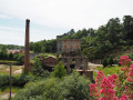
Built in 1954, the former foreman’s house in Saint-Crespin-sur-Moine bears witness to a prosperous industrial era driven by mining.
Forty years of mining inevitably left a deep mark on the village and its inhabitants. From the early 1950s until its closure in 1989, the Escarpière mine extracted up to 4,109 tonnes of ore. At the time, this made it one of the most important sites in the Vendée Mining Division. In 1987, a record output of 50 tonnes was recorded in the month of March alone! Of its 3.5 km stretch along the River Moine, all that remains now is a bare hill opposite the house. Elsewhere, nature has since reclaimed its rights. This site is closed to the public

(2) Château de Beauchêne:
Dating from the 15th century, the château was rebuilt around 1830 as a small castle reminiscent of the style of the original château.
“It is said that in the 17th century, a Lady de la Noue Roquet, wife of the lord of the manor, Rémy Clémot de la Nicolière, seneschal of Beaupréau, was buried with her jewellery. The following night, whilst thieves were attempting to cut off her fingers to steal her rings, the supposedly deceased woman came to her senses, putting the thieves to flight. It is said that she died the next day...”
In 1793, the château became a lookout post intended to provide the royalist troops with information on the movements of the Republicans. When the ruse was discovered, the owner was forced to leave the estate, which was ransacked and set alight by the Blues (private property).

Bikini Bellevue Botanical Garden:
This area, designed for relaxation and the observation of a variety of plant species, is called “Bikini” because a party was held there in honour of miners setting off for Bikini (Marshall Islands – Pacific Ocean) in the late
1950s.

(9) Écluseaux Chapel:
Built in the late 12th and early 13th centuries, with a chancel remodelled in 1854, the chapel dedicated to Our Lady of La Salette is situated in the cemetery. A niche at the entrance to the chancel houses a polychrome stone Pietà which bears the marks of gunshots fired by revolutionaries who attempted to destroy it. Consequently, Christ’s feet have been reconstructed in wood.

Reviews and comments

3.9 / 5
Based on 4 reviews

Reliability of the description
4.3 / 5
Ease of following the route
4 / 5
Route interest
3.5 / 5
User 18139746

Overall rating : 4.7 / 5

Date of your route : Jun 15, 2026
Reliability of the description : ★★★★★ Very good
Ease of following the route : ★★★★☆ Good
Route interest : ★★★★★ Very good
Very busy route : No

A shaded walk along the Moine. Much less so further up. So do the upper section in the morning and the lower section in the afternoon
Very, very quiet

Machine-translated

Randopat Christophoriens

Overall rating : 3.7 / 5

Date of your route : Sep 29, 2025
Reliability of the description : ★★★★☆ Good
Ease of following the route : ★★★★☆ Good
Route interest : ★★★☆☆ Average
Very busy route : No

a fairly pleasant and easy hike. Half of it is on small roads and gravel paths, but otherwise the riverbanks and paths through the woods are superb.

Machine-translated

Danval1
Danval1

Overall rating : 4 / 5

Date of your route : Sep 09, 2024
Reliability of the description : ★★★★☆ Good
Ease of following the route : ★★★★★ Very good
Route interest : ★★★☆☆ Average
Very busy route : No

Lovely
A lovely walk through the vineyards

Machine-translated

manuuher
manuuher

Overall rating : 3.3 / 5

Date of your route : Sep 24, 2023
Reliability of the description : ★★★★☆ Good
Ease of following the route : ★★★☆☆ Average
Route interest : ★★★☆☆ Average
Very busy route : No

The start gets off to a good start with a descent towards La Moine and a lovely path branching off to the left. Then you have to leave the path and head up onto a road, and that’s when the scenery changes completely! Stony roads or tracks through the vineyards in full sun. Why not, but that makes up three-quarters of the walk! Fortunately, the roads are deserted, except for the 150-metre stretch between two bends (6), which has no verge to walk on and no safety warning in the route description (usually the moderators always add one). I must admit I felt relieved once I’d left that stretch behind.
It’s therefore best to do this walk in mid-season or even in winter, as it’s simply not feasible in the blazing summer heat. Do as I did: go in mid-September to enjoy a few grapes gleaned from the vineyards…
In the height of summer, I think it’s better to do the one right next to it, La Pierre de l’Écuelle in Saint-Crespin-sur-Moine.

Machine-translated

Other walks in the area

For more walks, use our search engine .

The GPS track and description are the property of this route's author. Please do not copy them without permission.