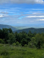
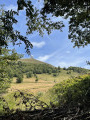
The slopes of the Grand Ballon and the Col du Haag

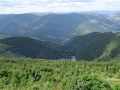
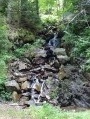
This medium-length route will take you past lovely waterfalls, along the shores of Lac du Ballon and through the heart of the pastures.

Details

44630298
Creation:
Last update:
Last review:
  • Walking
    Activity: Walking
  • ↔
    Distance: 9.67 mi
  • ◔
    Average duration: 6h 15 
  • ▲
    Difficulty: Moderate

  • ⚐
    Back to start: Yes
  • ↗
    Ascent: + 2,060 ft
  • ↘
    Descent: - 2,057 ft

  • ▲
    Highest point: 4,147 ft
  • ▼
    Lowest point: 2,303 ft

Description of the walk

The route starts at the Domaine Langmatt car park.

(S/E) From Langmatt, follow the ‘Red Saltire’ signposting and the path that runs alongside the road. After a hill, turn left then right to reach a junction with a path marked ‘Red Triangle’

(1) Turn right and, at the next junction, follow the ‘White Rectangle’ markings heading uphill. Ignore the paths leading uphill to the left and continue until you reach a Fork in the road. Continue uphill to the left until you reach the bend.

(2) At the junction, follow the Blue Cross markings to the right towards Lac du Ballon. At the next two junctions, carry on straight ahead, then turn right at the third until you reach the Lieserwasen picnic area.

(3) Stay on the track which branches off to the left, heading slightly downhill, then carry on straight ahead and turn left onto the track.

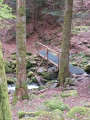
(4) Pass by the waterfalls and carry on straight ahead to the Gustiberg farmhouse inn.

(5) Turn left and carry on straight ahead on level ground to Lac du Ballon.

(6) Go round the lake on the right-hand side, then take the first path on the left and follow the ‘White Rectangle’ signposting.

(7) Cut across a track and continue along the winding path. Further up, carry on to the left until you reach the Col du Haag.

(8) Turn left onto the Chemin du Roedelen and follow it to the inn of the same name.

(9) Head off to the right, following the White Rectangle markings. At the edge of the forest, ignore a path leading down to the left. At the sharp bend to the left, continue to the right along the descending track, then, at the three-way junction that follows, turn left. Keep going straight on until you reach the hairpin bend in the track.

(10) Head right downhill, then straight on to the Col de Judenhut. Turn left and return to the junction you passed on the way out.

(2) Keep to the right and return to the Domaine Langmatt car park via the reverse route of the outward journey (S/E).


Waypoints

  1. S/E : mi 0 - alt. 2,303 ft - Domaine Langmatt car park
  2. 1 : mi 0.44 - alt. 2,740 ft - Red Triangle marked trail
  3. 2 : mi 1.11 - alt. 3,150 ft - Bend - judenhut
  4. 3 : mi 1.88 - alt. 3,048 ft - Lieserwasen
  5. 4 : mi 2.45 - alt. 3,058 ft - Waterfall
  6. 5 : mi 3.36 - alt. 3,199 ft - Auberge du Gustiberg
  7. 6 : mi 4.33 - alt. 3,340 ft - Lac du Grand Ballon
  8. 7 : mi 5.34 - alt. 3,652 ft - Crossing the piste
  9. 8 : mi 6.05 - alt. 4,042 ft - Ferme auberge du Haag
  10. 9 : mi 6.95 - alt. 4,114 ft - Ferme auberge du Roedelen
  11. 10 : mi 8.21 - alt. 3,366 ft - Junction
  12. S/E : mi 9.67 - alt. 2,306 ft - Domaine Langmatt car park

Worth a visit

Haag Farm Inn.
Lac du Ballon.
Highest point in the Vosges: Le Grand Ballon.

Reviews and comments

4.5 / 5
Based on 2 reviews

Reliability of the description
5 / 5
Ease of following the route
4.5 / 5
Route interest
4 / 5
Positiver68
Positiver68

Overall rating : 4.7 / 5

Date of your route : Jul 23, 2025
Reliability of the description : ★★★★★ Very good
Ease of following the route : ★★★★★ Very good
Route interest : ★★★★☆ Good
Very busy route : No

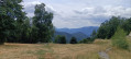
When I arrived at Haag, I took the path that leads to the restaurant with a view of the Alps to have a coffee. Haag is closed on Tuesdays and Wednesdays, so it was an extra kilometre and a slight climb of 100 metres
It is possible to climb up to the Grand Ballon, adding another 100 m of elevation gain and 20 minutes each way.
Thank you.
After the Lac du Ballon, the signs change to yellow-white-yellow rectangles.

Machine-translated

Nature57
Nature57

Overall rating : 4.3 / 5

Date of your route : Jun 17, 2024
Reliability of the description : ★★★★★ Very good
Ease of following the route : ★★★★☆ Good
Route interest : ★★★★☆ Good
Very busy route : No

A beautiful hike allowing you to discover a stunning waterfall, Lake Ballon and the beautiful forests around Grand Ballon. No particular difficulties encountered during this pleasant and uncrowded hike on this Sunday in June.

Machine-translated

Other walks in the area

For more walks, use our search engine .

The GPS track and description are the property of this route's author. Please do not copy them without permission.