Country:

 City:
City:


Car park on Avenue du Maréchal-Juin in Ornans, opposite the cemetery. Yellow and blue signposting; mountain bike route and some unmarked sections.
(S/E) Visit the grave of the painter Courbet at the entrance to the cemetery, then set off along the path, with your back to Ornans, which climbs up the slope at the foot of the tree, running alongside the cemetery wall. Cross the small road and climb the hillside via the steep staircase to warm up your legs.
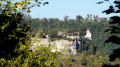
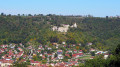
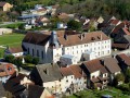
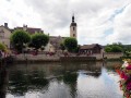
At the top of the wooden and stone steps, at the fork, turn left to reach the first viewpoint overlooking Ornans, its former Visitandines convent, the old Nahin bridge, the Château, the Roche du Mont and its Virgin, the Roche Botine, the Roche Lahier and the Loue valley. Return to the previous fork.
(1) Continue climbing to the left along the narrow path that runs alongside the cliffs. At a bend, you’ll join a stony track which you follow for a few metres (towards Roche d’Ully) before leaving it immediately and taking a signposted path leading up through the forest to the left. You’ll arrive at the foot of a cliff.
(2) Climb the ladder on the left with care. The path then runs alongside the cliffs and you’ll reach the Roche d’Ully viewpoint. Turn back to the bottom of the ladder. You’re now entering the wildest part of the walk.
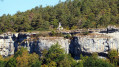
(2) Carry on along these beautiful, rugged little cliffs via a path that is not always visible and which sometimes disappears. But don’t worry – keep the cliffs close to your left. You’ll soon reach a narrow passage between the rocks. Squeeze through this passage, climbing carefully above the cliffs, to reach a path.
Head off to the right, following the ledge for about thirty paces, until you reach an unsecured viewpoint overlooking the small Lachenaud valley. Retrace your steps.
(3) Continue to the right along this lovely, steep path, which becomes stony and wider, and descends to the right towards the valley. When you can see a stony track on your right, head up to the left and join a wide stony path, which you follow down to the right to reach a crossroads, where you’ll find the signposting again.
(4) Head left, despite the signposted crosses. You’ll emerge onto the Ully plateau; carry on straight ahead towards the hamlet, passing the restaurant. Continue for a further 150 metres or so (signpost).
(5) Turn right onto the stony path, heading towards ‘Verger conservatoire’, passing between a hunting lodge and a picnic table. Keep right at the nearby fork. Enter the woods and, at the next fork just ahead, carry on straight ahead along this stony path, which begins to descend and leads to a fork marked by a signpost.
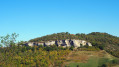
(6) Continue straight down this lovely path, passing beneath beautiful rocks and information boards. There are some marks left by our old carts on the stones of the path. Further down, there are lovely views of Ornans Castle and, to the right, of the cliffs we have just walked along.
(7) Join a wide stony track and head down to the left towards Ornans for about a hundred metres; when the track turns into tarmac, carry on to the right along the gravel path, then turn left again at the nearby junction to reach the cemetery car park. (S/E)
 Visorando Member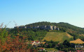
 Easy
Easy 


 Very difficult