Les Écuyers from Muneville-le-Bingard

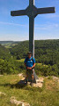
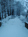
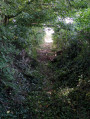
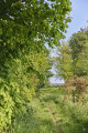
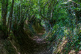
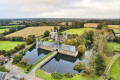
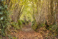
Why this name? The village provided three equerries to the king at various times between the 15th and 17th centuries. This route alternates between built and natural heritage. It will take you through a natural area that reveals many different facets depending on the season. By turns wooded countryside and heathland, discover this area bordered by hedgerows that are home to superb tree species and a wealth of plant and animal life.

Details

n°15896272
Creation:
Last update:
Last review:
  • Walking
    Activity: Walking
  • ↔
    Distance: 11.23 mi
  • ◔
    Average duration: 5h 25 
  • ▲
    Difficulty: Moderate

  • ⚐
    Back to start: Yes
  • ↗
    Ascent: + 269 ft
  • ↘
    Descent: - 249 ft

  • ▲
    Highest point: 299 ft
  • ▼
    Lowest point: 125 ft

Photos

Description of the walk

Park at Place des Écoles near the GR®223 B1 path, below the schools.

Yellow signposting

(S/E) Head due west along theGR® until you reach the D68 road. Turn right onto this road and then take the first left towards Coquière.

(1) At Coquière, follow the road to the left. Soon, take a path branching off to the right towards Le Haut de Bingard.

(2) Then turn right and walk past the water tower, which will be on your right. At the next junction, turn right and head back down to Coquière.

(1) Turn left onto a road which quickly becomes a footpath. Follow it until you come to a small road. Cross this road to stay on the footpath. At the next junction, near the D68, turn left to stay on the footpath again, heading towards Bas de Bingard. Pass through L’Ay.

(3) When you reach the road, turn right and then take the first path on the right until you cross the D68. Continue straight ahead, then take the first left towards La Blérie and then La Roque.

(4) At the next junction, turn right, then take the path on the left. Cross the road a little further on and carry straight on along a small road which quickly becomes a path.

(5) Cross the D534 carefully to continue along the path. At the next junction between two paths, take the one on the left, then turn left again to reach Le Temple.

(6) Once on the road leading to Le Temple, turn right onto a path and then leave it by taking another path on the left.

(7) On the road, turn right, then take the first path on the left. Cross the D431E with care and continue straight on. Carry on straight ahead until you reach the D53.

(8) Turn left and pass through the hamlet of La Péguchellerie. At the Fork in the road (waymark), veer left towards La Raisinière.

(9) Before reaching La Croix Jouin, take the path on the right. Cross the D53 carefully to stay on the path. This will take you back onto the D434.

(10) Turn left and continue until you reach a junction. Turn right onto a small road leading to the D101.

(11) Follow this road to the left and carry on straight ahead to reach Les Roques. Then take a path on the right. At the junction, carry on straight ahead.

(12) At the next junction, turn right, pass La Vicoquerie and carry on to the next junction, then turn left towards La Grande Maison.

(13) After this, take a path on the left and follow it straight on until you reach the D534.

(14) On this road, turn right towards Le Pied de Chat, then take the path on the left and continue straight on, ignoring the various junctions, until you reach the D53 and the outskirts of Les Delisles.

(15) Cross this road carefully, heading straight on, to continue along a minor road. At the first junction between the road and footpaths, take the path on the left to rejoin the Chemin du Val de L’Ay.

(16) Back on the D53, turn right and carry on until you reach the Place de l’École (S/E).

Waypoints

  1. S/E : mi 0 - alt. 144 ft - School square. Cross the - Ay (fleuve)
  2. 1 : mi 0.95 - alt. 180 ft - Coquière
  3. 2 : mi 1.59 - alt. 223 ft - Upper Bingard
  4. 3 : mi 3.37 - alt. 164 ft - Heading towards Le Bas de Bingard
  5. 4 : mi 4.23 - alt. 128 ft - La Roque
  6. 5 : mi 4.75 - alt. 157 ft - D534 road
  7. 6 : mi 5.36 - alt. 177 ft - Junction
  8. 7 : mi 5.75 - alt. 148 ft - D534 road
  9. 8 : mi 6.21 - alt. 197 ft - D53 road
  10. 9 : mi 6.64 - alt. 174 ft - On the outskirts of La Croix Jouin
  11. 10 : mi 7.29 - alt. 207 ft - D434 road
  12. 11 : mi 7.93 - alt. 282 ft - D101 road
  13. 12 : mi 8.79 - alt. 262 ft - La Vicoquerie
  14. 13 : mi 9.51 - alt. 230 ft - La Grande Maison
  15. 14 : mi 10.1 - alt. 177 ft - D534 road
  16. 15 : mi 10.74 - alt. 217 ft - D53 road
  17. 16 : mi 11.18 - alt. 161 ft - D53 road
  18. S/E : mi 11.23 - alt. 144 ft - School square

Notes

Difficulty: none

Public toilets and drinking water point
Restaurant in Muneville-le-Bingard
Draft Horse Festival on 15 August at La Ronde-Haye
Local shops in La Ronde-Haye

Worth a visit

Places of interest – The moors of Muneville-le-Bingard
Off the “Les Moulins, les Ecuyers” route (around 1 km), we encourage you to explore the moors of Muneville-le-Bingard. This 73-hectare open heathland is situated on a vast sandstone plateau dating back 500 million years. Its soil, which is poor in plant nutrients, is covered with heather, gorse and purple moor grass. It is an ideal spot for birds to nest and stopover.
This village is situated in the Ay Valley. The river flows into the harbour at Saint-Germain-sur-Ay, one of the seven harbours along the Cotentin coast. In the hamlet of Les Roques, you’ll find standing stones.

Church of La Ronde-Haye
According to the historian Renaud, the north wall of the church dates from the 11th or 12th century.
The bell tower, the two chapels and the sacristy were added later.
The stained-glass windows date from the 1920s and 1930s and depict events from the period of the Revolution.
Not to be missed: the 19th-century organ and the numerous wayside crosses.
The healing saint: Our Lady.

Muneville-le-Bingard
This village is situated within the Cotentin and Bessin Marshes Regional Nature Park.
Father Pierre-Adrien Toulorge, born on 4 May 1757 in Muneville-le-Bingard (Diocese of Coutances), was a Premonstratensian canon and a martyr of the Revolution, guillotined on 13 October 1793 in Coutances. He was beatified on 2 April 2011 at Notre-Dame Cathedral in Coutances.
Of interest in the church: a statue of the Nursing Virgin dating from 1343 (extremely rare).
The healing saint: Saint Orthaire.
In the village, next to the church, you can see the mill which was in operation between 1913 and 2000. It is owned by the Rapilly family. It produced six quintals of flour per hour.

Always be cautious and plan ahead when you're outdoors. Visorando and the author of this route cannot be held responsible for any accidents occurring on this route.

The GR® and PR® markings are the intellectual property of the Fédération Française de Randonnée Pédestre.

Reviews and comments

5 / 5
Based on 1 review

Reliability of the description
5 / 5
Ease of following the route
5 / 5
Route interest
5 / 5
User 30121811
• Edited:

A lovely, shaded route. Part of the route is overgrown (brambles, stinging nettles, the path is almost impossible to follow), so we had to take a detour.

Machine-translated

rando50
rando50

Overall rating : 5 / 5

Date of your route : Oct 29, 2023
Reliability of the description : ★★★★★ Very good
Ease of following the route : ★★★★★ Very good
Route interest : ★★★★★ Very good
Very busy route : No

We did this route in autumn, so the paths were wet! But you can still get through everywhere.
The route is varied, with lovely paths. We adapted the route so that we could return to Muneville for a picnic at lunchtime. It’s easy to do two circular routes and adjust the distances.
Best done on a sunny day!

Machine-translated

Other walks in the area

For more walks, use our search engine .

The GPS track and description are the property of this route's author. Please do not copy them without permission.