Route circular around the Ay starting from Ancteville

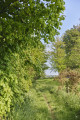
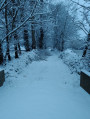
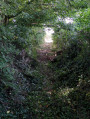
To the north of Coutances, the three villages through which this route passes offer a peaceful walk through the heart of the bocage.

Details

15941764
Creation:
Last update:
Last review:
  • Walking
    Activity: Walking
  • ↔
    Distance: 12.22 mi
  • ◔
    Average duration: 6h 00 
  • ▲
    Difficulty: Difficult

  • ⚐
    Back to start: Yes
  • ↗
    Ascent: + 433 ft
  • ↘
    Descent: - 436 ft

  • ▲
    Highest point: 449 ft
  • ▼
    Lowest point: 154 ft
  • ⚐ Country: France
  • ⚐ City: Ancteville (50200)
  • ⚑
    Start/End: N 49.102914° / W 1.478883°
  • ❏
    IGN map(s): Ref. 1212ET, 1313O
  • Hour-by-hour weather

Photos

Description of the walk

Starts from Ancteville town hall, near the church.

Blue signposting

(S/E) With your back to the town hall, turn right towards La Mare Cotelle and walk past the foot of the church. At the end of the road, take the path branching off to the left and pass through Le Bougon before reaching Servigny.

(1) Turn right towards Village Guillot and, at the junction after the town hall, turn left then right. Walk to the sewage treatment works.

(2) Turn left onto the road towards Village Capet. Then take the footpath to La Fosse Cardin and on to Le Manoir at the end of the path.

(3) Carry on straight ahead to reach La Vendelée town hall. At the next junction, turn left then carry on straight ahead onto a small road and then a footpath. Once on the footpath, take the first right to reach the Route du Château d’eau.

(4) Turn right onto this road, then take the first path on the left leading to the outskirts of Le Village au Rat on the D57.

(5) First turn left then right on this road towards La Cousinière. After passing this village, turn left onto the first footpath to rejoin the D57.

(6) On the D57, turn right, then, after a few dozen metres, turn left. Following the rows of trees and fields, rejoin a track leading to the village of Fromentin.

(7) Here, turn left, head towards the water tower and, at the next junction, turn right. Ignore the first road turning left and, after this, walk for a further 200 m or so before reaching a road turning right.

(8) Take this road, then, shortly afterwards, take the path on the left towards the village of Fillastre. After this point, take the second road on the right and continue for about 200 m.

(9) Then turn onto the path on the left. At the next junction, turn right and then left in turn, and continue along a path.

(10) At the next junction, turn right to stay on this path and walk straight on until you reach L’Hôtel Joie.

(11) Here, turn left then right and rejoin the road. At the end of the path, turn left and follow this road.

(12) At the junction, turn right and join the D393.

(13) Carry on straight ahead along the path. Turn left at the first junction, right at the second, right at the third, then left at the fourth to complete a circular route and return to the D393 at L’Hôtel Piquet.

(14) From there, turn right towards La Plichonnerie, then La Chênerie, and return to the start of the path. Continue straight on along the D393.

(13) Carry on along the D393 as far as L’Hôtel Bouillon.

(15) At Hôtel Bouillon, stay on this road and head towards La Verneuillerie de Bas, then past Le Vieux Presbytère. After that, turn right onto the path at a right angle and follow it to the end.

(16) Once you reach the road, turn left towards La Grande Maison. After passing this village, at the bend, take the path branching off to the left and continue straight on until you rejoin the D534.

(17) On the D534, turn right, then take the first road on the left onto the D436, passing by the Grand Moulin. Continue towards La Renaudière Juhel.

(18) Once you have passed through this village, take the path branching off to the left, which leads straight on to Ancteville. When you reach the D393, turn left and then take the first right to return to the starting point of this walk at Ancteville Town Hall (S/E).


Waypoints

  1. S/E : mi 0 - alt. 197 ft - Town hall - Église Saint-Pierre (Ancteville)
  2. 1 : mi 0.78 - alt. 240 ft - Servigny
  3. 2 : mi 1.37 - alt. 272 ft - Wastewater treatment plant
  4. 3 : mi 2.35 - alt. 308 ft - The Manor
  5. 4 : mi 3.03 - alt. 433 ft - Route du Château d’eau
  6. 5 : mi 3.53 - alt. 427 ft - Crossing the D57
  7. 6 : mi 3.95 - alt. 413 ft - D57 road
  8. 7 : mi 4.45 - alt. 410 ft - Fromentin village
  9. 8 : mi 5.03 - alt. 427 ft - Towards the village of Fillastre
  10. 9 : mi 5.65 - alt. 358 ft - Path
  11. 10 : mi 6.04 - alt. 338 ft - Path towards L’Hôtel Joie
  12. 11 : mi 6.54 - alt. 243 ft - The Hôtel Joie
  13. 12 : mi 6.99 - alt. 194 ft - Towards the D393
  14. 13 : mi 7.11 - alt. 207 ft - D393 road – Carrefour de la circular junction
  15. 14 : mi 8.41 - alt. 213 ft - The Hôtel Piquet
  16. 15 : mi 9.02 - alt. 210 ft - The Hôtel Bouillon
  17. 16 : mi 9.97 - alt. 243 ft - Towards La Grande Maison
  18. 17 : mi 10.72 - alt. 187 ft - D534 road - Ay (fleuve)
  19. 18 : mi 11.6 - alt. 230 ft - La Renaudière Juhel
  20. S/E : mi 12.22 - alt. 197 ft - Town hall - Église Saint-Pierre (Ancteville)

Notes

Difficulty: none
Public toilets and a water point near Ancteville Town Hall.

Worth a visit

Points of interest
The clear waters of the Ay spring from the green hills of the La Vendelée area. This coastal river flows into the English Channel at the harbour of Saint-Germain-sur-Ay after a course of around thirty kilometres. Further upstream, near Ancteville, it flows gently through a wooded valley, passing through a succession of wetlands and collecting water from several small tributaries. As it nears the sea, it ends its course in the heart of the Natura 2000 site of the Saint-Germain Harbour and the Landes de Lessay, having passed through the commune of Lessay.

The Church of Ancteville
In Ancteville, the Church of Saint-Pierre dates from the 16th century. It features a hipped-roof bell tower, a style common in Normandy and particularly in the Manche department. The 13th-century baptismal font and a 16th-century statue of Saint Peter seated as Pope are listed as historic monuments. Nearby stands the Saint-Méen fountain, renowned for its water, which is said to cure skin diseases.

The Church of Servigny
The Church of Saint John the Baptist in Servigny dates from the 12th century. It contains three statues from the 14th and 16th centuries, as well as an 18th-century limestone sundial.

The Church of La Vendelée
In La Vendelée, the Church of Saint-Sébastien dates from the 15th century and was remodelled in the 17th and 18th centuries. Inside the building is a 15th-century bas-relief (The Martyrdom of Saint Sebastian), listed as a historic monument. A 13th-century baptismal font and a granite lectern in the chancel are also worth seeing. A stone bas-relief depicting the Descent from the Cross can be seen on the north wall, on the outside.

The Manoir de la Foulerie
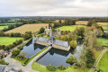
This former manor house is situated in a peaceful and authentic setting. The main building dates mainly from the 16th century and is recognisable by its mullioned windows, stair turrets, ogee lintels and gun ports. Among the manor’s former owners was Jean-Nicolas Juhel de Boissussé, a dragoon captain who had refused to enlist in the National Guard during the Revolution and was guillotined in Paris as part of the ‘Coutances batch’. The property boasts a large wooded park where visitors can enjoy a range of activities. It offers both private accommodation (bed and breakfast) and group accommodation (group lodge), whilst also operating as an organic farm.
The manor house likely takes its name from an old fulling mill (for fulling cloth) that stood nearby and was run by the manor’s owners.

Reviews and comments

3.9 / 5
Based on 4 reviews

Reliability of the description
4 / 5
Ease of following the route
4 / 5
Route interest
3.8 / 5
coutan
coutan

Overall rating : 4 / 5

Date of your route : May 18, 2026
Reliability of the description : ★★★★☆ Good
Ease of following the route : ★★★★☆ Good
Route interest : ★★★★☆ Good
Very busy route : No

Some paths are only just passable after a spell of rain. Keep an eye out for the signposts.

Machine-translated

User 25665923

Overall rating : 2 / 5

Date of your route : May 26, 2025
Reliability of the description : ★★☆☆☆ Disappointing
Ease of following the route : ★★☆☆☆ Disappointing
Route interest : ★★☆☆☆ Disappointing
Very busy route : Yes

Some lovely routes with beautiful paths.
But I’m not sure – there are quite a few blue-coloured routes, and some of the signposts aren’t pointing in the right direction, so it’s best to follow the route using GPS.

Machine-translated

rando50
rando50
• Edited:

Overall rating : 4.7 / 5

Date of your route : Aug 04, 2024
Reliability of the description : ★★★★★ Very good
Ease of following the route : ★★★★★ Very good
Route interest : ★★★★☆ Good
Very busy route : No

A lovely route through wooded countryside featuring some beautiful sunken paths. A varied route passing through several local authorities, whether designated or not. In season, brambles overrun the paths! Be sure to bring a pair of secateurs!
Alternative routes are available
Well worth a go!!

Machine-translated

Mjoux
Mjoux
• Edited:

Overall rating : 5 / 5

Date of your route : Apr 23, 2024
Reliability of the description : ★★★★★ Very good
Ease of following the route : ★★★★★ Very good
Route interest : ★★★★★ Very good
Very busy route : Yes

A lovely walk. The signposting is clear. There are plenty of alternative routes. A real pleasure.
Go and explore!

Machine-translated

Other walks in the area

For more walks, use our search engine .

The GPS track and description are the property of this route's author. Please do not copy them without permission.