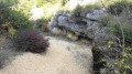
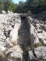
The Dolmens of Vailhauquès

Vailhauquès, surrounded by its ruins, is an iconic place where the village, marked by its past and looking towards its future, proudly embraces its history. Discover unusual and surprising places, notably its dolmens on a north-west dial, which will spark the curiosity of history buffs.

Details

24812568
Creation:
Last update:
Last review:
  • Walking
    Activity: Walking
  • ↔
    Distance: 5.87 mi
  • ◔
    Average duration: 3h 15 
  • ▲
    Difficulty: Difficult

  • ⚐
    Back to start: Yes
  • ↗
    Ascent: + 640 ft
  • ↘
    Descent: - 650 ft

  • ▲
    Highest point: 965 ft
  • ▼
    Lowest point: 482 ft
  • ⚐ Country: France
  • ⚐ City: Montarnaud (34570)
  • ⚑
    Start/End: N 43.682149° / E 3.691718°
  • ❏
    IGN map(s): Ref. 2742ET, 2743ET
  • Hour-by-hour weather

Photos

Description of the walk

Access: from Montarnaud, head north towards Argeliers. In a left-hand bend uphill, at the road-track junction, turn right onto the DFCI track, at the pumping station. Park in the dirt car park bordered by coppice opposite the station, which is protected by a fence.

(S/E) Heading south-east, at the corner of the station, turn left onto the path. Do not go onto the road.
Join a path. Continue left in a north-easterly direction, cross a stream and approach a crossroads.
Turn right heading south-east and walk along the Ruisseau de la Garenne stream on your right. Avoid an exit at elevation 157 and approach a section (not shown on the map) at a fork.

(1) Continue straight ahead and reach a fork in the road.
Turn left uphill heading east, negotiate a right-hand bend at a place called La Gariguette and reach a junction.
Continue right on the path heading south.
On a long straight stretch, at a place called Fontenille, cross a stream, avoid all exits, walk alongside the Bergerie de Nasse, then pass the 158 metre mark and reach a fork.

(2) Turn left into the undergrowth, heading north-east, cross the summit at hill 181 and reach a crossroads.
Keep left, heading north on the winding, stony track with a steep climb, cross the 206-metre peak and arrive at the crossroads.

Keep left uphill, cross the dolmen ruins and continue uphill, past the copses, to a section (blue cairn).

Important: Site of ruined dolmens. For hikers and visitors, outside the track, refer to your own visible trail (essential) so as not to get lost (sense of direction).
Warning: there aremany paths around the site, so be careful to stay on the main track.

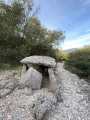
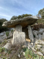
(3) Dolmen de la Coste or de la Lauze Couverte.
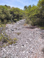
- It is possible to visit the site and its dolmen (remarkable) below, near rocky scree, with a significant technical passage (be careful), keep the trail visible.
Climb back up, rejoin the track and turn right heading north. Cross the visible dolmen ruins and rejoin the old wall.

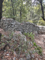
(4) Walk along the left side of the old boundary wall and its scree, on the right at elevation 295, and cross the top of the Bois de Paturascle. Avoid two exits and reach an intersection.

(5) At elevation 284, keep right and join a DFCI track (cistern). Turn right onto thePR® (yellow marker), cross elevation 278 and arrive at the junction.

(6) Leave the path, continue left on an uphillPR® trail (yellow marker) and follow the summit (Le Closcas). Cross the 289-metre peak marked by an exit, keep left on thePR® (yellow marker) and stay on the visible trail.
Reach a steep slope on a technical section and join Dolmen A at Mas Reynard (remarkable).

(7) Take the path in the opposite direction, cross the 289-metre peak marked by an exit, keep right on thePR® (yellow marker), stay on the visible trail and rejoin the DFCI track.

(6) Turn right after hill 278 and reach a crossroads (cistern). Turn left onto the track, leaving thePR®, and reach a fork from hill 284.

(5) Turn right onto the track, which is partially visible on the map. Cairns are positioned here and there to mark the trail. Reach a section.
Keep right, continue over a rocky area (the rest of the route is not shown on the map) and reach a fork.

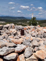
(8) Keep right, continue up a steep rocky slope and you will come to an old wall and its scree.

(9) Walk along it on your left, continue on the visible path, follow the trail carefully (not shown on the map), cross a steep rocky slope, go through the undergrowth and reach a section.

(10) Continue straight ahead through the undergrowth and you will eventually come out onto a path.

(1) Turn right, avoid the exit at elevation 157, keep left and reach the fork. Turn left, cross a stream and follow the same route as on the way there. Reach the pumping station and the car park (S/E).

Waypoints

  1. S/E : mi 0 - alt. 561 ft - Car park - Pumping station
  2. 1 : mi 0.53 - alt. 509 ft - Section
  3. 2 : mi 1.91 - alt. 486 ft - Junction
  4. 3 : mi 2.66 - alt. 856 ft - Section - Le dolmen de La Coste ou de la Lauze Couverte
  5. 4 : mi 2.97 - alt. 945 ft - Old wall
  6. 5 : mi 3.56 - alt. 932 ft - Section
  7. 6 : mi 3.76 - alt. 906 ft - Junction
  8. 7 : mi 4.13 - alt. 873 ft - Dolmen A du Mas Reynard
  9. 8 : mi 4.9 - alt. 909 ft - Path
  10. 9 : mi 4.95 - alt. 840 ft - Old wall and its rubble
  11. 10 : mi 5.16 - alt. 610 ft - Section
  12. S/E : mi 5.87 - alt. 558 ft - Car park - Pumping station

Notes

- There are no water sources along the entire route. Bring the usual equipment for hiking.
Wear good high-top shoes (the terrain is particularly rocky in places, so be careful with your ankles).
Foot care is essential (anti-chafing cream), backpack with only the bare essentials, clothing suitable for the season and weather conditions. Headgear with neck protection in hot weather. Don't forget drinking water, as refreshments will be limited. In short, your rucksack should not be too heavy and should be well suited to your body size. Walking sticks may be useful, so consider bringing them. Always know your position on the route with a map, compass, GPS and mobile app. Follow the route point by point.

Important information: in hot weather, set off early in the morning.

Tips:
GPS: 10 m capture interval
To ensure that the fix (1) is done correctly:

  • update the app
  • allow the application to use your location
  • disable power saving mode
  • allow the application to run in the background
  • check that no phone optimisation applications (antivirus, cleaner, etc.) are forcing energy-saving mode.
  • Do not use other applications at the same time. Smartphones are designed to disable applications at any time to free up memory for a foreground application.
  • Avoid storing your device at the bottom of your bag; keep it on your wrist or on top of your backpack, for example, or, for practicality, in a bum bag (keep the pocket open).
  • GPS signals come from satellites and are greatly attenuated when they have to pass through anything other than air.
  • Use the application outdoors and in open terrain. In forests and near cliffs, you may have difficulty obtaining a fix (1). (I recommend holding it in your hand at certain times).

1 - Fix = the time it takes for a GPS receiver to lock on.

Worth a visit

- Human presence in the Vailhauquès area dates back at least 5,000 years, when the first "farmers" settled in the heath during the Neolithic period. Between 3,500 and 2,500 BC, these people, whether sedentary or nomadic, erected a large number of dolmens. In Vailhauquès, on its western and northern slopes, at least eleven dolmen sites have been identified, two of which are visible. Source: http://www.ville-vailhauques.fr/la-commu...

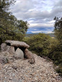
(3) - The Dolmen de La Coste or Lauze Couverte is one of the most beautiful dolmens in the Hérault department. Its table, which is still in place, weighs an estimated 17 tonnes. Built on a stony slope, it appears never to have been covered by a tumulus. Source: http://www.ville-vailhauques.fr/la-commu...

(7) - The Mas Reynard dolmen A is the best known and best preserved on this site, which has two others buried in vegetation. These date from the late Neolithic period, but excavations have shown that they were used in the Chalcolithic period (3000 to 2400 BC), as well as in the Bronze Age (2400 to 900 BC) and the Iron Age (800 BC). Source: http://www.ville-vailhauques.fr/la-commu...

Always be cautious and plan ahead when you're outdoors. Visorando and the author of this route cannot be held responsible for any accidents occurring on this route.

The GR® and PR® markings are the intellectual property of the Fédération Française de Randonnée Pédestre.

Reviews and comments

3.9 / 5
Based on 10 reviews

Reliability of the description
4.2 / 5
Ease of following the route
3.3 / 5
Route interest
4.1 / 5
Claude ANDRE
Claude ANDRE

Overall rating : 4.7 / 5

Date of your route : Feb 19, 2026
Reliability of the description : ★★★★★ Very good
Ease of following the route : ★★★★★ Very good
Route interest : ★★★★☆ Good
Very busy route : No

Hike reported as difficult? If walking on stones is the difficulty (maybe...!) With GPX tracking, no problem, despite a few minor interruptions. With the paper document, the description is perfect, but it's a little more complicated to find the trails as the markings are not obvious and without the GPX you risk missing the first dolmen! There are chains blocking the path almost everywhere! Why? Perhaps to deter mountain bikers? The discovery of the two dolmens is the only interesting part of the hike, along with a spectacularly long boundary wall marking the edge of the commune.

Machine-translated

User 28022421

Overall rating : 3.3 / 5

Date of your route : Nov 10, 2025
Reliability of the description : ★★★☆☆ Average
Ease of following the route : ★★★☆☆ Average
Route interest : ★★★★☆ Good
Very busy route : No

Hi, as already pointed out by other hikers, we regularly encounter signs on this route prohibiting access, indicating private property or even private hunting grounds, when the path is not completely blocked by a cable. This is quite disturbing!!! It's a shame that the municipality of Vailauquès doesn't bother to mark this hike properly, because you can walk right past the dolmens without seeing them The paths are very stony and your ankles take a beating at times, but experienced hikers have seen worse. I strayed from the right path at the end and found myself on a very dangerous steep, stony slope. Conclusion: a hike worth doing for the dolmens if you are in the area, but not an unmissable hike! Have a good trip.

Machine-translated

etamine11
etamine11

Overall rating : 4.3 / 5

Date of your route : Oct 07, 2025
Reliability of the description : ★★★★★ Very good
Ease of following the route : ★★★☆☆ Average
Route interest : ★★★★★ Very good
Very busy route : No

Hike completed with people over 60 years old. Walk to point 2 easy and pleasant. Walk from point 2 to point 3 difficult, rocky and trail invisible in places, rely on the app's tracking. From point 3 to point 5 easy. Only problem is chains and piles of rocks on the trail. About ten times. Is it worth it? That's the question. We didn't follow the trail from point 5 to point 7. Now, from point 8 to point 10, it's very difficult. People with knee problems should avoid this section; walking sticks will also be very useful. Then it's easy going until the end. Overall, we enjoyed the hike, but it's not suitable for everyone.

Machine-translated

cham34
cham34

Overall rating : 4.3 / 5

Date of your route : Dec 11, 2024
Reliability of the description : ★★★★★ Very good
Ease of following the route : ★★★★☆ Good
Route interest : ★★★★☆ Good
Very busy route : No

Hike completed on 11 December 2024. The challenging aspect of the numerous chains and other low walls between points 2 and 5 is more than compensated for by the interest of the two dolmens, which are well worth the detour.
The rest of the hike is pleasant.

Machine-translated

Nygard
Nygard
• Edited:

Overall rating : 2.7 / 5

Date of your route : Dec 07, 2024
Reliability of the description : ★★★★☆ Good
Ease of following the route : ★★☆☆☆ Disappointing
Route interest : ★★☆☆☆ Disappointing
Very busy route : No

Hike done alone on an autumn day. I look for challenging and technical trails. This one is classified as difficult only because of the many rocks. So there is no physical challenge as we understand it, it's just a hike that is a bit hard on the ankles. You walk under the vegetation, with no scenery to look at 95% of the time. Numerous chains and stone walls block access to the trail. Nevertheless, it's quite surprising to see dolmens in these places. I was alone the whole way, so it's an interesting route in summer when you want to escape the tourists.

Machine-translated

farine66
farine66

Overall rating : 5 / 5

Date of your route : May 06, 2024
Reliability of the description : ★★★★★ Very good
Ease of following the route : ★★★★★ Very good
Route interest : ★★★★★ Very good
Very busy route : No

Varied hike over rocks, under woods, along main paths and small trails. It's incredible to find dolmens in these places!
Watch out for chains across the path!

Machine-translated

Syl_vi
Syl_vi

Hello, yes, the chains are still there, we stepped over them one by one. We didn't see any signs or power lines.

Machine-translated

Toumabena
Toumabena

Hello,
Are there still chains, power lines and signs prohibiting passage along the route, which forced us to take a detour?

Machine-translated

Syl_vi
Syl_vi

Overall rating : 3.3 / 5

Date of your route : Jan 08, 2024
Reliability of the description : ★★★☆☆ Average
Ease of following the route : ★★★☆☆ Average
Route interest : ★★★★☆ Good
Very busy route : No

Perfect for a hike on a windy day, as it is well sheltered. The difficulty is justified by the numerous rocks. The trail is only marked at the top, but if you use the app's route guide along the way, you'll be fine. A little bell 🛎️ rings when you stray too far. We found two dolmens! Magnificent 🌳

Machine-translated

Toumabena
Toumabena

Overall rating : 3 / 5

Date of your route : Feb 09, 2023
Reliability of the description : ★★★☆☆ Average
Ease of following the route : ★☆☆☆☆ Very disappointing
Route interest : ★★★★★ Very good
Very busy route : No

Hike to be removed from the catalogue. From point 2 onwards, new chains, low walls, a power line at head height and recent signs prohibit passage. These prohibitions, accompanied by signs from a nature conservation association (ASPAS), prevent visitors from enjoying this otherwise very pleasant route.

Machine-translated

Ghislaine R.
Ghislaine R.

Overall rating : 3.7 / 5

Date of your route : Nov 12, 2022
Reliability of the description : ★★★★☆ Good
Ease of following the route : ★★★☆☆ Average
Route interest : ★★★★☆ Good
Very busy route : No

A pleasant, slightly technical route to discover the dolmens, which is part of its charm.

Machine-translated

Claude340
Claude340

Chains have been put in place to block motocross bikes from riding on the trail. During hunting season, hikers are obviously warned.

Machine-translated

AlxNzx
AlxNzx

Overall rating : 4.3 / 5

Date of your route : Nov 13, 2022
Reliability of the description : ★★★★★ Very good
Ease of following the route : ★★★★☆ Good
Route interest : ★★★★☆ Good
Very busy route : No

We did the route yesterday and encountered two major problems: a large-scale hunt was being organised on the lower section of the route (between the car park and the KM 2 marker) and in many places there were "private property, no trespassing" signs, as well as small symbolic stone walls and metal chains installed to prevent passage. I therefore think it is not advisable to continue offering this route.

Machine-translated

Other walks in the area

For more walks, use our search engine .

The GPS track and description are the property of this route's author. Please do not copy them without permission.