Country:

 City:


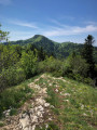
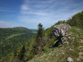
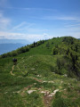
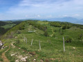
The starting point is situated between the Col de la Biche and the Sur Lyand viewpoint. There is a car park on site near a large sign marking the start of the route.
Follow the stickers marked ‘LY’ on the hiking signposts.
(S/E) From the starting point, at the Grange d’en bas, head south along the most clearly marked path, following the signs for the Chalet d’Arvière.
(1) Continue straight on along the main path near the Grange Falavier.
(2) At Les Granges d’Arvière, take a detour first to the right then to the left to the gardens of the Chalet d’Arvière to admire the view.
(3) Then return to the junction.
(2) Carry on straight ahead.
(4) For the more adventurous, a short detour to the left – 800 metres (there and back) with a 50-metre climb – leads to a spring and another, more elevated viewpoint over the Arvière ski area. Otherwise, carry on straight ahead.
(5) At the bend, turn right onto the white path leading downhill.
(6) Take the path on the left and continue to the Col de Charbemènes, passing the Sapin Daubrée and running alongside the Griffe du Diable Integral Biological Reserve. Then keep going straight on.
(7) Turn left until you reach the steep path climbing straight up the slope.
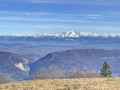
(8) There is a magnificent panoramic view of Mont Blanc from the Col de Charbemènes. A 3-kilometre round trip to the right, with 200 metres of elevation gain, allows the more adventurous to reach the Grand Colombier cross. Otherwise , turn left before the fence at the Col de Charbemènes to follow the ridge line to the Griffe du Diable. Go past the Griffe and you’ll reach a junction.
(9) Turn right, then left, avoiding the path that runs along the edge of the forest to the left of the fence.
(10) At this point, at the junction where there are numerous tracks trodden by cows, climb the small hill opposite and continue towards the road.
(11) Near the road, take the path that dips to the left and leads back to the starting point (S/E).
 Visorando Member

 Difficult

 Tourist office
 Easy
 Very difficult
 Association / Club / Walk leader