Country:

 City:
City:



The village of Éourres is a pedestrian-only area. Visitors are therefore asked to leave their vehicles in the car park 300 metres below the village.
(S/E) Leave the car park and turn right onto the Sentier des Poètes, which climbs up to the entrance to the village (telephone box).
(1) Turn right onto the road, then immediately left, and follow the main street until you reach the Chemin du Teron.
(2) Ignore it (turn back) and carry on straight ahead along the Chemin du Col de Verdun until you reach the cemetery.
(3) Carry on along the unpaved track.
(4) At the fork in the road, take the path on the left (the one on the right is a farm track, not shown on the map). Climb through the woodland (it’s cooler on the way up).
(5) Join the GRP® and follow it uphill to the left, then join the PR® route (yellow markings) which climbs to the Col de Verdun.
(6) Continue the climb up to the Col de Verdun.
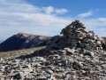
(7) Turn left towards the first summit of the Montagne de Mare.
(8) After a well-deserved short break and a 360° panoramic view, turn right and head for the second summit of the Montagne de Mare. Follow the poorly marked path, with rather sparse yellow markings and a few cairns here and there. Head towards the ridge and continue to follow it. Admire the Jabron valley and Montagne de Lure. The path becomes better marked and joins the place-name post ‘Crête de Mare’.
(9) Carry on more or less straight ahead towards the Col Saint-Pierre. At the start, the path is no longer marked at all: follow it from cairn to cairn (once the cairns become visible again, it’s too late – you’ve missed the turn-off for the Col Saint-Pierre!). Carry on straight ahead and, with some difficulty, reach a track at a place called La Faïrotte.
(10) Take the path furthest to the left and reach the Col Saint-Pierre, about 500 m away.
(11) Continue along the path on the right (GR® signpost) and climb up to the Col de Branche.
(12) Turn left and take the path that follows the summit ridge and climbs to the summit of Fléossier or Montagne de Chanteduc.
(13) Continue straight on along the ridge on the faintly marked path. Descend from cairn to cairn until you reach a fork.
(14) Carry on straight ahead along the now well-marked path and you’ll soon reach a fork.
(15) Turn left onto the path that descends through the woodland. It’s very easy at first, but gets quite tricky towards the end as the slope becomes steeper. Take care! As fatigue starts to set in, there’s a real risk of a stone rolling under your foot! At the bottom of the slope, you’ll reach a small road.
(16) Follow it to the right and you’ll soon reach the hamlet of Les Peyres. Walk through it and, as you leave, take care not to miss the path (PR®, yellow markings) on the left.
(17) Take this path, climbing the embankment to the left of the road, and follow it until you reach a wide track at a place called Queyrilière.
(18) Continue along the track until you reach Éourres and the route you took on the way there.
(2) Carry on to the right and, following the opposite route to the outward journey, reach the car park below the village (S/E).
 Visorando Member

 Moderate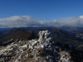
 Very difficult