Country:
 City:


Start at the Saint-Briac tennis courts. You can park in the complex’s car park.
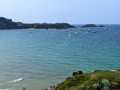
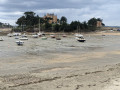
(S/E) Opposite the car park entrance, walk alongside the campsite, then follow the Chemin des Douaniers to the left. Enjoy the panoramic view of the Frémur.
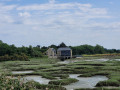
(1) Turn left, walk alongside the river and pass the Rochegoude mill (Roche Good on IGN maps).
(2) Head up to the left to rejoin the D3 and follow it to the right. Ignore a road on the right
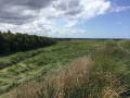
(3) 500 m further along this road, take the path on the right to head back down towards the Frémur. You are now between the countryside and the banks of the Frémur.
(4) At the hamlet known as La Gautrais, cross the Frémur via a bridge (it’s barely visible) and continue straight on until you reach a junction. Turn right onto the other bank. Follow the path along the banks of the Frémur.
(5) From the hamlet of La Chambre, at low tide, it is possible to cross the Frémur. Be careful – it’s muddy – so cross barefoot and bring some water to rinse your feet, then head back to the car park by walking alongside the campsite.
(6) During my recce, I crossed at this point, but there are other options further upstream depending on the weather. Otherwise, turn back and cross via the bridge.
(4) Return to the tennis court car park via the same route you took on the way there (S/E).
 Visorando Member
 Moderate