The five churches of Sainte-Marie

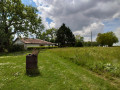
The history of Sainte-Marie is closely linked to that of the Cistercians of Gimont, who were lords of these lands as far as La Grange du Hour near Saint-Martin. At that time, the village was called Manville. The depopulation of the countryside gradually led to the amalgamation of parishes and local authorities. Sainte-Marie now has five churches: the parish church in the heart of the village, and those at Saint-Martin du Hour, Saint-Germain, Le Travès and Saint-Pé du Bosc. Magnificent footpaths lead you through fields, along a stream and through the woods of a castle… without ever losing sight of the charming village of Sainte-Marie.

Details

n°108685454
Creation:
Last update:
Last review:
–
  • Walking
    Activity: Walking
  • ↔
    Distance: 5.16 mi
  • ◔
    Average duration: 2h 45 
  • ▲
    Difficulty: Easy

  • ⚐
    Back to start: Yes
  • ↗
    Ascent: + 446 ft
  • ↘
    Descent: - 446 ft

  • ▲
    Highest point: 719 ft
  • ▼
    Lowest point: 479 ft

Description of the walk

Start from the village hall car park.

(S/E) Head towards the church.

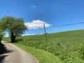
(1) Take the Chemin de Saint-Martin to the right. Continue straight on along the road until you reach the top of the hill.

(2) At the junction with the Chemin des Barraques, turn left. After passing through the copse, the path turns left. Continue for 200 metres.

(3) Follow the stony track to the left, then head down towards the farm. Go round it on the left, cross the valley and head back up alongside the woodland.

(4) Take the D105 to the right for a few metres, taking care.

(5) Head down the valley to the left along the path that runs alongside the fields to the stream.

(6) Continue along the tree-lined path on the left which climbs up to the ridge.

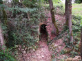
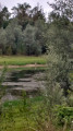
(7) Before the descent, turn left, pass a ruin and head down to the left to the small lake. On the right, Lassale Castle (private) takes its name from a site which, in the Middle Ages, was home to a garrison controlling the Salette ford at Gimont.

(8) Follow the stream, then cross over to the other bank. Enter the woodland, then walk alongside the fields.

(9) In the woods, at the crossroads, turn left. Cross the stream and head back up to the D105.

(10) Follow it to the left back up to the village. Take care on this section. Head for the village hall car park (S/E).

Waypoints

  1. S/E : mi 0 - alt. 686 ft - Car park at the village hall
  2. 1 : mi 0.09 - alt. 692 ft - Route de Saint-Martin
  3. 2 : mi 0.86 - alt. 679 ft - Chemin des Barraques
  4. 3 : mi 1.63 - alt. 689 ft - Path to Le Pey
  5. 4 : mi 2.22 - alt. 696 ft - D105
  6. 5 : mi 2.27 - alt. 699 ft - Path
  7. 6 : mi 2.52 - alt. 600 ft - Tree-lined path
  8. 7 : mi 3.16 - alt. 666 ft - Forks before the descent
  9. 8 : mi 3.68 - alt. 541 ft - Stream
  10. 9 : mi 4.56 - alt. 482 ft - Uphill path
  11. 10 : mi 4.81 - alt. 623 ft - D105
  12. S/E : mi 5.16 - alt. 686 ft - Car park at the village hall

Notes

Children’s playground, picnic table and multi-sports ground next to the village hall.

Worth a visit

Parish church in the heart of the village.

Church of Saint-Martin du Hour.

Church of Saint-Germain.

Church of Le Travès.

Church of Saint-Pé du Bosc.

Lassale Castle (private).

Village of Sainte-Marie

Other walks in the area

For more walks, use our search engine .

The GPS track and description are the property of this route's author. Please do not copy them without permission.