


 Country:

 City:
City:


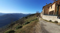
Parking at the Chalets du Boucillon: please note that there is no public car park.
(S/E) Take the road uphill, leaving the road leading to the hamlet of Le Serre on your right, then, a few metres further on, you’ll come to a crossroads of paths.
(1) Take the path on the left, then theGR®427, marked in white and red, to reach the highest point in the village of Conjols.
(2) Walk through the village, then take the small path on the right to reach the sawmill. Return to the track on the left. Continue along theGR® to reach the Col des Buffes, a junction of several roads.
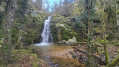
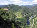
(3) Turn left onto the path known as the ‘Chemin de la Mine’. Cross a cow pasture and head down through a pretty little valley. You’ll reach the Ravin de Ribemale.
(4) Cross it, then continue the descent, finishing in the village of Issantouans, where you’ll join the Dolce Via or Voie Verte.
(5) Turn left onto it, following the right bank of the Eyrieux to reach the hamlet of Les Salins.
(6) Leave the Voie Verte and turn left onto the road leading uphill. Continue until you reach the junction with the D2.
(7) Carry on straight ahead along this road for 100 metres.
(8) Turn left onto the road (Chemin de Garaud) and, a little further on, you’ll come to the Route du Boucillon. Take it all the way to the left to return to the car park at the Boucillon chalets (S/E).


 Visorando Member
 Easy
Easy 
 Difficult
