Pérouse Circular

A very lovely circular walk starting from Pérouse. Close to Belfort, it offers a chance to discover varied landscapes: the pretty village of Pérouse, farmland and beautiful forests. You’ll pass by the fortifications of Chèvremont and walk alongside the orchid meadow. This walk follows a section of the old military railway line that linked the forts together, and it is signposted.

Details

42003870
Creation:
Last update:
Last review:
  • Walking
    Activity: Walking
  • ↔
    Distance: 4.02 mi
  • ◔
    Average duration: 2h 00 
  • ▲
    Difficulty: Easy

  • ⚐
    Back to start: Yes
  • ↗
    Ascent: + 210 ft
  • ↘
    Descent: - 203 ft

  • ▲
    Highest point: 1,388 ft
  • ▼
    Lowest point: 1,188 ft
  • ⚐ Country: France
  • ⚐ City: Pérouse (90160)
  • ⚑
    Start/End: N 47.636112° / E 6.893053°
  • ❏
    IGN map(s): Ref. 3621OT
  • Hour-by-hour weather

Photos

Description of the walk

Park in the car park at the Place de la Mairie and the church in Pérouse.
The walk is signposted with a ‘Green Ring’.

(S/E) Turn right, walking alongside the church. After a few metres, turn right onto a lovely path called Chemin Lagasse, which leads onto Rue des Marronniers. Turn right, cross Rue des Sapins and continue along Rue des Marronniers. You will reach a four-way junction.

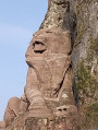
(1) Turn right into a small street which becomes a path. Cross the Ruisseau du Trovaire and start climbing up alongside the meadow. Halfway up the slope, admire the pretty carved stone bench. Continue climbing and enter a lovely woodland. You will then come to a T-junction.

(2) Take the path on the left, continuing along a wider track until you reach a gate blocking the track.

(3) Turn left before the gate and carry on until you reach the fortifications.

(4) A sign points to a combat shelter. Take the time to walk there and back to visit the gun battery emplacements and, further on, the combat shelter: two information panels provide some very interesting details.
Follow the path on the left which climbs into the forest. Walk alongside pastures classified as a sensitive natural area: the orchid meadow. Join the path in front of the tennis courts, turn right and enter the forest to return to the crossroads before the barrier. Turn left onto the path leading uphill just before the barrier.
Turn right a few metres further on.

::5: You’ll reach the ruins of ancient fortifications, similar to those seen earlier.
Follow the signposted path, which curves to the right further on and leads onto a wide track.

(6) Turn slightly right, walk along the edge of a field and you’ll reach a remarkable tree, a gnarled oak.

(7) Continue along the path, turn left at the three-way junction to leave the forest, cross the D31 road and continue straight ahead on the path that runs alongside the military base. You’ll reach a crossroads just before the track.

(8) Turn right. Be careful not to go past the barrier; instead, follow the signpost carefully to avoid taking this track. Continue along the path, passing two tracks on your right, then arrive at a junction with another track just before the edge of the woodland.

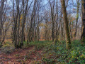
(9) Turn right onto this path, taking care to follow the signposts closely as the map does not show all the paths. Continue winding your way through the Bois des Perches, using the signposts to guide you. You will then reach the edge of the forest after taking a sharp left turn.

(10) Leave the forest and walk past the first houses along Rue du Tilleul. Take the hairpin bend into Rue des Cèdres. When you reach the Ruisseau du Trovaire, turn right for a short round trip to admire a beautiful arboretum. Continue along Rue des Saules, then turn right onto Rue de l’École to reach the town hall car park (S/E).


Waypoints

  1. S/E : mi 0 - alt. 1,211 ft - Car park at the church and town hall in Pérouse
  2. 1 : mi 0.24 - alt. 1,198 ft - Four-way junction
  3. 2 : mi 0.68 - alt. 1,227 ft - Crossroads in the forest
  4. 3 : mi 1.06 - alt. 1,191 ft - Barrier at the exit from the forest
  5. 4 : mi 1.17 - alt. 1,191 ft - Fortifications: ‘Combat shelter’ sign
  6. 5 : mi 1.49 - alt. 1,234 ft - Ruins of fortifications
  7. 6 : mi 1.84 - alt. 1,263 ft - Wide path
  8. 7 : mi 2.07 - alt. 1,266 ft - Oak longhorn beetle
  9. 8 : mi 2.49 - alt. 1,243 ft - Crossroads before the military base
  10. 9 : mi 2.95 - alt. 1,358 ft - Crossroads before the edge of the woods
  11. 10 : mi 3.57 - alt. 1,217 ft - Edge of the woodland
  12. S/E : mi 4.02 - alt. 1,211 ft - Car park at the church and town hall in Pérouse

Notes

(S/E) To reach the car park near the town hall and the church. Address: Place de la Mairie 90160
If you’re coming from Chévremont, turn left onto a small street 50 metres before the D419. Take care not to miss it – it’s hard to spot for an uninformed driver, and the D419 is really dangerous.
You can also travel by suburban bus: Optymo network, lines 24, 33, 34 and 35. You can pay by text message. For further details, see the website
This walk has been signposted by volunteers on the initiative of the municipality of Pérouse.

Worth a visit

(S/E) Pérouse Church: rebuilt around 1756, it is dedicated to Saint Matthew.

(4) Fortifications at Chèvremont: as the information board explains, these fortifications were used to conceal the artillery guns. Each position is designed to accommodate a cannon. It fires over the wall, which protects it from enemy fire. On either side of the cannon emplacement there is a shelter for the soldiers. At the foot of the wall there are two areas for storing gunpowder or ammunition.
There are numerous battery emplacements all along the defence line to the east of Belfort.

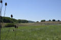
Between (4) and (3) Orchid Meadow: 18 species of orchid have been recorded at this former military site. They flower in May.

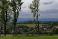
Between (6) and (7), do not hesitate to take a short 10-metre detour to admire the view of the Swiss Jura.

(7) The oak: admire this remarkable tree – a large oak with a prominent bump halfway up its trunk: an oak burl, which is a growth on the tree resulting from an insect bite or injury. The wood is used in cabinet-making.

Reviews and comments

4 / 5
Based on 4 reviews

Reliability of the description
3.8 / 5
Ease of following the route
3.8 / 5
Route interest
4.5 / 5
lyryc28
lyryc28

Overall rating : 4.7 / 5

Date of your route : Apr 05, 2026
Reliability of the description : ★★★★★ Very good
Ease of following the route : ★★★★★ Very good
Route interest : ★★★★☆ Good
Very busy route : No

The Strategic Trail is a lovely route!
You leave Perugia and immediately find yourself surrounded by nature.
The route isn’t difficult.
The signposting is very good.
It’s a lovely little hike.

Machine-translated

christian90
christian90

Good evening,

OK, we went left as the description says, and then there was nothing there. I think the work being done by the labourers has changed the area. There were eight of us who all saw the same thing, though.
I know I’m repeating myself, but it’s a lovely little route.

Kind regards
Christian 90

Machine-translated

POULIN Gérard
POULIN Gérard ★

Hello,
It is indeed the route description that should be followed, rather than waypoints that do not necessarily correspond to the author’s route.

Machine-translated

christian90
christian90

Overall rating : 4 / 5

Date of your route : Apr 09, 2024
Reliability of the description : ★★★☆☆ Average
Ease of following the route : ★★★★☆ Good
Route interest : ★★★★★ Very good
Very busy route : No

There were eight of us on this lovely walk. We got a bit lost at the gate where there’s a problem.
Either the route description is incorrect, because if you turn left you come to two logging tracks with no signposts at all.
Or the signposting has been changed, because just after the gate the signs say to go straight on, but the route description doesn’t.
We managed to find our way because there’s a section that overlaps with the Chèvremont Cabbage Route.
The visibility of the signposting needs to be reviewed, as some markers may be hidden by foliage.
I like the fact that the total elevation gain is given, rather than the elevation gain between the highest and lowest points.
A lovely walk with the orchids in bloom – and there are plenty of them, especially before the military track.
Christian 90

Machine-translated

Pat et Michel
Pat et Michel

Overall rating : 5 / 5

Date of your route : Nov 17, 2023
Reliability of the description : ★★★★★ Very good
Ease of following the route : ★★★★★ Very good
Route interest : ★★★★★ Very good
Very busy route : No

Thank you for this new walk!
The route is very well signposted
This walk is not difficult... so it’s suitable for children.

Machine-translated

kty 90
kty 90

Overall rating : 2.3 / 5

Date of your route : Nov 08, 2023
Reliability of the description : ★★☆☆☆ Disappointing
Ease of following the route : ★☆☆☆☆ Very disappointing
Route interest : ★★★★☆ Good
Very busy route : No

Signposting is very, very poor – you really have to look hard...
Incorrect description,
It’s closer to 7km than the advertised 6.5km.
In short, disappointing

&

Machine-translated

Other walks in the area

For more walks, use our search engine .

The GPS track and description are the property of this route's author. Please do not copy them without permission.