Country:
 City:


Place de la Mairie car park in Goyrans (31)
(S/E) Take thefirst road on the left (the D68) as you leave the car park, continuing for about 200 metres.
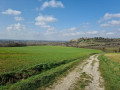
(1) Head down Chemin du Carrelot on the right, a tarmac road that turns into a grassy track; keep straight on. Go downhill and then uphill through the woods until you reach Rue des Biches.
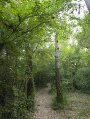
(2) Carry on straight down this street and, at the end, turn left for a few metres to find the small path on the right, level with the bus shelter, and follow it for a long way downhill through the woods. Head back up through the fields until you reach Chemin de la Loupiasse.
(3) Turn right onto the road and, at the next junction, turn right again onto Chemin de Marcounat.
(4) Just to the left of the gate to the private property, take the path at the top of the field that runs alongside it.
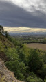
(5) At the crossroads, carry on to the right to follow the path which runs along the cliff top for some time and comes out onto Chemin de Regautier.
(6) Turn left, then, after 100 m, turn right onto Chemin de Clermont and follow it for about 500 m.
(7) Leave the road and continue straight on along the path closest to the River Ariège.
(8) After about 500 m along this track, you’ll find a small opening on the right and a path leading through the woods, which eventually joins a wider track.
(9) Follow it to the right, then quickly turn left to head up the gently sloping Chemin de la Côte du Bugat to Goyrans. Go through the barrier and you’ll reach the road.
(10) Turn left onto Rue Chemin des Puits towards the town hall. Cross the D68 carefully and return to the car park at Place de la Mairie (S/E).
 Visorando Member
 Moderate