


 Country:

 City:


Start from Aurillac town centre, at the Gravier car park.
(S/E) Head north-west towards the far end of the car park, turn right onto the bridge over the Jordanne, then turn left onto Cours d’Angoulême. At the end, turn right and go up the hill along Chemin de la Côte du Buis, then turn left onto Rue de la Libération.
(1) At the bend to the right, carry on straight ahead along Rue de la Libération (see mountain bike alternative below). At the top of the hill, turn left and continue climbing for a further 800 metres past Caussac, until you reach the Col du Croizet.
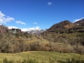
(2) Take the junction leading uphill to the left. One last push, and we finally reach a relatively flat stretch, the Route Pastorale du Croizet; the Jordanne Valley lies below on the left.
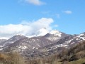
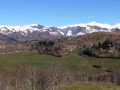
Pass a large solar farm on the right-hand side of the road. Magnificent views across the entire Chaîne des Volcans. From left to right, you can make out: the Crête de Chavaroche, Mont Mary, the Puy de Peyre Arse and the Plomb du Cantal.
(3) In Boussac, a small, typical village, take a short detour to the right to the very unassuming bell tower. Do not cross the river. Turn back, then take the Chemin de Faliès, continuing along the same route you came from. Carry on to Auzolles.
(4) After the hamlet of Auzolles, there is a steep and slippery descent towards Velzic. Take care!
(5) At Velzic (see mountain bike alternative below), join the main road at the bottom of the Jordanne valley – which is quite busy in summer – and turn right onto the D17 (upstream, north), staying on this road as you pass through Lascelle and Saint-Cirgues-de-Jordanne before reaching Saint-Julien-de-Jordanne.
(6) Saint-Julien-de-Jordanne: a pretty little village and the starting point for some lovely walks. There’s a drinking water tap hidden under the church porch. Continue along the D17 to Mandailles.
(7) Mandailles: Return to Saint-Julien-de-Jordanne by following theGR®400(red and white markings) along the right bank for mountain bikes or hybrid bikes (route shown on the map). Those on more delicate bikes should head back down via the path they came up, on the left bank.
(8) At Saint-Julien, take the road (D246) which follows the river on the right bank (north bank). At the junction leading up towards Laveissière, stay on the D246, which is relatively flat and follows the river. From here, follow the ‘Route des Crêtes’ as far as Aurillac. Pass Aubusson and continue to a crossroads on a downhill stretch.
(9) Don’t let the speed on the descent catch you out: turn right towards Houade (D246) and pass through several hamlets.
(10) At the fork in the road just before reaching Houade, turn left onto the D35 and head for the large crossroads at La Croix de Cheules, where there is an inn.
(11) Carry on straight ahead along the Route des Crêtes: to the left lies the Jordanne valley and to the right, the Authre valley. Continue until you reach the (discreet) ‘Table d’orientation’ sign (towards the hamlet of Alquier).
(12) If you’ve still got some energy left, take the hairpin bend to the right and climb up to the orientation table, situated on the summit of an ancient volcanic vent.
Return to the D35, then continue to the right to reach Aurillac via the Route des Crêtes, which becomes the Route de Done and then the Avenue de Done.
(13) At the roundabout, turn left onto Boulevard du Pavatou, then take the first street on the right, Rue des Frères Delmas, which becomes Rue du Monastère (you’ll pass the Abbey Church of Saint-Géraud) and then Rue des Forgerons. At the junction with Rue Victor Hugo, turn left to reach Cours Monthion and the starting point (S/E).


 – forced us to take a detour via Saint-Cirgues-de-Jordanne to climb directly up to the Croix de Cheules.
 Visorando Member
 Easy

 Moderate

